3546: Difference between revisions
No edit summary |
No edit summary |
||
| Line 1: | Line 1: | ||
{{Sidebar Info Query}} | {{Sidebar Info Query}} | ||
{{Header | {{Header | ||
|checked= | |checked=Checked OK | ||
|unlocated=No | |unlocated=No | ||
|shown_on_map=Yes | |shown_on_map=Yes | ||
| Line 9: | Line 9: | ||
|mine_type=Underground | |mine_type=Underground | ||
|mined-out-area=112 | |mined-out-area=112 | ||
|indicated=No | |||
|county1=St. Clair | |county1=St. Clair | ||
|quad1=French Village | |quad1=French Village | ||
|datemod=Pre | |||
|year-start=1874 | |year-start=1874 | ||
|year-end=9999 | |year-end=9999 | ||
Revision as of 14:08, September 24, 2022
Mine Index Number: 3546
| Company Name: | Unknown | ||
|---|---|---|---|
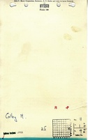
| Mine Name: | Colby Mine | ||
| Start Date: | Pre 1874 | End Date: | Unknown |
| Type of Mine: | Underground | ||
| Total acres shown: | 112 | ||
| Acres after map date: | General Area of mining acres shown: | ||
Shaft, Slope, Drift or Tipple Location(s)
| Type | County | Township-Range | Section | Part Section |
|---|
| Main shaft | St. Clair | 1N 9W | 11 | NE NE SE |
| Air shaft | St. Clair | 1N 9W | 11 | SW NE SE |
Geology
| Thickness (ft) | |||||
|---|---|---|---|---|---|
| Seam | Depth (ft) | Min | Max | Ave | Mining Method |
| Herrin | 160 | RP |
Geological Problems Reported
Production
| Company | Mine Name | Date | Production (tons) |
| Unknown | Colby | pre1874-? | Unknown No production was reported under this name. Most of the production may have been prior to 1882, when the first Coal Report was released. |
Production Notes
Coal Report production (if available)
Sources of Data
| Source Map | Map Date | Original Scale | Digitized Scale | Map Type |
| Federal Land Bank Report | 5-1934 | 1:124320 | 1:124320 | Secondary source |
| WPA, T1N-R9W | circa 1934 | 1:12000 | 1:63360 | Secondary source |
Annotated Bibliography (Data source - brief description of information)
| Directory of Illinois Coal Mines (St. Clair County) - Mine names, mine index, ownership, years of operation. |
| Mine notes (St. Clair County) - Depth, seam, mine type, shaft location. |
| Federal Land Bank Report (St. Clair County) - Mine outline. |
| WPA map, T1N-R9W - Shaft locations. |
| Atlas of St. Clair County, Illinois, 1874, Warner & Beers, Chicago, Illinois - Years of operation. |
Mine Notes
Mine Images


Photographs