3606: Difference between revisions
No edit summary |
No edit summary |
||
| Line 1: | Line 1: | ||
{{Sidebar Info Query}} | {{Sidebar Info Query}} | ||
{{Header | {{Header | ||
|checked= | |checked=Checked OK | ||
|unlocated=No | |unlocated=No | ||
|shown_on_map=Yes | |shown_on_map=Yes | ||
|reason_nsm=The mine is larger than expected from the reported production. It is likely other operators worked this site. | |||
|Mine-index=3606 | |Mine-index=3606 | ||
|Coal_co=Charles C. Dove | |Coal_co=Charles C. Dove | ||
|Mine Name Header=Dove Mine | |Mine Name Header=Dove Mine | ||
|mine_type=Underground | |mine_type=Underground | ||
|mined-out-area=27 | |mined-out-area=27 | ||
|after_map=9 | |||
|indicated=Yes | |||
|county1=St. Clair | |county1=St. Clair | ||
|quad1=French Village | |quad1=French Village | ||
Latest revision as of 14:54, September 24, 2022
Mine Index Number: 3606
| Company Name: | Charles C. Dove | ||
|---|---|---|---|
| Mine Name: | Dove Mine | ||
| Start Date: | 1930 | End Date: | 1942 |
| Type of Mine: | Underground | ||
| Total acres shown: | 27 | ||
| Production Indicated Acres: | 9 | General Area of mining acres shown: | |
|
The mine is larger than expected from the reported production. It is likely other operators worked this site. | |||
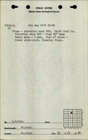
Shaft, Slope, Drift or Tipple Location(s)
| Type | County | Township-Range | Section | Part Section |
|---|
| Main drift | St. Clair | 2N 8W | 18 | NE SE NW |
| Air drift | St. Clair | 2N 8W | 18 | NE SE NW |
| Escapement | St. Clair | 2N 8W | 18 | NE SE NW |
Geology
| Thickness (ft) | |||||
|---|---|---|---|---|---|
| Seam | Depth (ft) | Min | Max | Ave | Mining Method |
| Herrin | 20 | 6.0 | MRP |
Geological Problems Reported
Production
| Company | Mine Name | Date | Production (tons) |
| Drift Coal Company | Drift | 1930-1935 Idle 1932 and 1933 | 31,507 |
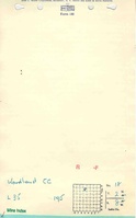
| Woodland Coal Company | Woodland | 1935-1942 | 13,518 |
| Charles C. Dove | Dove | 1942-1942 | 642 |
| Total Production: 45,667 | |||
Production Notes
Coal Report production (if available)
Sources of Data
| Source Map | Map Date | Original Scale | Digitized Scale | Map Type |
| Microfilm, document 351024 | 3-3-1944 | 1:2400 | 1:4966 | Secondary source |
Annotated Bibliography (Data source - brief description of information)
| Coal Reports - Production, ownership, years of operation. |
| Directory of Illinois Coal Mines (St. Clair County) - Mine names, mine index, ownership, years of operation. |
| Microfilm map, document 352356, reel 03138, frame 470, map of Pyramid No. 4 Mine (mine index 501) - Drift locations, mine outline, mining method. |
| Mine notes (St. Clair County) - Mine type, shaft location, seam, depth, thickness. |
| ISGS field notes (St. Clair County) - Depth, thickness. |
Mine Notes
Mine Images

Photographs