3612: Difference between revisions
No edit summary |
No edit summary |
||
| Line 1: | Line 1: | ||
{{Sidebar Info Query}} | {{Sidebar Info Query}} | ||
{{Header | {{Header | ||
|checked= | |checked=Checked OK | ||
|unlocated=No | |unlocated=No | ||
|shown_on_map=Yes | |shown_on_map=Yes | ||
| Line 8: | Line 8: | ||
|Mine Name Header=Ziska Mine | |Mine Name Header=Ziska Mine | ||
|mine_type=Underground | |mine_type=Underground | ||
|mined-out-area=3 | |mined-out-area=3 | ||
|after_map=Less than 1 | |||
|indicated=No | |||
|county1=St. Clair | |county1=St. Clair | ||
|quad1=French Village | |quad1=French Village | ||
| Line 25: | Line 27: | ||
|Section=34 | |Section=34 | ||
|partsection=NE NE SE | |partsection=NE NE SE | ||
}} | |||
{{Shaft locations | |||
|shaft_type=Old drift | |||
|County=St. Clair | |||
|Town-Range=2N 9W | |||
|Section=34 | |||
|partsection=SE SE NE | |||
}} | }} | ||
==Geology== | ==Geology== | ||
Revision as of 18:23, September 24, 2022
Mine Index Number: 3612
| Company Name: | Fred J. Ziska | ||
|---|---|---|---|
| Mine Name: | Ziska Mine | ||
| Start Date: | 1908 | End Date: | 1938 |
| Type of Mine: | Underground | ||
| Total acres shown: | 3 | ||
| Acres after map date: | Less than 1 | General Area of mining acres shown: | |
Shaft, Slope, Drift or Tipple Location(s)
| Type | County | Township-Range | Section | Part Section |
|---|
| Main drift | St. Clair | 2N 9W | 34 | NE NE SE |
| Old drift | St. Clair | 2N 9W | 34 | SE SE NE |
Geology
| Thickness (ft) | |||||
|---|---|---|---|---|---|
| Seam | Depth (ft) | Min | Max | Ave | Mining Method |
| Herrin | 25-60 | 7.0 | RPB |
Geological Problems Reported
The source map showed an old drift mine north of Ziska's mine (mine index 6883). The ownership, extent, and years of operation are not known. As no air shaft was shown on the source map, it is possible that the two mines were connected underground for ventilation.
Production
| Company | Mine Name | Date | Production (tons) |
| Fred J. Ziska | Ziska | 1908-1932 Idle 1918, 1922 and 1930. | 27,026 |
| Fred J. Ziska | Ziska | 1932-1938 | 1,284 Production after map date |
| Total Production: 28,310 | |||
Production Notes
Coal Report production (if available)
Sources of Data
| Source Map | Map Date | Original Scale | Digitized Scale | Map Type |
| Microfilm, document 351128 | 12-6-1932 | 1:1200 | 1:1655 | Not final |
Annotated Bibliography (Data source - brief description of information)
| Coal Reports - Production, ownership, years of operation. |
| Directory of Illinois Coal Mines (St. Clair County) - Mine names, mine index, ownership, years of operation. |
| Microfilm map, document 351128, reel 03134, frame 263 - Drift location, mine outline, mining method, geologic problems. |
| Mine notes (St. Clair County) - Thickness, seam, mine type, drift location. |
Mine Notes
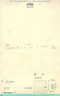
Mine Images

Photographs