3613: Difference between revisions
No edit summary |
No edit summary |
||
| Line 1: | Line 1: | ||
{{Sidebar Info Query}} | {{Sidebar Info Query}} | ||
{{Header | {{Header | ||
|checked= | |checked=Checked OK | ||
|unlocated=No | |unlocated=No | ||
|shown_on_map=Yes | |shown_on_map=Yes | ||
| Line 9: | Line 9: | ||
|mine_type=Underground | |mine_type=Underground | ||
|mined-out-area=88 | |mined-out-area=88 | ||
|indicated=No | |||
|county1=St. Clair | |county1=St. Clair | ||
|quad1=French Village | |quad1=French Village | ||
Revision as of 10:24, September 28, 2022
Mine Index Number: 3613
| Company Name: | Edgemont Coal Company | ||
|---|---|---|---|
| Mine Name: | Edgemont Mine | ||
| Start Date: | 1889 | End Date: | 1941 |
| Type of Mine: | Underground | ||
| Total acres shown: | 88 | ||
| Acres after map date: | General Area of mining acres shown: | ||
Shaft, Slope, Drift or Tipple Location(s)
| Type | County | Township-Range | Section | Part Section |
|---|
| Buxton/Charleton drift | St. Clair | 2N 9W | 35 | NW SW NW |
| "Ziska" drift | St. Clair | 2N 9W | 35 | SE NW NW |
Geology
| Thickness (ft) | |||||
|---|---|---|---|---|---|
| Seam | Depth (ft) | Min | Max | Ave | Mining Method |
| Herrin | 50-80 | 5.0-6.0 | MRP |
Geological Problems Reported
Production
| Company | Mine Name | Date | Production (tons) |
| James Charleton | Charleton No. 2 | 1889-1899 | 19,353 Operation between 1899 and 1914 unknown (may have been idled or abandoned) |
| Mueller and Buxton | Mueller and Buxton | 1914-1916 | 2,332 |
| John Buxton | Buxton Drift | 1916-1917 | 2,280 |
| L. Senior | Senior | 1917-1919 | 7,034 |
| Barton-Senior Coal Company | Barton-Senior | 1919-1922 | 29,117 Production not reported in 1922. |
| Victoria Coal Company | Victoria, Buxton Drift | 1922-1928 | 156,091 |
| Edgemont Coal Company | Edgemont | 1928-1941 | 304,478 |
| Total Production: 520,685 | |||
Production Notes
Coal Report production (if available)
Sources of Data
| Source Map | Map Date | Original Scale | Digitized Scale | Map Type |
| Microfilm, document 351083 | 2-7-1942 | 1:1200 | 1:2400 | Final |
Annotated Bibliography (Data source - brief description of information)
| Coal Reports - Production, ownership, years of operation. |
| Directory of Illinois Coal Mines (St. Clair County) - Mine names, mine index, ownership, years of operation. |
| Microfilm map, document 351083, reel 03134, frames 188-190 - Drift locations, mine outline, method. |
| Microfilm map, document 351081, reel 03134, frame 185 - Mine ownership (Charleton). |
| Mine notes (St. Clair County) - Thickness, depth, seam, mine type, shaft location. |
Mine Notes
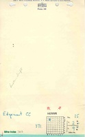
Mine Images
![[[:Edgemont|Edgemont]]](https://wikiimage.isgs.illinois.edu/ilmines/st_clair/thumbnails/m3613_IL_393_03_th.jpg)
Photographs