2776: Difference between revisions
Alan.Myers (talk | contribs) No edit summary |
No edit summary |
||
| Line 1: | Line 1: | ||
{{Sidebar Info Query}} | {{Sidebar Info Query}} | ||
{{Header | {{Header | ||
|checked= | |checked=Checked OK | ||
|unlocated=No | |unlocated=No | ||
|shown_on_map=Yes | |shown_on_map=Yes | ||
| Line 10: | Line 10: | ||
|mined-out-area=508 | |mined-out-area=508 | ||
|after_map=50 | |after_map=50 | ||
|indicated=No | |||
|county1=Madison | |county1=Madison | ||
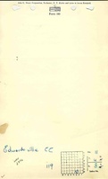
|quad1=Edwardsville | |quad1=Edwardsville | ||
| Line 144: | Line 145: | ||
{{Photo Query}} | {{Photo Query}} | ||
{{Page Notes | {{Page Notes | ||
|pagenotes=No entries yet | |pagenotes=No entries yet | ||
Revision as of 14:54, October 8, 2022
Mine Index Number: 2776
| Company Name: | Edwardsville Coal Company | ||
|---|---|---|---|
| Mine Name: | Edwardsville No. 3 Mine | ||
| Start Date: | 1879 | End Date: | April 1923 |
| Type of Mine: | Underground | ||
| Total acres shown: | 508 | ||
| Acres after map date: | 50 | General Area of mining acres shown: | |
Shaft, Slope, Drift or Tipple Location(s)
| Type | County | Township-Range | Section | Part Section |
|---|
| Main shaft | Madison | 4N 8W | 11 | SE SW SE |
| Air shaft | Madison | 4N 8W | 11 | SE SW SE |
Geology
| Thickness (ft) | |||||
|---|---|---|---|---|---|
| Seam | Depth (ft) | Min | Max | Ave | Mining Method |
| Herrin | 216-217 | 3.5-7.0 | MRP |
Geological Problems Reported
Production
| Company | Mine Name | Date | Production (tons) |
| Wolf Brothers Coal and Mining Company | Wolf | 1879-1891 | 576,332 |
| Madison Coal Company | Madison No. 3 | 1891-1904 | 893,917 |
| Edwardsville Coal Company | Edwardsville No. 3 | 1904-1910 | 380,734 |
| City Coal Company Operated by Herzogg-Gears and Co. in 1912 | City No. 3 | 1910-1917 | 216,445 |
| Edwardsville Coal Company | Edwardsville No. 3 | 1917-1920 | 151,280 |
| Edwardsville Coal Company | Edwardsville No. 3 | 1920-1923 | 215,336 Production after map date |
| Total Production: 2,434,004 | |||
Production Notes
Coal Report production (if available)
Sources of Data
| Source Map | Map Date | Original Scale | Digitized Scale | Map Type |
| Microfilm, document 352354 | 2-1920 | 1:2400 | 1:4966 | Not final |
| WPA, T4N-R8W | 10-1-1920 Date of the outline (mine survey) shown on WPA map. The WPA map was produced in the 1930s and was undated. | 1:1200 | 1:41143 | Secondary source |
Annotated Bibliography (Data source - brief description of information)
| Coal Reports - Production, ownership, years of operation. |
| Directory of Illinois Coal Mines (Madison County) - Mine names, mine index, ownership, years of operation. |
| Mine notes (Madison County) - Mine type, shaft location, seam, depth, thickness. |
| History of Madison County, Illinois; Published by W. R. Brink & Co., Edwardsville, Illinois, 1882 - Opening year, depth. |
| Microfilm map, document 352354, reel 03138, frame 468 - Shaft location, mine outline, mining method. |
| WPA map, T4N-R8W - Air shaft location. |
Mine Notes
Mine Images
![[[:Madison No. 4|Madison No. 4]]](https://wikiimage.isgs.illinois.edu/ilmines/madison/thumbnails/M0070mrg_th.jpg)
![[[:Edwardsville No. 3|Edwardsville No. 3]]](https://wikiimage.isgs.illinois.edu/ilmines/madison/thumbnails/M2776_th.jpg)
![[[:Madison No. 4|Madison No. 4]]](https://wikiimage.isgs.illinois.edu/ilmines/madison/thumbnails/m0070_IL_12_06_th.jpg)
Photographs
Additional Notes