4138: Difference between revisions
Alan.Myers (talk | contribs) No edit summary |
No edit summary |
||
| Line 4: | Line 4: | ||
|unlocated=No | |unlocated=No | ||
|shown_on_map=Yes | |shown_on_map=Yes | ||
|reason_nsm=This mine was later partially surface mined by Producers No 2 Mine (mine index [[3730]]). | |||
|Mine-index=4138 | |Mine-index=4138 | ||
|Coal_co=Gresham Coal Company | |Coal_co=Gresham Coal Company | ||
| Line 79: | Line 80: | ||
{{Source map header}} | {{Source map header}} | ||
{{Source Map | {{Source Map | ||
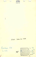
|Source Map= | |Source Map=State archive, IL_1461_01 | ||
|Map Date=4-8-1937 | |Map Date=4-8-1937 | ||
|Original Scale=1:1200 | |Original Scale=1:1200 | ||
| Line 96: | Line 97: | ||
}} | }} | ||
{{Annotated bibliography | {{Annotated bibliography | ||
|bibliography= | |bibliography=State archive map, IL_1461_01 - Slope and shaft locations, mine outline, mining method. | ||
}} | }} | ||
==Mine Notes== | ==Mine Notes== | ||
Latest revision as of 13:57, June 27, 2023
Mine Index Number: 4138
| Company Name: | Gresham Coal Company | ||
|---|---|---|---|
| Mine Name: | Gresham Mine | ||
| Start Date: | 1932 | End Date: | 1937 |
| Type of Mine: | Underground | ||
| Total acres shown: | 5 | ||
| Acres after map date: | General Area of mining acres shown: | ||
|
This mine was later partially surface mined by Producers No 2 Mine (mine index 3730). | |||
Shaft, Slope, Drift or Tipple Location(s)
| Type | County | Township-Range | Section | Part Section |
|---|
| Main slope | Williamson | 9S 4E | 32 | SW SE NW |
| Air shaft | Williamson | 9S 4E | 32 | NW SE NW |
Geology
| Thickness (ft) | |||||
|---|---|---|---|---|---|
| Seam | Depth (ft) | Min | Max | Ave | Mining Method |
| Springfield | MRP |
Geological Problems Reported
Production
| Company | Mine Name | Date | Production (tons) |
| R. O. Gresham and Leland Jackson | Gresham and Jackson | 1932-1932 | 1,100 |
| Gresham and Roberts | Gresham and Roberts | 1933-1934 | 3,696 |
| Gresham Coal Company | Gresham | 1935-1937 | 7,914 |
| Total Production: 12,710 | |||
Production Notes
Coal Report production (if available)
Sources of Data
| Source Map | Map Date | Original Scale | Digitized Scale | Map Type |
| State archive, IL_1461_01 | 4-8-1937 | 1:1200 | 1:1200 | Final |
Annotated Bibliography (Data source - brief description of information)
| Coal Reports - Production, ownership, years of operation. |
| Directory of Illinois Coal Mines (Williamson County) - Mine names, mine index, ownership, years of operation. |
| Mine notes (Williamson County) - Mine type, slope location. |
| State archive map, IL_1461_01 - Slope and shaft locations, mine outline, mining method. |
Mine Notes
Mine Images
![[[:Gresham|Gresham]]](https://go.illinois.edu/ILMImages/williamson/thumbnails/m4138_IL_1461_01_th.jpg)
Photographs