3353: Difference between revisions
No edit summary |
No edit summary |
||
| Line 8: | Line 8: | ||
|Mine Name Header=Peabody No. 40 Mine | |Mine Name Header=Peabody No. 40 Mine | ||
|mine_type=Underground | |mine_type=Underground | ||
|mined-out-area= | |mined-out-area=597 | ||
|indicated=No | |indicated=No | ||
|county1=Saline | |county1=Saline | ||
| Line 28: | Line 28: | ||
|Section=31 | |Section=31 | ||
|partsection=NW SW NW | |partsection=NW SW NW | ||
}} | }} | ||
{{Shaft locations | {{Shaft locations | ||
| Line 72: | Line 65: | ||
{{Source map header}} | {{Source map header}} | ||
{{Source Map | {{Source Map | ||
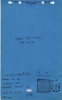
|Source Map= | |Source Map=State archive, IL_347_01 | ||
|Map Date=3-9-1954 | |||
|Original Scale=1:4800 | |||
|Digitized Scale=1:4800 | |||
|Map Type=Final | |||
|Map Date= | |||
|Original Scale=1: | |||
|Digitized Scale=1: | |||
|Map Type= | |||
}} | }} | ||
{{Annotated bibliography header}} | {{Annotated bibliography header}} | ||
| Line 96: | Line 82: | ||
}} | }} | ||
{{Annotated bibliography | {{Annotated bibliography | ||
|bibliography= | |bibliography=State archive, IL_347_01 - Slope locations, mine outline, mining method. | ||
}} | }} | ||
==Mine Notes== | ==Mine Notes== | ||
Revision as of 11:51, March 22, 2024
Mine Index Number: 3353
| Company Name: | Peabody Coal Company | ||
|---|---|---|---|
| Mine Name: | Peabody No. 40 Mine | ||
| Start Date: | 1950 | End Date: | March 1954 |
| Type of Mine: | Underground | ||
| Total acres shown: | 597 | ||
| Acres after map date: | General Area of mining acres shown: | ||
Shaft, Slope, Drift or Tipple Location(s)
| Type | County | Township-Range | Section | Part Section |
|---|
| Main slope | Saline | 8S 5E | 31 | NW SW NW |
| Air slope | Williamson | 8S 4E | 36 | NE SE NE |
Geology
| Thickness (ft) | |||||
|---|---|---|---|---|---|
| Seam | Depth (ft) | Min | Max | Ave | Mining Method |
| Springfield | 328 | 4.17 | RPP |
Geological Problems Reported
Roof problems were common. Bolting was extensive, but the roof problems persisted even after bolting.
Production
| Company | Mine Name | Date | Production (tons) |
| Peabody Coal Company | Peabody No. 40 | 1950-1954 | 2,176,003 |
| Total Production: 2,176,003 | |||
Production Notes
Coal Report production (if available)
Sources of Data
| Source Map | Map Date | Original Scale | Digitized Scale | Map Type |
| State archive, IL_347_01 | 3-9-1954 | 1:4800 | 1:4800 | Final |
Annotated Bibliography (Data source - brief description of information)
| Coal Reports - Production, ownership, years of operation, depth, thickness, mining method. |
| Directory of Illinois Coal Mines (Saline County) - Mine names, mine index, ownership, years of operation. |
| Mine notes (Saline County) - Mine type, slope location, seam, geologic problems. |
| State archive, IL_347_01 - Slope locations, mine outline, mining method. |
Mine Notes
Mine Images
![[[:Peabody No. 40|Peabody No. 40]]](https://wikiimage.isgs.illinois.edu/ilmines/saline/thumbnails/m3353_IL_347_01_th.jpg)
Photographs