Mine Index Number: 2751
| Company Name:
|
Brookside Coal Company
|
| Mine Name:
|
Brookside Mine
|
| Start Date:
|
before 1881
|
End Date:
|
November 1912
|
| Type of Mine:
|
Underground
|
| Total acres shown:
|
195
|
| Acres after map date:
|
|
General Area of mining acres shown:
|
|
|
|
Shaft, Slope, Drift or Tipple Location(s)
| Type
|
County
|
Township-Range
|
Section
|
Part Section
|
| Main shaft
|
Madison
|
3N 7W
|
9
|
SE SE SW
|
| Air shaft
|
Madison
|
3N 7W
|
9
|
SE SE SW
|
Geology
| Herrin
|
290-298
|
|
|
5.0-5.5
|
MRP
|
Geological Problems Reported
Production
| Company
|
Mine Name
|
Date
|
Production (tons)
|
Production Notes
Coal Report production (if available)
Sources of Data
| Microfilm, document 352345
|
6-22-1911
|
1:1200
|
1:2234
|
Not final
|
| State archive, IL_987
|
4-14-1914
|
1:1200
|
1:1200
|
Final
|
Annotated Bibliography (Data source - brief description of information)
| Coal Reports - Production, ownership, years of operation.
|
| Directory of Illinois Coal Mines (Madison County) - Mine names, mine index, ownership, years of operation.
|
| Mine notes (Madison County) - Mine type, shaft location, seam, depth, thickness.
|
| Microfilm map, document 352345, reel 03138, frames 452, 453 - Shaft locations, mine outline, mining method.
|
| State archive, IL_987 - Shaft locations, mine outline, mining method.
|
Mine Notes
Mine Images
Microfilm: 352380
Map Date: 1114-1953
Coal Co.: Troy Domestic Mining Company
Mine Name: Troy Mine
Full Res Download
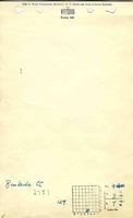
Company: IL_987
Map Date: 4-14-1914
Coal Co.: Brookside Coal Company
Mine Name: Brookside Mine
Image Credit: Illinois Department of Natural Resources - Office of Mines and Minerals
Full Res Download
Microfilm: 352345
Map Date: 6-22-1911
Coal Co.: Brookside Coal Company
Mine Name: Brookside Mine
Full Res Download
Microfilm: 352391
Map Date: 12-1903
Coal Co.: Troy Cooperative Coal and Mining Company
Mine Name: Troy Mine
Full Res Download
Photographs