Mine Index Number: 4135
| Company Name:
|
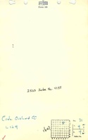
Crab Orchard Coal Company
|
| Mine Name:
|
Crab Orchard Mine
|
| Start Date:
|
1938
|
End Date:
|
1939
|
| Type of Mine:
|
Surface
|
| Total acres shown:
|
None Production indicates approximately 1 acre was mined. This location is inside a larger area of surface mining.
|
| Acres after map date:
|
|
General Area of mining acres shown:
|
|
|
|
Shaft, Slope, Drift or Tipple Location(s)
| Type
|
County
|
Township-Range
|
Section
|
Part Section
|
| Tipple or pit
|
Williamson
|
9S 4E
|
31
|
SE NW NE
|
Geology
| Springfield
|
11-40
|
|
|
4.17
|
Surface
|
Geological Problems Reported
Production
| Company
|
Mine Name
|
Date
|
Production (tons)
|
Production Notes
Coal Report production (if available)
Sources of Data
| Mine notes
|
Undated
|
(text only)
|
1:24000 Point plotted onto 1:24,000 USGS quadrangle and digitized.
|
Secondary source
|
Annotated Bibliography (Data source - brief description of information)
| Coal Reports - Production, ownership, years of operation.
|
| Directory of Illinois Coal Mines (Williamson County) - Mine names, mine index, ownership, years of operation.
|
| Mine notes (Williamson County) - Mine type, mine location, seam, depth, thickness.
|
Mine Notes
Mine Images
Photographs