Mine Index Number: 4141
| Company Name:
|
Gib Henson Coal Company
|
| Mine Name:
|
Henson Mine
|
| Start Date:
|
1927
|
End Date:
|
1941
|
| Type of Mine:
|
Underground
|
| Total acres shown:
|
27 The area shown is too large for the reported production. The reported production indicates approximately 13 acres were mined. Mine index 4470 is also in this vicinity. J. H. Hughes found a slope in this vicinity about 1926, which is further evidence of previous ownership. The general area of mining in the northeastern part of the mine was later surface-mined by mine index 6853.
|
| Acres after map date:
|
|
General Area of mining acres shown:
|
|
|
|
Shaft, Slope, Drift or Tipple Location(s)
| Type
|
County
|
Township-Range
|
Section
|
Part Section
|
| Main slope, No. 2
|
Williamson
|
9S 4E
|
32
|
SW NE NW
|
| Air shaft
|
Williamson
|
9S 4E
|
32
|
NW NE NW
|
| Slope No. 1
|
Williamson
|
9S 4E
|
32
|
NE NE NW
|
Geology
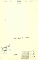
| Springfield
|
32-35
|
|
|
4.5
|
MRP
|
Geological Problems Reported
The source map indicates that mining holed into Steel Tipple No. 2 Mine (mine index 4137).
Production
| Company
|
Mine Name
|
Date
|
Production (tons)
|
Production Notes
Coal Report production (if available)
Sources of Data
| Microfilm, document 353211
|
1-18-1942
|
1:1200
|
1:1241
|
Final
|
| Company, 4103.W52 i5.1-82
|
1-9-1941
|
1:1200
|
1:1200
|
Not final
|
Annotated Bibliography (Data source - brief description of information)
| Coal Reports - Production, ownership, years of operation, mining method.
|
| Directory of Illinois Coal Mines (Williamson County) - Mine names, mine index, ownership, years of operation.
|
| Mine notes (Williamson County) - Mine type, slope location, seam, depth, thickness.
|
| Microfilm map, document 353211, reel 03142, frame 130 - Slope and shaft locations, mine outline, mining method, geologic problems.
|
| Company map, ISGS map library, 4103.W52 i5.1-82 - Mine outline (east, north, northwest), slope and air shaft locations.
|
| Microfilm map, document 353159, reel 03142, frame 46 - Mine ownership, years of operation.
|
Mine Notes
Mine Images
![[[:Henson|Henson]]](https://go.illinois.edu/ILMImages/williamson/thumbnails/m4141b_th.jpg) These files may not be true to scale and are not georgistered. These files may not be true to scale and are not georgistered.
|
Map Type:
|
Company
|
| Map ID:
|
4103.w52 i5.1-82
|
| Company:
|
Gib Henson Coal Company
|
| Mine Name:
|
Henson
|
| Caption:
|
|
| Map Date:
|
01-09-1941
|
| Map Status:
|
Not Final
|
| Image Credit:
|
|
| Note:
|
|
| More Info:
|
M4141b
|
| Full Res Download:These files are true to scale and most are georegistered for gis software. These files may be a very large (>1GB) download!
|
https://go.illinois.edu/ILMImages/williamson/m4141b.zip
|
![[[:Henson|Henson]]](https://go.illinois.edu/ILMImages/williamson/thumbnails/m4141_msha_558_01_th.jpg) These files may not be true to scale and are not georgistered. These files may not be true to scale and are not georgistered.
|
Map Type:
|
State Archive
|
| Map ID:
|
msha_558_01
|
| Company:
|
Gib Henson Coal Company
|
| Mine Name:
|
Henson
|
| Caption:
|
|
| Map Date:
|
01-18-1942
|
| Map Status:
|
Final
|
| Image Credit:
|
|
| Note:
|
|
| More Info:
|
M4141 msha 558 01
|
| Full Res Download:These files are true to scale and most are georegistered for gis software. These files may be a very large (>1GB) download!
|
https://go.illinois.edu/ILMImages/williamson/m4081 IL 1407 01.zip
|
Photographs