Mine Index Number: 3551
| Company Name:
|
Southern Coal, Coke and Mining Company
|
| Mine Name:
|
Southern Mine No. 1
|
| Start Date:
|
1889
|
End Date:
|
March 1936
|
| Type of Mine:
|
Underground
|
| Total acres shown:
|
346
|
| Acres after map date:
|
|
General Area of mining acres shown:
|
|
|
|
Shaft, Slope, Drift or Tipple Location(s)
| Type
|
County
|
Township-Range
|
Section
|
Part Section
|
| Main shaft
|
St. Clair
|
1N 9W
|
12
|
SE NW NE
|
| Air shaft
|
St. Clair
|
1N 9W
|
12
|
SE NW NE
|
Geology
| Herrin
|
160-200
|
6.42
|
8.0
|
7.0
|
MRP
|
Geological Problems Reported
The roof consisted of 1 to 8 inches of clod that comes down with the coal or up to 4 feet of black shale, which was full of slips and "practically impossible to hold". The black shale was not a serious mining problem, because the condition was understood and they did not try to hold it up.
Production
| Company
|
Mine Name
|
Date
|
Production (tons)
|
|
|
|
|
|
| Total Production: 2,465,443
|
Production Notes
Coal Report production (if available)
Sources of Data
| Microfilm, document 350963
|
4-2-1936
|
1:2400
|
1:5462
|
Final
|
Annotated Bibliography (Data source - brief description of information)
| Coal Reports - Production, ownership, years of operation.
|
| Directory of Illinois Coal Mines (St. Clair County) - Mine names, mine index, ownership, years of operation.
|
| Microfilm map, document 350963, reel 03134, frame 7 - Shaft locations, mine outline, method.
|
| Mine notes (St. Clair County) - Thickness, depth, seam, mine type, shaft location, geologic problems.
|
Mine Notes
Mine Images
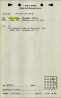
Microfilm: 350963
Map Date: 4-2-1936
Coal Co.: Southern Coal, Coke & Mining Company
Mine Name: Southern No. 1 Mine
Full Res Download
Photographs