Mine Index Number: 4329
| Company Name:
|
Unknown
|
| Mine Name:
|
Kelly Mine
|
| Start Date:
|
Circa 1874
|
End Date:
|
Before 1903
|
| Type of Mine:
|
Underground
|
| Total acres shown:
|
9
|
| Acres after map date:
|
|
General Area of mining acres shown:
|
|
|
|
Shaft, Slope, Drift or Tipple Location(s)
| Type
|
County
|
Township-Range
|
Section
|
Part Section
|
| Main shaft
|
St. Clair
|
1N 8W
|
6
|
SW NW SE
|
Geology
Geological Problems Reported
Production
| Company
|
Mine Name
|
Date
|
Production (tons)
|
| Unknown
|
Kelly
|
circa 1874
|
none No production reported under this name. Map sources indicated Kelly Mine abandoned prior to 1903. The 1874 Atlas of St. Clair County shows a shaft at this location, indicating that mining was taking place in the early 1870s.
|
|
|
Production Notes
Coal Report production (if available)
Sources of Data
| Map library, 4103.S31 i5.1-49
|
3-21-1903
|
1:2400
|
1:4966
|
Secondary source
|
Annotated Bibliography (Data source - brief description of information)
| Coal Reports - Production, ownership, years of operation.
|
| Directory of Illinois Coal Mines (St. Clair County) - Mine names, mine index, ownership, years of operation.
|
| ISGS map library, 4103.S31 i5.1-49, map of Knecht Mine (mine index 3502) - Shaft location, mine outline, mining method.
|
| Mine notes (St. Clair County) - Thickness, depth, seam, mine type, shaft location.
|
| Atlas of St. Clair County, Illinois, 1874, Warner and Beers, Chicago, Illinois - Years of operation.
|
Mine Notes
Mine Images
Company: 4103.S31 i5.1-49
Map Date: 3-21-1903
Coal Co.: Consolidated Coal Company of St. Louis
Mine Name: Knecht Mine
Full Res Download
Atlas:
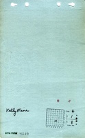
Map Date: 1874
Mine Name: Kelly Mine
Photographs