Mine Index Number: 2762
| Company Name:
|
Consolidated Coal Company of St. Louis
|
| Mine Name:
|
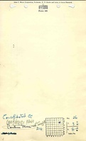
Confidence Mine
|
| Start Date:
|
1870
|
End Date:
|
1887
|
| Type of Mine:
|
Underground
|
| Total acres shown:
|
92
|
| Acres after map date:
|
|
General Area of mining acres shown:
|
|
|
|
Shaft, Slope, Drift or Tipple Location(s)
| Type
|
County
|
Township-Range
|
Section
|
Part Section
|
| Main shaft
|
Madison
|
3N 8W
|
26
|
NW SE NE
|
| Air shaft
|
Madison
|
3N 8W
|
26
|
NW SE NE
|
Geology
| Herrin
|
216-226
|
|
|
6.0-7.5
|
RPB
|
Geological Problems Reported
Production
| Company
|
Mine Name
|
Date
|
Production (tons)
|
| Wilborn Mining Company
|
Wilborn
|
1870-1874
|
unknown Production prior to 1878 unknown. According to the History of Madison County (published by W. R. Brink & Co., Edwardsville, Illinois, 1882), the shaft was sunk in the spring of 1870 by Seybt, Bandelier & Company, and leased to Bartlett Coal & Mining Company in the fall of that year.
|
|
|
| Bartlett Coal and Mining Company
|
Wilborn
|
1874-1878
|
unknown Production prior to 1878 unknown. According to the History of Madison County (published by W. R. Brink & Co., Edwardsville, Illinois, 1882), the shaft was sunk in the spring of 1870 by Seybt, Bandelier & Company, and leased to Bartlett Coal & Mining Company in the fall of that year.
|
|
|
|
|
|
|
|
| Total Production: 287,436
|
Production Notes
Coal Report production (if available)
Sources of Data
| Microfilm, document 352374
|
5-20-1950
|
1:2400
|
1:4634
|
Secondary source
|
| State archive, IL_969
|
8-1872
|
1:1200
|
1:1200
|
Not final
|
Annotated Bibliography (Data source - brief description of information)
| Coal Reports - Production, ownership, years of operation, seam, depth, thickness.
|
| Directory of Illinois Coal Mines (Madison County) - Mine names, mine index, ownership, years of operation.
|
| Microfilm map, document 352374, reel 03138, frames 497-500 - Shaft locations, mine outline, mining method.
|
| State archive, IL_969 - Shaft locations, mine outline (portion of eastern boundary).
|
Mine Notes
Mine Images
Microfilm: 352370
Map Date: 7-1944
Coal Co.: Lumaghi Coal Company
Mine Name: Cantine No. 3 Mine
Full Res Download
Company: IL_969
Map Date: 8-1872
Coal Co.: Bartlett Coal and Mining Company
Mine Name: Wilborn Mine
Image Credit: Illinois Department of Natural Resources - Office of Mines and Minerals
Full Res Download
Photographs