Mine Index Number: 4555
| Company Name:
|
Unknown
|
| Mine Name:
|
Cherry Mine
|
| Start Date:
|
{{{year-start}}}
|
End Date:
|
{{{year-end}}}
|
| Type of Mine:
|
Underground
|
| Total acres shown:
|
|
| Acres after map date:
|
|
General Area of mining acres shown:
|
|
|
|
"{{{year-start}}}" contains an extrinsic dash or other characters that are invalid for a date interpretation."{{{year-end}}}" contains an extrinsic dash or other characters that are invalid for a date interpretation.
Shaft, Slope, Drift or Tipple Location(s)
| Type
|
County
|
Township-Range
|
Section
|
Part Section
|
| Mine
|
Macoupin
|
12N 9W
|
4
|
SW NW NE
|
Geology
Geological Problems Reported
Production
| Company
|
Mine Name
|
Date
|
Production (tons)
|
|
|
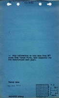
CherryNot reported under this name in the Coal Reports, production and years of operation unknown. The mine notes indicate this mine was active in 1931, one of the four years (1930-1933) that the Coal Reports did not report mines producing less than 1,000 tons per year.
|
|
|
|
|
Production Notes
Coal Report production (if available)
Sources of Data
Annotated Bibliography (Data source - brief description of information)
| Directory of Illinois Coal Mines (Macoupin County) - Mine names, mine index.
|
| Mine notes (Macoupin County) - Mine location, depth.
|
Mine Notes
Mine Images
 These files may not be true to scale and are not georgistered. These files may not be true to scale and are not georgistered.
|
Map Type:
|
ISGS map library
|
| Map ID:
|
4103.M34 i5.1-27
|
| Company:
|
|
| Mine Name:
|
|
| Caption:
|
|
| Map Date:
|
3-20-1934
|
| Map Status:
|
Secondary
|
| Image Credit:
|
|
| Note:
|
Work map for Macoupin County Federal Land Bank Report
|
| More Info:
|
Maplib quade1 geo
|
| Full Res Download:These files are true to scale and most are georegistered for gis software. These files may be a very large (>1GB) download!
|
https://go.illinois.edu/ILMImages/macoupin/maplib quade1 geo.zip
|
 These files may not be true to scale and are not georgistered. These files may not be true to scale and are not georgistered.
|
Map Type:
|
USGS topographic
|
| Map ID:
|
USGS topographic Coal Section files
|
| Company:
|
|
| Mine Name:
|
|
| Caption:
|
|
| Map Date:
|
1937
|
| Map Status:
|
Secondary
|
| Image Credit:
|
|
| Note:
|
|
| More Info:
|
M2937 geo
|
| Full Res Download:These files are true to scale and most are georegistered for gis software. These files may be a very large (>1GB) download!
|
https://go.illinois.edu/ILMImages/macoupin/m2937 geo.zip
|
Photographs