Mine Index Number: 4150
| Company Name:
|
Two Way Coal Company
|
| Mine Name:
|
Two Way Mine
|
| Start Date:
|
1935
|
End Date:
|
1937
|
| Type of Mine:
|
Underground
|
| Total acres shown:
|
1
|
| Acres after map date:
|
|
General Area of mining acres shown:
|
|
|
Not Shown On Map. This mine is not shown on the accompanying map because the area was later surface-mined by the Delta Mine (mine index 0702).
|
Shaft, Slope, Drift or Tipple Location(s)
| Type
|
County
|
Township-Range
|
Section
|
Part Section
|
| Main slope
|
Williamson
|
9S 4E
|
35
|
SE NE SW
|
Geology
Geological Problems Reported
Production
| Company
|
Mine Name
|
Date
|
Production (tons)
|
Production Notes
Coal Report production (if available)
Sources of Data
| ISGS Coal Section files
|
7-1-1952
|
1:2400
|
1:2400
|
Secondary source
|
| Microfilm, document 353117
|
1937
|
1:1200
|
1:1655
|
Final
|
Annotated Bibliography (Data source - brief description of information)
| Coal Reports - Production, ownership, years of operation, mining method.
|
| Directory of Illinois Coal Mines (Williamson County) - Mine names, mine index, ownership, years of operation.
|
| Mine notes (Williamson County) - Mine type, seam, depth, thickness.
|
| Microfilm map, document 353117, reel 03141, frame 344 - Slope, mine outline, mining method.
|
| ISGS Coal Section files, map of Delta Mine (mine index 0702) - Mine location.
|
Mine Notes
Mine Images
 These files may not be true to scale and are not georgistered. These files may not be true to scale and are not georgistered.
|
Map Type:
|
Coal Section files
|
| Map ID:
|
6-13
|
| Company:
|
|
| Mine Name:
|
|
| Caption:
|
|
| Map Date:
|
07-01-1952
|
| Map Status:
|
Secondary
|
| Image Credit:
|
|
| Note:
|
The map was used to place map M4150_MSHA_522_01
|
| More Info:
|
M4150d
|
| Full Res Download:These files are true to scale and most are georegistered for gis software. These files may be a very large (>1GB) download!
|
https://go.illinois.edu/ILMImages/williamson/m4150d.zip
|
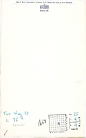
![[[:Two Way|Two Way]]](https://go.illinois.edu/ILMImages/williamson/thumbnails/m4150_MSHA_522_01_th.jpg) These files may not be true to scale and are not georgistered. These files may not be true to scale and are not georgistered.
|
Map Type:
|
State Archive
|
| Map ID:
|
MSHA_522_01
|
| Company:
|
Two Way Coal Company
|
| Mine Name:
|
Two Way
|
| Caption:
|
|
| Map Date:
|
11-01-1937
|
| Map Status:
|
Final
|
| Image Credit:
|
|
| Note:
|
See 4150 for additional location information.
|
| More Info:
|
M4150 MSHA 522 01
|
| Full Res Download:These files are true to scale and most are georegistered for gis software. These files may be a very large (>1GB) download!
|
https://go.illinois.edu/ILMImages/williamson/m4150 MSHA 522 01.zip
|
Photographs