0934: Difference between revisions
Jack Brown (talk | contribs) No edit summary |
Alan.Myers (talk | contribs) No edit summary |
||
| Line 1: | Line 1: | ||
{{Sidebar Info Query}} | {{Sidebar Info Query}} | ||
{{Header | {{Header | ||
|checked=Checked OK | |||
|unlocated=No | |unlocated=No | ||
|shown_on_map=Yes | |shown_on_map=Yes | ||
| Line 17: | Line 18: | ||
|Latitude=38.256840751 | |Latitude=38.256840751 | ||
|Longitude=-89.7870872299999 | |Longitude=-89.7870872299999 | ||
|Zoom=15 | |||
}} | }} | ||
==Shaft, Slope, Drift or Tipple Location(s)== | ==Shaft, Slope, Drift or Tipple Location(s)== | ||
Revision as of 09:25, December 7, 2021
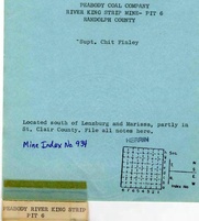
Mine Index Number: 0934
| Company Name: | Peabody Coal Company | ||
|---|---|---|---|
| Mine Name: | River King Pit No. 6 Mine | ||
| Start Date: | 1976 | End Date: | 1992 |
| Type of Mine: | Surface | ||
| Total acres shown: | 9,589 The area shown on the accompanying map, combined with that shown on Tilden and New Athens East Quadrangles, is much larger than expected for the reported production. The area shown for River King Surface Mine (mine index 857) on the Freeburg, Mascoutah, and New Athens East Quadrangles is much smaller than indicated for the reported production. If both index numbers are combined for all of the River King Surface mines, the area shown on the quadrangle maps is in line with the reported production. The total area mined was 13,164 acres for a total 104,187,734 tons. | ||
| Acres after map date: | General Area of mining acres shown: | ||
Shaft, Slope, Drift or Tipple Location(s)
| Type | County | Township-Range | Section | Part Section |
|---|
| Tipple | St. Clair | 3S 6W | 16 | SW SW SW |
| Auger | Randolph | 4S 6W | 36 | SW SW NW |
Geology
| Thickness (ft) | |||||
|---|---|---|---|---|---|
| Seam | Depth (ft) | Min | Max | Ave | Mining Method |
| Herrin | 60-100 | 5.33-6.5 | Surface |
| Springfield (1984 & 1985) | 78 | 3.0-4.7 | Surface |
Geological Problems Reported
Production
| Company | Mine Name | Date | Production (tons) |
| Peabody Coal Company | River King Pit No. 6 | 1976-1992 Idle 1990 | 27,155,940 |
Production Notes
Coal Report production (if available)
Sources of Data
| Source Map | Map Date | Original Scale | Digitized Scale | Map Type |
| Company, 4103.S31 i5.1-63 | 3-14-1969 | 1:62500 | 1:62500 | Not final |
| Company, 10-4-38 | 6-13-1979 | 1:4800 | 1:4800 | Final (for pit) |
| Company, 6-311 | 7-1994 | 1:4800 | 1:4800 | Final |
Annotated Bibliography (Data source - brief description of information)
| Coal Reports - Production, ownership, years of operation, seam, depth, thickness, mining method. |
| Directory of Illinois Coal Mines (Randolph County) - Mine names, mine index, ownership, years of operation. |
| Mine notes (Randolph County) - Geologic problems. |
| Company map, ISGS map library, 4103.S31 i5.1-63 - Mine outline, mining method. |
| Company map, Coal Section files, 10-4-38 - Mine outline. |
| Company map, Coal Section files, 6-311 - Mine outline. |
Mine Notes
Mine Images
![[[:River King Pit No. 6|River King Pit No. 6]]](https://wikiimage.isgs.illinois.edu/ilmines/randolph/thumbnails/m0934b.jpg)
![[[:River King Pit No. 6|River King Pit No. 6]]](https://wikiimage.isgs.illinois.edu/ilmines/randolph/thumbnails/m0934a.jpg)
![[[:River King Pit No. 6|River King Pit No. 6]]](https://wikiimage.isgs.illinois.edu/ilmines/randolph/thumbnails/m0934.jpg)
Photographs