3688: Difference between revisions
Alan.Myers (talk | contribs) m (Text replacement - "Danville Southwest" to "Danville SW") |
Alan.Myers (talk | contribs) No edit summary |
||
| Line 33: | Line 33: | ||
|depth=74-80 | |depth=74-80 | ||
|thick-ave=5.5-6.0 | |thick-ave=5.5-6.0 | ||
|mining-method=RP, HER {{#info: The 1885 Coal Report listed a death that occurred while drawing pillars. The extent of this practice throughout the mine is not known.|note}} | |mining-method=RP, HER | ||
|mining-method_note={{#info: The 1885 Coal Report listed a death that occurred while drawing pillars. The extent of this practice throughout the mine is not known.|note}} | |||
}} | }} | ||
===Geological Problems Reported=== | ===Geological Problems Reported=== | ||
Revision as of 16:21, January 22, 2021
Mine Index Number: 3688
| Company Name: | Consolidated Coal Company of St. Louis | ||
|---|---|---|---|
| Mine Name: | Ellsworth No. 2 Mine | ||
| Start Date: | 1870 | End Date: | 1890 |
| Type of Mine: | Underground | ||
| Total acres shown: | 16 Production indicates approximately 90 acres were mined in addition to what is shown on the incomplete map source. This is shown on the accompanying map as a general area of mining. | ||
| Acres after map date: | General Area of mining acres shown: | ||
Shaft, Slope, Drift or Tipple Location(s)
| Type | County | Township-Range | Section | Part Section |
|---|
| Main shaft | Vermilion | 19N 11W | 17 | SW SW NW The 1885 Coal Report (p. 69) stated that an air & escape shaft was constructed for Ellsworth No. 4 Mine (mine index 3694) that also served to ventilate portions of Ellsworth No. 2 Mine, which was connected underground. These portions are shown in the SW SW of section 17, T19N-R11W and E ½ SE section 18, T19N-R11W. |
Geology
| Thickness (ft) | |||||
|---|---|---|---|---|---|
| Seam | Depth (ft) | Min | Max | Ave | Mining Method |
| Danville | 74-80 | 5.5-6.0 | RP, HERThe 1885 Coal Report listed a death that occurred while drawing pillars. The extent of this practice throughout the mine is not known. |
Geological Problems Reported
Production
| Company | Mine Name | Date | Production (tons) |
| Ellsworth Coal Company | Ellsworth No. 2 | 1870-1886 | 91,632 Production prior to 1882 is unknown. 1883 & 1884 production included in production reported for Ellsworth No. 1 (mine index 3691) |
| Consolidated Coal Company of St. Louis | Ellsworth No. 2 | 1886-1888 | 171,394 |
| Consolidated Coal Company of St. Louis | Ellsworth No. 2 | 1888-1890 | 120,953 Production after map date; however, the map shows only a small part of the mine. |
Production Notes
Coal Report production (if available)
Sources of Data
| Source Map | Map Date | Original Scale | Digitized Scale | Map Type |
| Microfilm, document 352903 | 1888 | 1:6000 | 1:6000 | Incomplete |
Annotated Bibliography (Data source - brief description of information)
| Coal Reports - Production, ownership, years of operation, seam, depth, thickness, mining method. |
| Directory of Illinois Coal Mines (Vermilion County) - Mine names, mine index, ownership, years of operation. |
| Mine notes (Vermilion County) - Mine type, shaft location. |
| Microfilm map, document 352903, reel 03141, frame 40 - Mine outline. |
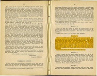
| History of Vermilion County, Illinois, by Lottie E. Jones, 1911 - years of operation. |
Mine Notes
Mine Images

Photographs