Mine Index Number: 0009
| Company Name:
|
Illinois Zinc Company
|
| Mine Name:
|
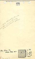
Deer Park Mine or Illinois Zinc No. 1 Mine
|
| Start Date:
|
1900
|
End Date:
|
December 1920
|
| Type of Mine:
|
Underground
|
| Total acres shown:
|
167
|
| Acres after map date:
|
|
General Area of mining acres shown:
|
|
|
|
Shaft, Slope, Drift or Tipple Location(s)
| Type
|
County
|
Township-Range
|
Section
|
Part Section
|
| Main slope
|
La Salle
|
33N 2E
|
30
|
SW SW NE Production was reported for this company in 1900, but these shaft locations were shown on the 1876 Atlas of La Salle County, under the ownership of the M. Reynolds Estate.
|
| Slope
|
La Salle
|
33N 2E
|
30
|
SW SW NE Production was reported for this company in 1900, but these shaft locations were shown on the 1876 Atlas of La Salle County, under the ownership of the M. Reynolds Estate.
|
| Air shaft
|
La Salle
|
33N 2E
|
30
|
NW SW NE Production was reported for this company in 1900, but these shaft locations were shown on the 1876 Atlas of La Salle County, under the ownership of the M. Reynolds Estate.
|
| Old air shaft
|
La Salle
|
33N 2E
|
30
|
NW SW NE Production was reported for this company in 1900, but these shaft locations were shown on the 1876 Atlas of La Salle County, under the ownership of the M. Reynolds Estate.
|
Geology
| Colchester
|
224
|
2.0
|
4.17
|
3.0-3.5
|
LW (old longwall)
|
Geological Problems Reported
Some faults were present and the roof contained many slips. Roof conditions were generally bad. The mine was situated on the La Salle Anticline, and the extreme dip of the coal on the flanks of the anticline resulted in broken roof shale and hard, brittle coal. The gray shale roof contained numerous small pyrite nodules. The coal contained layers of pyrite lenses 8 inches and 16 inches from the floor. The long axis of the lenses was parallel to bedding. Some limestone boulders were reported in the coal seam in NE 30-T33N-R2E. These boulders ranged from 1 x 4 x 5 feet to 3 x 6 x 12 feet. The underclay floor was 12 to 15 feet thick and heaved badly. Sometimes the heaving completely closed an entry. The clay swelled at night whether the mine was wet or dry, and the road had to be graded each morning to allow loads to pass.
Production
| Company
|
Mine Name
|
Date
|
Production (tons)
|
|
|
|
|
|
| Total Production: 1,176,131
|
Production Notes
Coal Report production (if available)
Sources of Data
| Microfilm, document 352412
|
Undated
|
1:1200
|
1:2482
|
Undated
|
| Microfilm, document 352409
|
1-1919
|
1:2400
|
1:4634
|
Secondary source
|
Annotated Bibliography (Data source - brief description of information)
| Coal Reports - Production, ownership, years of operation, mining method.
|
| Directory of Illinois Coal Mines (La Salle County) - Mine names, mine index, ownership, years of operation.
|
| Mine notes (La Salle County) - Mine type, slope location, seam, depth, thickness, geologic problems.
|
| Microfilm map, document 352412, reel 03139, frames 80 & 81 - Slope & shaft locations, mine outline, mining method.
|
| Microfilm map, document 352409, reel 03139, frames 72 & 73, map of Oglesby Mine (mine index 2) - Mine outline (western extent).
|
| Coal Mining Investigations, Bulletin 10 - Geologic problems.
|
Mine Notes
Mine Images
Photographs