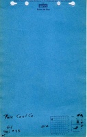
Mine Index Number: 0085
| Company Name:
|
Pure Coal Comapny
|
| Mine Name:
|
Pure Mine
|
| Start Date:
|
1904
|
End Date:
|
October 1946
|
| Type of Mine:
|
Underground
|
| Total acres shown:
|
998
|
| Production Indicated Acres:
|
40
|
General Area of mining acres shown:
|
|
|
|
Shaft, Slope, Drift or Tipple Location(s)
| Type
|
County
|
Township-Range
|
Section
|
Part Section
|
| Main shaft
|
Clinton
|
2N 3W
|
22
|
SW NW NW
|
| Air shaft
|
Clinton
|
2N 3W
|
22
|
SE NW NW
|
Geology
| Herrin
|
440
|
7.5
|
9.0
|
8.0
|
MRP
|
Geological Problems Reported
The roof near the shaft was black shale up to 30 feet thick. This shale came down readily. The area mined by the reported production is lower than expected for the reported average thickness. It is likely that top coal was left in the mine to support the roof. Many concretions were present in the roof. In some areas, a limestone cap rock was present. A brecciated zone ran east-west through the mine, although this zone was not designated on the source map. This zone was 12 inches wide and extended from the floor to the roof, but with no vertical displacement. The source map showed a “fault” crossing a haul route in SW SW SW 22-T2N-R3W. Saltwater seeped into the mine at the rate of about 1 quart per minute. The salt water was associated with a thick oil that also seeped in at a lower rate. Associated gas may have ignited in explosions that took place in December 1937 and January 1938 that killed a total of five miners. The underclay heaved badly.
Production
| Company
|
Mine Name
|
Date
|
Production (tons)
|
|
|
|
|
|
| Total Production: 5,779,190
|
Production Notes
Coal Report production (if available)
Sources of Data
| Microfilm, document 351401
|
9-1943
|
1:2400
|
1:5296
|
Not final
|
Annotated Bibliography (Data source - brief description of information)
| Coal Reports - Production, ownership, years of operation.
|
| Directory of Illinois Coal Mines (Clinton County) - Mine names, mine index, ownership, years of operation.
|
| Mine notes (Clinton County) - Mine type, shaft location, seam, depth, thickness, geologic problems.
|
| Microfilm map, document 351401, reel 03136, frames 9-12 - Shaft locations, mine outline, mining method.
|
Mine Notes
Mine Images
Photographs