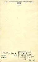
Mine Index Number: 0194
| Company Name:
|
Indiana and Illinois Coal Corporation
|
| Mine Name:
|
Indiana and Illinois No. 10 Mine
|
| Start Date:
|
1906
|
End Date:
|
April 1939
|
| Type of Mine:
|
Underground
|
| Total acres shown:
|
2,381
|
| Acres after map date:
|
|
General Area of mining acres shown:
|
|
|
|
Shaft, Slope, Drift or Tipple Location(s)
| Type
|
County
|
Township-Range
|
Section
|
Part Section
|
| Main shaft (10'x26.67')
|
Montgomery
|
10N 2W
|
10
|
SE NW NE
|
| Air/escape shaft (10'x15')
|
Montgomery
|
10N 2W
|
10
|
NW SE NE
|
Geology
| Herrin
|
635-646
|
|
|
7.0-8.5
|
RPP
|
Geological Problems Reported
Two areas of faulting were noted on the source map, one in NW NE NW 3-T10N-R2W and the other in W ½ NW NW 2-T10N-R2W. Top coal (18 to 24 inches) was left to support the black shale roof. The coal had a few small slips that had little effect on mining; the floor clay also had slips. The underclay heaved in the northern part of the mine.
Production
| Company
|
Mine Name
|
Date
|
Production (tons)
|
|
|
|
|
|
| Total Production: 14,202,442
|
Production Notes
Coal Report production (if available)
Sources of Data
| Microfilm, document 352583
|
6-1-1939
|
1:2400
|
1:5462
|
Final
|
Annotated Bibliography (Data source - brief description of information)
| Coal Reports - Production, ownership, years of operation, shaft sizes, seam, depth, thickness.
|
| Directory of Illinois Coal Mines (Montgomery County) - Mine names, mine index, ownership, years of operation.
|
| Mine notes (Montgomery County) - Mine type, shaft location, depth, thickness, geologic problems.
|
| Microfilm map, document 352583, reel 03139, frames 384-387 - Shaft locations, mine outline, mining method, geologic problems.
|
Mine Notes
Mine Images
Photographs
Caption: Drowned-out area of corn near Nokomis where the 8 foot coal bed is worked at a depth of about 625 feet.
Credit: Illinois State Geological Survey
Date: Pre-1914
Library No.: M-1000
Caption: Drowned-out area of corn near Nokomis where the 8 foot coal bed is worked at a depth of about 625 feet.
Credit: Illinois State Geological Survey
Date: Pre-1914
Library No.: M-1001
Caption: Drowned-out area of corn near Nokomis where the 8 foot coal bed is worked at a depth of about 625 feet.
Credit: Illinois State Geological Survey
Date: Pre-1914
Library No.: M-995
Caption: Drowned-out area of corn near Nokomis where the 8 foot coal bed is worked at a depth of about 625 feet.
Credit: Illinois State Geological Survey
Date: Pre-1914
Library No.: M-996
Caption: Drowned-out area of corn near Nokomis where the 8 foot coal bed is worked at a depth of about 625 feet.
Credit: Illinois State Geological Survey
Date: Pre-1914
Library No.: M-997
Caption: Drowned-out area of corn near Nokomis where the 8 foot coal bed is worked at a depth of about 625 feet.
Credit: Illinois State Geological Survey
Date: Pre-1914
Library No.: M-998
Caption: Drowned-out area of corn near Nokomis where the 8 foot coal bed is worked at a depth of about 625 feet.
Credit: Illinois State Geological Survey
Date: Pre-1914
Publication: Fig. 32 Cooperative Bulletin 17 – Subsidence in Illinois
Library No.: M-999