Mine Index Number: 0195
| Company Name:
|
Nokomis Coal Company
|
| Mine Name:
|
Reliance Mine
|
| Start Date:
|
1913
|
End Date:
|
July 1952
|
| Type of Mine:
|
Underground
|
| Total acres shown:
|
2,966
|
| Acres after map date:
|
|
General Area of mining acres shown:
|
|
|
|
Shaft, Slope, Drift or Tipple Location(s)
| Type
|
County
|
Township-Range
|
Section
|
Part Section
|
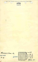
| Main shaft (11.42 ft x 17.42 ft)
|
Montgomery
|
10N 2W
|
27
|
SE SW NW
|
| Air shaft (11.42 ft x 17.42 ft)
|
Montgomery
|
10N 2W
|
27
|
NW SW NW
|
Geology
| Herrin
|
638-659
|
7.0
|
9.0
|
7.5-8.5
|
RPP
|
Geological Problems Reported
A squeeze in SW NE 21-T10N-R2E caused the abandonment of a panel. Other panels in the area are labeled “approximate”, and it is possible that squeezes in this part of the mine prevented surveying.
Production
| Company
|
Mine Name
|
Date
|
Production (tons)
|
|
|
|
|
|
| Total Production: 17,856,892
|
Production Notes
Coal Report production (if available)
Sources of Data
| State Archive, MSHA_422
|
6-1944
|
1:1244
|
1:2400
|
Not final The most recent mining took place in the southern portion of the mine. Although the northern portions are from maps dated before mine closure and are coded “not final” on the accompanying map, the outline is considered to be a final mine outline, and tonnage and the area mined after the map date were not calculated.
|
| State Archive, IL_1758
|
6-1-1954
|
1:2400
|
1:2400
|
Final
|
| State Archive, MSHA_432
|
6-1-1947
|
1:2400
|
1:2400
|
Not final The most recent mining took place in the southern portion of the mine. Although the northern portions are from maps dated before mine closure and are coded “not final” on the accompanying map, the outline is considered to be a final mine outline, and tonnage and the area mined after the map date were not calculated.
|
Annotated Bibliography (Data source - brief description of information)
| Coal Reports - Production, ownership, years of operation, shaft sizes, seam, depth, thickness.
|
| Directory of Illinois Coal Mines (Montgomery County) - Mine names, mine index, ownership, years of operation.
|
| Mine notes (Montgomery County) - Mine type, shaft location, seam, depth, thickness.
|
| State Archive, MSHA_422, courtesy of Robert Gibson, IDNR - Mine outline (northern half), mining method, geologic problems.
|
| State Archive, IL_1758, courtesy of Robert Gibson, IDNR - Shaft locations, mine outline (southern half).
|
| State Archive, MSHA_432, courtesy of Robert Gibson, IDNR - Partial outline (northern half).
|
Mine Notes
Mine Images
Photographs
![[[:Reliance|Reliance]]](https://wikiimage.isgs.illinois.edu/ilmines/montgomery/thumbnails/m0195b_MSHA_432_th.jpg)
![[[:Reliance|Reliance]]](https://wikiimage.isgs.illinois.edu/ilmines/montgomery/thumbnails/m0195a_IL_1758_th.jpg)
![[[:Reliance|Reliance]]](https://wikiimage.isgs.illinois.edu/ilmines/montgomery/thumbnails/m0195_msha_442_th.jpg)