Mine Index Number: 0196
| Company Name:
|
Indiana and Illinois Coal Corporation
|
| Mine Name:
|
Indiana and Illinois No. 12 Mine
|
| Start Date:
|
1897
|
End Date:
|
February 1925
|
| Type of Mine:
|
Underground
|
| Total acres shown:
|
741
|
| Production Indicated Acres:
|
13
|
General Area of mining acres shown:
|
|
|
|
Shaft, Slope, Drift or Tipple Location(s)
| Type
|
County
|
Township-Range
|
Section
|
Part Section
|
| Main shaft
|
Montgomery
|
9N 2W
|
6
|
NE NW SE
|
| Air shaft
|
Montgomery
|
9N 2W
|
6
|
SE NW SE
|
Geology
| Herrin
|
549-568
|
|
|
6.0-8.0
|
RPP
|
Geological Problems Reported
At least one roll was seen in this mine. The roof was clod, up to 1.5 inches thick, with black shale above. An unknown thickness of top coal was left to keep the roof shale up. The coal contained a few small slips, with maximum displacement of 6 inches. The underclay heaved in some places.
Production
| Company
|
Mine Name
|
Date
|
Production (tons)
|
|
|
|
|
|
| Total Production: 4,577,214
|
Production Notes
Coal Report production (if available)
Sources of Data
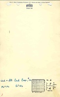
| Microfilm, document 352586
|
1-27-1923
|
1:2400
|
1:4966
|
Not final
|
Annotated Bibliography (Data source - brief description of information)
| Coal Reports - Production, ownership, years of operation, thickness.
|
| Directory of Illinois Coal Mines (Montgomery County) - Mine names, mine index, ownership, years of operation.
|
| Mine notes (Montgomery County) - Mine type, seam, depth, geological problems.
|
| Microfilm map, document 352586, reel 03139, frames 395, 396 - Shaft locations, mine outline, mining method.
|
| State Archive, MSHA_434, courtesy of Robert Gibson - Shaft locations.
|
Mine Notes
Mine Images
Photographs