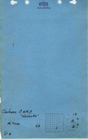
Mine Index Number: 0226
| Company Name:
|
Clarkson Coal Mining Company
|
| Mine Name:
|
Nashville Mine
|
| Start Date:
|
Pre 1881
|
End Date:
|
1939
|
| Type of Mine:
|
Underground
|
| Total acres shown:
|
468
|
| Acres after map date:
|
|
General Area of mining acres shown:
|
|
|
|
Shaft, Slope, Drift or Tipple Location(s)
| Type
|
County
|
Township-Range
|
Section
|
Part Section
|
| Main shaft (6 x 12 feet)
|
Washington
|
2S 3W
|
13
|
NE SW SE
|
| Air shaft
|
Washington
|
2S 3W
|
13
|
SE SW SE
|
Geology
| Herrin
|
425
|
4.5
|
9.5
|
5.8
|
MRP
|
Geological Problems Reported
Faults were numerous in this mine, with displacement up to 3 feet. Some gas was reported. The eastern side of the mine was abandoned when they encountered the coal cut-out of the Anvil Rock Sandstone. Limestone was present generally 4 feet above the coal. The lower surface was irregular and sometimes knobs (“bosses”) extended down through the black shale and into the coal. The knobs were commonly 4 to 6 feet across and extended 1 to 2 feet below the normal bottom of the limestone. The black shale was the most common roof material, and ranged from the average 1.5 feet up to 6 feet thick. Concretions 12 to 15 inches across were present in the black shale roof. Source maps indicate the concretions were problematic more in the eastern and northern portions of the mine and the bosses presented more of a problem in the southeastern part of the mine. A blocky bastard limestone 8 to 10 feet thick was sometimes present below the black shale, and was very difficult to keep up. In some areas, the roof was composed of lenticular deposits of soft light gray shale. The white top was commonly 12 to 15 inches thick, but in places was 8 to 10 feet thick, and this made a treacherous roof. Pyrite was present throughout the coal, with irregular distribution in thickness and continuity. The blue band, generally 3 feet above the bottom of the seam, was very soft and irregular and did not separate from the coal as easily or cleanly as at other mines. Bone coal made up much of the bottom coal, and this was often not mined but used for the floor, to prevent heaving. Along the west entry in 1918 (southern part of the mine), the underclay floor heaved and practically closed the entry. The heaving was exacerbated by water infiltrating the mine from below. Grading was required often near the squeeze so that the haulage way remained open.
Production
| Company
|
Mine Name
|
Date
|
Production (tons)
|
| Charles Hortman
|
Hortman
|
pre1881-1883 Years of operation and production before 1882 are not known. The 1882 Coal Report indicated 15 acres were mined. In 1862 a shaft was sunk by Mr. Huegeli near his flouring mill. The mill was located at roughly the same location that the shaft for the Nashville Mine is located. Mr. Huegeli’s shaft was sunk 230 feet deep, and then drilled another 200 feet. It is likely that Huegeli’s shaft was expanded and later became the Nashville Mine.
|
9,000
|
|
|
| Finke and Harris Coal Company
|
Nashville
|
1909-1911 Idle 1911. When this mine reopened, it may have sunk an additional shaft not shown on the accompanying map. The shaft may have been located along the Missouri-Illinois railroad tracks.
|
6,397
|
|
|
|
|
|
|
|
| Total Production: 2,385,482
|
Production Notes
Coal Report production (if available)
Sources of Data
| State Archive, IL_1815
|
4-1939
|
1:1200
|
1:1200
|
Final
|
Annotated Bibliography (Data source - brief description of information)
| Coal Reports - Production, ownership, years of operation.
|
| Directory of Illinois Coal Mines (Washington County) - Mine names, mine index, ownership, years of operation.
|
| Mine notes (Washington County) - Mine type, shaft size & location, seam, depth, thickness, geologic problems.
|
| State Archive, IL_1815, courtesy of Robert Gibson, IDNR - Mine outline, mining method.
|
| Company map, ISGS map library, 4103.W33 i5.1-4 - Shaft locations, geologic problems.
|
| Worthen, A. H., 1868, Geology and Paleontology of Illinois, Volume III, Chapter IX, Washington County by Henry Engleman, State Journal Steam Press, Springfield, Illinois, 574p. - Ownership, years of operation.
|
| Brinkman, Grover, 1968 - Possible additional shaft location.
|
Mine Notes
Mine Images
Photographs