Mine Index Number: 0335
| Company Name:
|
Indiana and Illinois Coal Corporation
|
| Mine Name:
|
Indiana and Illinois No. 14 Mine
|
| Start Date:
|
1907
|
End Date:
|
April 1921
|
| Type of Mine:
|
Underground
|
| Total acres shown:
|
723
|
| Production Indicated Acres:
|
50
|
General Area of mining acres shown:
|
|
|
|
Shaft, Slope, Drift or Tipple Location(s)
| Type
|
County
|
Township-Range
|
Section
|
Part Section
|
| Main shaft
|
Montgomery
|
10N 2W
|
32
|
NW SW NW There were no shaft locations shown on the source map. The workings shown on the source map were examined and points were placed at the most likely locations for both the main shaft and the air shaft based on the configuration of the workings and the surface buildings.
|
| Air shaft
|
Montgomery
|
10N 2W
|
32
|
NW SW NW There were no shaft locations shown on the source map. The workings shown on the source map were examined and points were placed at the most likely locations for both the main shaft and the air shaft based on the configuration of the workings and the surface buildings.
|
Geology
Geological Problems Reported
Occasional pockets of gas were found in the coal.
Production
| Company
|
Mine Name
|
Date
|
Production (tons)
|
|
|
|
|
|
| Total Production: 4,892,884
|
Production Notes
Coal Report production (if available)
Sources of Data
| Microfilm, document 352587
|
4-1920
|
1:2400
|
1:4634
|
Not final
|
Annotated Bibliography (Data source - brief description of information)
| Coal Reports - Production, ownership, years of operation, mine type, seam.
|
| Directory of Illinois Coal Mines (Montgomery County) - Mine names, mine index, ownership, years of operation.
|
| Mine notes (Montgomery County) - Shaft location, depth, thickness, geologic problems.
|
| Microfilm map, document 352587, reel 03139, frames 397-400 - Shaft locations, mine outline, mining method.
|
Mine Notes
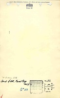
Mine Images
Photographs
Caption: Pond North of Witt
Credit: Illinois State Geological Survey
Library No.: M-809