Mine Index Number: 0359
| Company Name:
|
Peabody Coal Company
|
| Mine Name:
|
Northern
|
| Start Date:
|
1928
|
End Date:
|
1974
|
| Type of Mine:
|
Surface
|
| Total acres shown:
|
13,840 The area shown is larger than expected for the reported tonnage. It is likely that some unmined areas are shown as mined that have been disturbed but not mined.
|
| Acres after map date:
|
|
General Area of mining acres shown:
|
|
|
|
Shaft, Slope, Drift or Tipple Location(s)
| Type
|
County
|
Township-Range
|
Section
|
Part Section
|
| Tipple Mining occurred in Kankakee, Will and Grundy Counties. This mine is atypical in having separate index numbers in the different counties. The early (three-digit) mine index numbers were assigned for chemical analyses and sample sets in other databases, thus it would be imprudent to change the numbers to make them more consistent in this database of mine names, owners and years of production. Mine index 0834 is the same mine in Kankakee County, mine index 0675 is the same in Grundy County, and in Will County, the mine index is 0359.
|
Kankakee
|
31N 9E
|
6
|
SW NW SE
|
| Tipple Mining occurred in Kankakee, Will and Grundy Counties. This mine is atypical in having separate index numbers in the different counties. The early (three-digit) mine index numbers were assigned for chemical analyses and sample sets in other databases, thus it would be imprudent to change the numbers to make them more consistent in this database of mine names, owners and years of production. Mine index 0834 is the same mine in Kankakee County, mine index 0675 is the same in Grundy County, and in Will County, the mine index is 0359.
|
Will
|
33N 9E
|
29
|
SE SW SE
|
Geology
| Houchin Creek Most pits mined the Colchester Coal. The Houchin Creek and Cardiff Coals were mined only where those seams were thick enough, generally in the southern and eastern parts of the mine.
|
52
|
1.71
|
3.42
|
|
Surface
|
| Cardiff Most pits mined the Colchester Coal. The Houchin Creek and Cardiff Coals were mined only where those seams were thick enough, generally in the southern and eastern parts of the mine.
|
58
|
|
|
3.83
|
Surface
|
| Colchester Most pits mined the Colchester Coal. The Houchin Creek and Cardiff Coals were mined only where those seams were thick enough, generally in the southern and eastern parts of the mine.
|
64
|
|
|
2.4-3.0
|
Surface
|
Geological Problems Reported
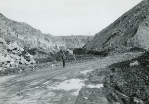
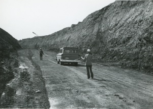
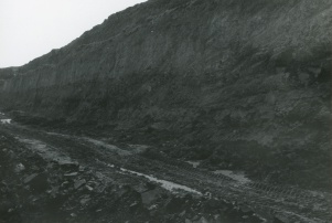
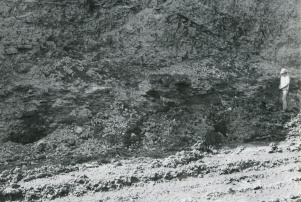
The overlying drift was a hard, gray, boulder-filled clay, and below that, in Will County,
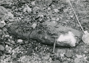
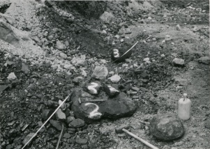
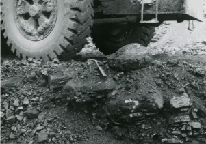
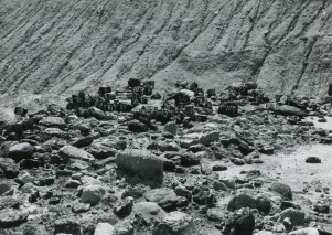
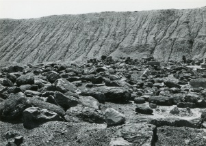
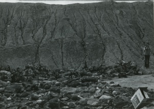
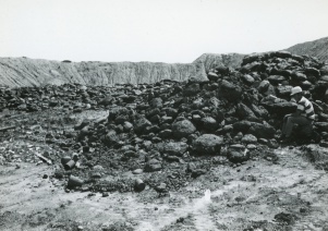
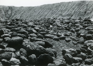
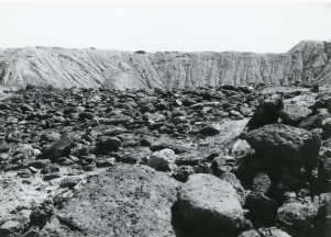
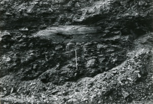
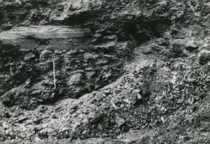
up to 20 feet of massive gray shale (Francis Creek). The Colchester Coal was relatively flat-lying, while the Cardiff Coal dipped markedly where the Francis Creek Shale (overlies Colchester Coal) thinned rapidly. The bottom 5 feet of the Francis Creek Shale contained concretions and siderite nodules up to 1 inch thick and 4 inches across. In Will County, rolls were a prominent feature of the Colchester Coal. The top of the seam may vary 8 feet vertically over 50 horizontal feet. The Colchester Coal also contained stony masses that may have been petrifactions of woody material. These stony masses ranged from 6 inches to 3 feet long, 3 inches to 2 feet wide, and 1 to 8 inches thick. They were present throughout the seam. The Houchin Creek and Cardiff Coals contained prominent cleat fillings of pyrite and calcite. Pyrite was also present as lenses that were up to 0.125 inches thick and extending laterally 2 feet across.
Production
| Company
|
Mine Name
|
Date
|
Production (tons)
|
|
|
|
|
|
| Total Production: 44,024,604 The production for each county was not always reported separately. In Grundy County, 3,476,341 tons were mined. 31,986,845 tons were mined in Will County. 4,525,991 tons were reported mined in Kankakee County. This leaves 4,035,427 tons for which the county has not been indicated. Mining ended in Grundy County in 1972 and 1973 in Kankakee County.
|
Production Notes
Coal Report production (if available)
Sources of Data
| Coal Section files, 5-e-16
|
Undated
|
1:12000
|
1:12000
|
Undated
|
| Coal Section files, 1-29-17
|
12-22-1971
|
1:4800
|
1:4800
|
Not final
|
| USGS topographic map (Gardner Quadrangle))
|
1983
|
1:24000
|
1:24000
|
Secondary source
|
| Company map, 4102 i5.1-18
|
7-1-1950
|
1:4800
|
1:4800
|
Final
|
| Company map, 4103.G72 i5.1-3
|
7-1-1950
|
1:4800
|
1:4800
|
Final
|
| Company map, 4103.G72 i5.1-4
|
1-1-1947
|
1:4800
|
1:4800
|
Final
|
| WPA, T33N-R8E
|
7-1-1937
|
1:69696
|
1:69696
|
Secondary source
|
| USGS topographic map (Coal City Quadrangle)
|
1993
|
1:24000
|
1:24000
|
Secondary source
|
| Company, 4103.W51 i5.1-1
|
1-1945
|
1:4800
|
1:4800
|
Final
|
| Microfilm, document 351368
|
1-1941
|
1:4800
|
1:7945
|
Final
|
| ISGS map library, 4103.W51 i5.1-4
|
1935
|
1:31680
|
1:31680
|
Secondary source
|
| USGS topographic map (Wilmington Quadrangle)
|
1993
|
1:24000
|
1:24000
|
Secondary source
|
| Coal Section files, 1-27-30A
|
6-30-1967
|
1:9600
|
1:9600
|
Not final
|
| Coal Section files, 1-27-30C
|
6-30-1967
|
1:9600
|
1:9600
|
Not final
|
| USGS topographic map (Essex Quadrangle)
|
PR1980
|
1:24000
|
1:24000
|
Secondary source
|
Annotated Bibliography (Data source - brief description of information)
| Coal Reports - Production, ownership, years of operation.
|
| Directory of Illinois Coal Mines (Will County) - Mine names, mine index, ownership, years of operation.
|
| Mine notes (Grundy County) - Mine type, seam, depth, thickness, geologic problems.
|
| Coal Section files, 5-e-16 - Mine outline (Pits 12, 13, 15 and 16), mining method.
|
| Coal Section files, 1-29-17 - Mine outline (Pit 14), mining method.
|
| USGS 7.5-minute topographic map, Gardner Quadrangle, Provisional 1983 - Mine outline.
|
| Company map, ISGS map library, 4102 i5.1-18 - Mine outline (Pit 6), mining method.
|
| Company map, ISGS map library, 4103.G72 i5.1-3 - Mine outline (Pit 7), mining method.
|
| Company map, ISGS map library, 4103.G72 i5.1-4 - Mine outline (Pit 8), mining method.
|
| WPA map, T33N-R8E - Mine outline (Pit 1).
|
| USGS 7.5-minute topographic map, Coal City Quadrangle, 1993 - Mine outline.
|
| Mine notes (Will County) - Mine type, tipple location, seam, depth, thickness.
|
| ISGS field notes (Will County) - Geologic problems.
|
| Company map, ISGS map library, 4103.W51 i5.1-1 - Mine outline (pits 2-5), mining method.
|
| Microfilm map, document 351368, reel 03135, frames 396-397 - Mine outline (pits 1 and 6), mining method.
|
| ISGS map library, 4103.W51 i5.1-4, sheet 3, work map compiled from J. C. Quade notes and maps - Tipple location.
|
| USGS 7.5-minute topographic map, Wilmington Quadrangle, 1993 - Mine outline.
|
| Coal Section files, 1-27-30A - Tipple location, mine outline (south half, Pit 11), mining method.
|
| Coal Section files, 1-27-30C - Mine outline (north half, Pit 11), mining method.
|
| USGS 7.5-minute topographic map, Essex Quadrangle, 1973, photorevised 1980 - Mine outline.
|
Mine Notes
Mine Images
Photographs
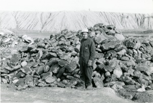
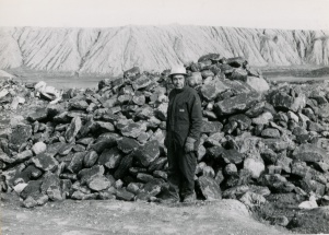
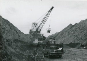
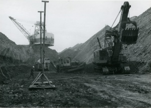
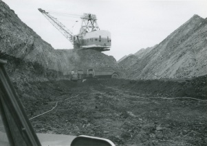
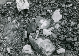
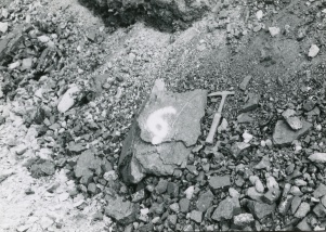
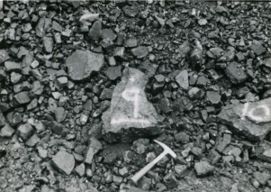
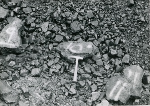
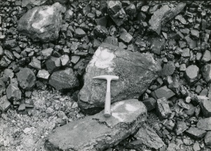
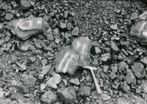
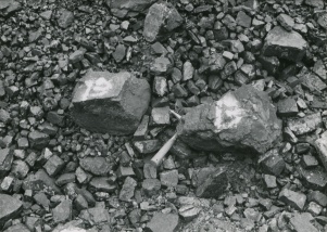
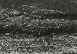
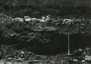
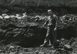
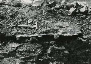
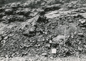
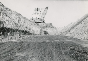
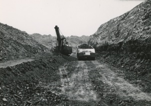
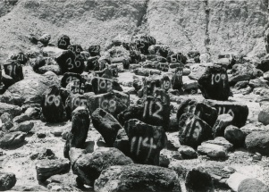
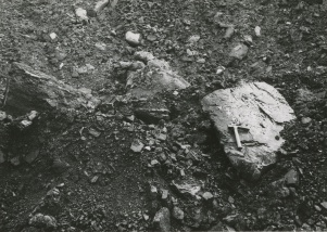
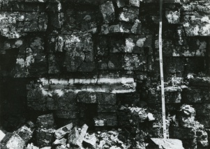
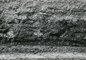
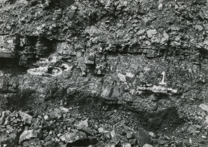
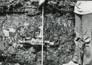
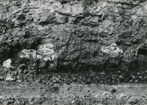
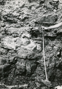
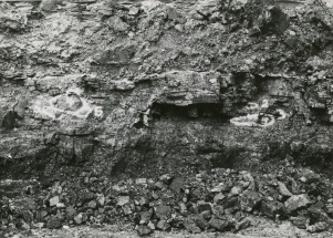
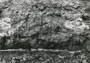
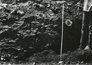
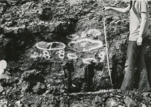
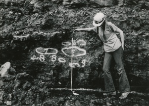
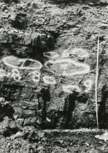
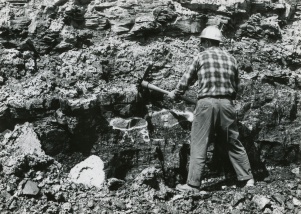
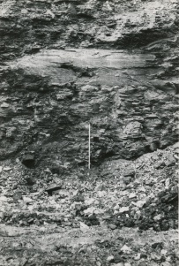
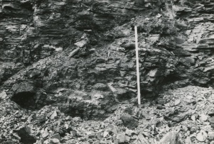
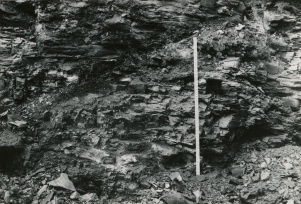
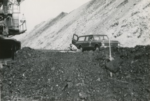
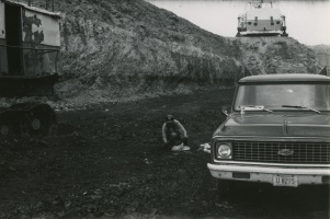
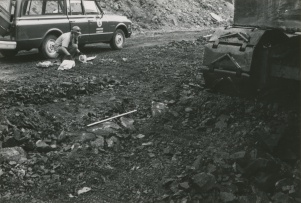
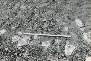
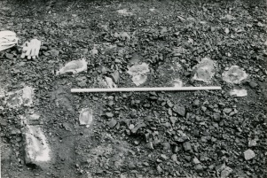
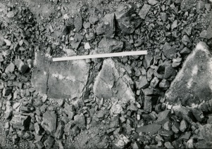
Caption: Coalballs in Pit 14
Credit: Phillips Coal Ball Collection
Date: 05/06/1972
Caption: Coalballs in Pit 14
Credit: Phillips Coal Ball Collection
Date: 05/06/1972
Caption: Coalballs in Pit 14
Credit: Phillips Coal Ball Collection
Date: 05/06/1972
Caption: Coalballs in Pit 14
Credit: Phillips Coal Ball Collection
Date: 05/06/1972
Caption: Coalballs in Pit 14
Credit: Phillips Coal Ball Collection
Date: 05/06/1972
Caption: Coalballs in Pit 14
Credit: Phillips Coal Ball Collection
Date: 05/06/1972
Caption: Coalballs in Pit 14
Credit: Phillips Coal Ball Collection
Date: 05/06/1972
Caption: Coalballs in Pit 14
Credit: Phillips Coal Ball Collection
Date: 05/06/1972
Caption: Coalballs in Pit 14
Credit: Phillips Coal Ball Collection
Date: 05/06/1972
Caption: Coalballs in Pit 14
Credit: Phillips Coal Ball Collection
Date: 05/06/1972
Caption: Coalballs in Pit 14
Credit: Phillips Coal Ball Collection
Date: 05/06/1972
Caption: Coalballs in Pit 14
Credit: Phillips Coal Ball Collection
Date: 05/06/1972
Caption: Coalballs in Pit 14
Credit: Phillips Coal Ball Collection
Date: 05/06/1972
Caption: Coalballs in Pit 14
Credit: Phillips Coal Ball Collection
Date: 05/06/1972
Caption: Coalballs in Pit 14
Credit: Phillips Coal Ball Collection
Date: 05/06/1972
Caption: Coalballs in Pit 14
Credit: Phillips Coal Ball Collection
Date: 05/06/1972
Caption: Coalballs in Pit 14
Credit: Phillips Coal Ball Collection
Date: 05/06/1972
Caption: Coalballs in Pit 14
Credit: Phillips Coal Ball Collection
Date: 05/06/1972
Caption: Coalballs in Pit 14
Credit: Phillips Coal Ball Collection
Date: 05/06/1972
Caption: Coalballs in Pit 14
Credit: Phillips Coal Ball Collection
Date: 05/06/1972
Caption: Coalballs in Pit 14
Credit: Phillips Coal Ball Collection
Date: 05/06/1972
Caption: Coalballs in Pit 14
Credit: Phillips Coal Ball Collection
Date: 05/06/1972
Caption: Coalballs in Pit 14
Credit: Phillips Coal Ball Collection
Date: 05/06/1972
Caption: Coalballs in Pit 14
Credit: Phillips Coal Ball Collection
Date: 05/06/1972
Caption: Coalballs in Pit 14
Credit: Phillips Coal Ball Collection
Date: 05/06/1972
Caption: Coalballs in Pit 14
Credit: Phillips Coal Ball Collection
Date: 05/06/1972
Caption: Coalballs in Pit 14
Credit: Phillips Coal Ball Collection
Date: 05/06/1972
Caption: Coalballs in Pit 14
Credit: Phillips Coal Ball Collection
Date: 05/06/1972
Caption: Coalballs in Pit 14
Credit: Phillips Coal Ball Collection
Date: 05/06/1972
Caption: Coalballs in Pit 14
Credit: Phillips Coal Ball Collection
Date: 05/06/1972
Caption: Coalballs in Pit 14
Credit: Phillips Coal Ball Collection
Date: 05/06/1972
Caption: Coalballs in Pit 14
Credit: Phillips Coal Ball Collection
Date: 05/06/1972
Caption: Coalballs in Pit 14
Credit: Phillips Coal Ball Collection
Date: 05/06/1972
Caption: Coalballs in Pit 14
Credit: Phillips Coal Ball Collection
Date: 05/06/1972
Caption: Coalballs in Pit 14
Credit: Phillips Coal Ball Collection
Date: 05/06/1972
Caption: Coalballs in Pit 14
Credit: Phillips Coal Ball Collection
Date: 05/06/1972
Caption: Coalballs in Pit 14
Credit: Phillips Coal Ball Collection
Date: 05/06/1972
Caption: Coalballs in Pit 14
Credit: Phillips Coal Ball Collection
Date: 05/06/1972
Caption: Coalballs in Pit 14
Credit: Phillips Coal Ball Collection
Date: 05/06/1972
Caption: Coalballs in Pit 14
Credit: Phillips Coal Ball Collection
Date: 05/06/1972
Caption: Coalballs in Pit 14
Credit: Phillips Coal Ball Collection
Date: 05/06/1972
Caption: Coalballs in Pit 14
Credit: Phillips Coal Ball Collection
Date: 05/06/1972
Caption: Coalballs in Pit 14
Credit: Phillips Coal Ball Collection
Date: 05/06/1972
Caption: Coalballs in Pit 14
Credit: Phillips Coal Ball Collection
Date: 05/06/1972
Caption: Coalballs in Pit 14
Credit: Phillips Coal Ball Collection
Date: 05/06/1972
Caption: Coalballs in Pit 14
Credit: Phillips Coal Ball Collection
Date: 05/06/1972
Caption: Coalballs in Pit 14
Credit: Phillips Coal Ball Collection
Date: 05/06/1972
Caption: Coalballs in Pit 14
Credit: Phillips Coal Ball Collection
Date: 05/06/1972
Caption: Coalballs in Pit 14
Credit: Phillips Coal Ball Collection
Date: 05/06/1972
Caption: Coalballs in Pit 14
Credit: Phillips Coal Ball Collection
Date: 05/06/1972
Caption: Coalballs in Pit 14
Credit: Phillips Coal Ball Collection
Date: 05/06/1972
Caption: Coalballs in Pit 14
Credit: Phillips Coal Ball Collection
Date: 05/06/1972
Caption: Coalballs in Pit 14
Credit: Phillips Coal Ball Collection
Date: 05/06/1972
Caption: Coalballs in Pit 14
Credit: Phillips Coal Ball Collection
Date: 05/06/1972
Caption: Coalballs in Pit 14
Credit: Phillips Coal Ball Collection
Date: 05/06/1972
Caption: Coalballs in Pit 14
Credit: Phillips Coal Ball Collection
Date: 05/06/1972
Caption: Coalballs in Pit 14
Credit: Phillips Coal Ball Collection
Date: 05/06/1972
Caption: Coalballs in Pit 14
Credit: Phillips Coal Ball Collection
Date: 05/06/1972
Caption: Coalballs in Pit 14
Credit: Phillips Coal Ball Collection
Date: 05/06/1972
Caption: Coalballs in Pit 14
Credit: Phillips Coal Ball Collection
Date: 05/06/1972
Caption: Coalballs in Pit 14
Credit: Phillips Coal Ball Collection
Date: 05/06/1972
Caption: Coalballs in Pit 14
Credit: Phillips Coal Ball Collection
Date: 05/06/1972
Caption: Coalballs in Pit 14
Credit: Phillips Coal Ball Collection
Date: 05/06/1972
Caption: Coalballs in Pit 14
Credit: Phillips Coal Ball Collection
Date: 05/06/1972
Caption: Coalballs in Pit 14
Credit: Phillips Coal Ball Collection
Date: 05/06/1972
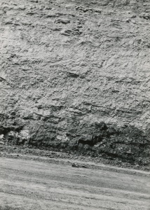
Caption: In situ coalballs and main coalball zone did not have a dark shale immediately over coal.
Credit: Phillips Coal Ball Collection
Date: 05/06/1972
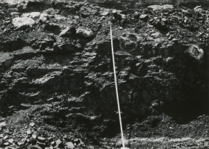
Caption: Coalballs in situ 50-75cm below top of Summum (No.4) coal in main coalball Zone, Northern Illinois Mine, South Wilmington.
Credit: Phillips Coal Ball Collection
Date: 05/06/1972
Caption: Coalballs in situ 50-75cm below top of Summum (No.4) coal in main coalball Zone, Northern Illinois Mine, South Wilmington.
Credit: Phillips Coal Ball Collection
Date: 05/06/1972
Caption: Coalballs in situ 50-75cm below top of Summum (No.4) coal in main coalball Zone, Northern Illinois Mine, South Wilmington.
Credit: Phillips Coal Ball Collection
Date: 05/06/1972
Caption: Coalballs in situ 50-75cm below top of Summum (No.4) coal in main coalball Zone, Northern Illinois Mine, South Wilmington.
Credit: Phillips Coal Ball Collection
Date: 05/06/1972
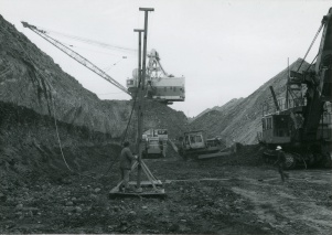
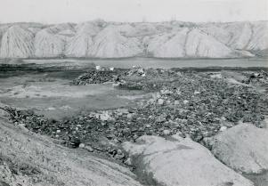
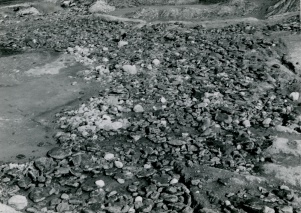
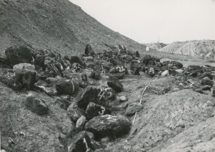
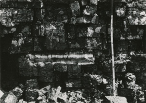
Caption: Main Coalballs zone in Pit 14
Credit: Phillips Coal Ball Collection
Date: 05/06/1972
Caption: Main Coalballs zone in Pit 14
Credit: Phillips Coal Ball Collection
Date: 05/06/1972
Caption: Main Coalballs zone in Pit 14
Credit: Phillips Coal Ball Collection
Date: 05/06/1972
Caption: Main Coalballs zone in Pit 14
Credit: Phillips Coal Ball Collection
Date: 05/06/1972
Caption: Coalballs in place at top of Summum coal in main coalball zone of pit 14
Credit: Phillips Coal Ball Collection
Date: 05/06/1972
Caption: Coalballs in place at top of Summum coal in main coalball zone of pit 14
Credit: Phillips Coal Ball Collection
Date: 05/06/1972
Caption: Coalballs in place at top of Summum coal in main coalball zone of pit 14
Credit: Phillips Coal Ball Collection
Date: 05/06/1972
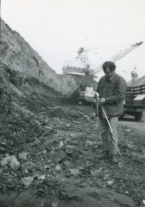
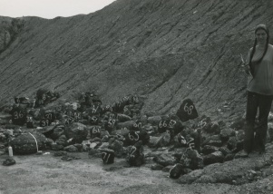
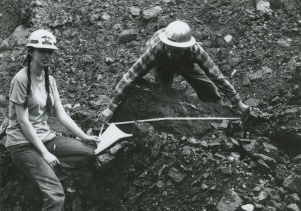
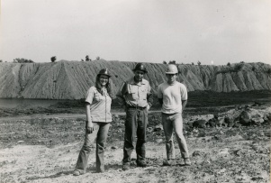
Caption: Joan Courvoisier, Melbourne McKee, & Kenneth Cope in Pit 14
Credit: Phillips Coal Ball Collection
Date: 09/18/1972
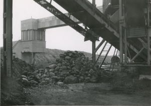
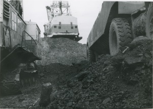
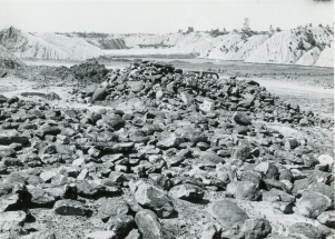
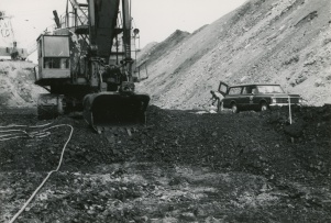
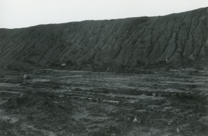
Caption: Stockpile in Pit 11 (coalballs from Pit 14)
Credit: Phillips Coal Ball Collection
Date: 09/18/1972
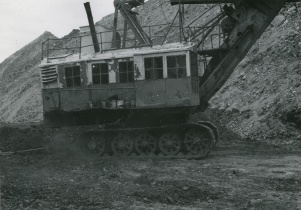
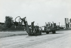
Caption: Coal Cutter
Credit: Phillips Coal Ball Collection
Date: 05/06/1972
Caption: Coal Cutter - High pressure water
Credit: Phillips Coal Ball Collection
Date: 05/06/1972

