Gardner Quadrangle
Mining in the Gardner Quadrangle
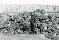
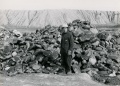
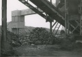
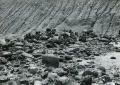
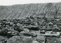
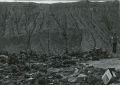
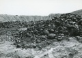
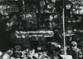
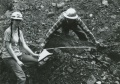
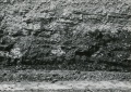
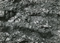
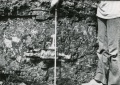
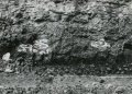
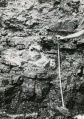
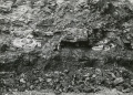
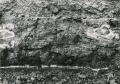
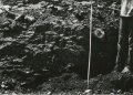
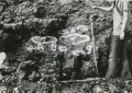
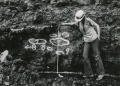
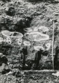
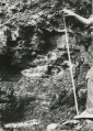
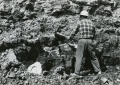
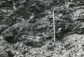
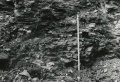
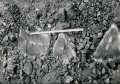
The Colchester Coal was mined in this area by longwall mines that operated before 1915. The two underground mines (mine index 2359, Truckers Mine and mine index 2337, the Number Three Mine) that operated after 1930 utilized the room-and-pillar method of mining. Much of the area is shown as a general area of mining because of a lack of good mine maps, an issue related to the age of the mining. The seam ranges between 90 and 200 feet deep and averages about 3 feet thick. Rolls and small faults interfered somewhat with mining. Roof falls from near-surface water percolating into the mines was a problem at two mines in this quadrangle.
Near the town of Gardner, a mine was started in 1863 by James Congson & William Odell (mine index 7029) and operated for more than ten years. Another mine started in 1865, was not so fortunate. The Joint Stock Coal Mining Company attempted to sink a shaft southwest of town, which was abandoned at 40 feet when water was hit. This shaft was then used as a water well for steam locomotives.
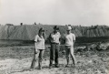
Around the village of Braceville, the Milwaukee Coal Company bought out most of the mines and built ‘Company Houses’ for their employees. At one point, they employed over 600 miners. As these mines closed, most by the late 1800's, many of the ‘Company Houses’ were moved to southern Illinois by flat car.
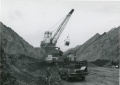
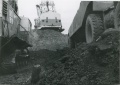
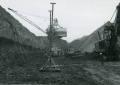
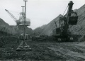
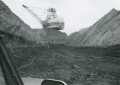
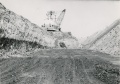
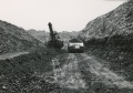
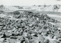
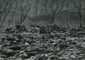
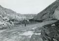
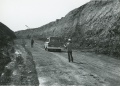
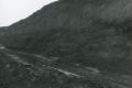
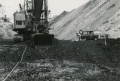
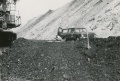
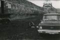
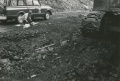
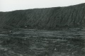
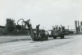
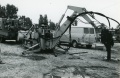
The most recent mining was from the surface. The Northern Mine (mine index 675) operated in other seams where the coal was thick enough, such as the Houchin Creek and Cardiff Coals, in addition to the Colchester Coal. This mine ceased operations in 1974.
Map and Directory PDF Download
Coal Mines In Illinois Gardner Quadrangle
Mines that Appear on the Gardner Quadrangle
Unlocated Mines
Grundy County
Pages in category "Gardner Quadrangle"
The following 24 pages are in this category, out of 24 total.
Media in category "Gardner Quadrangle"
The following 82 files are in this category, out of 82 total.
 Cb001.jpg 2,242 × 1,512; 1.01 MB
 Cb002 01.jpg 1,965 × 1,404; 793 KB
 Cb002 02.jpg 2,178 × 1,525; 677 KB
 Cb002 03.jpg 2,159 × 1,540; 1.24 MB
 Cb002 04.jpg 2,169 × 1,541; 987 KB
 Cb003 01.jpg 2,176 × 1,526; 812 KB
 Cb003 02.jpg 2,178 × 1,541; 700 KB
 Cb003 03.jpg 2,164 × 1,512; 905 KB
 Cb003 04.jpg 2,177 × 1,550; 810 KB
 Cb004 01.jpg 2,159 × 1,525; 771 KB
 Cb004 02.jpg 1,526 × 2,176; 858 KB
 Cb004 03.jpg 2,165 × 1,550; 812 KB
 Cb004 04.jpg 2,167 × 1,530; 780 KB
 Cb005 01.jpg 2,169 × 1,530; 1.07 MB
 Cb005 02.jpg 2,157 × 1,530; 1.04 MB
 Cb005 03.jpg 2,170 × 1,537; 817 KB
 Cb005 04.jpg 2,157 × 1,534; 1.06 MB
 Cb006 01.jpg 2,147 × 1,534; 977 KB
 Cb006 02.jpg 2,174 × 1,537; 906 KB
 Cb006 03.jpg 2,160 × 1,538; 938 KB
 Cb007 01.jpg 2,174 × 1,513; 984 KB
 Cb007 02.jpg 2,165 × 1,530; 1.11 MB
 Cb008 01.jpg 2,222 × 1,577; 1.04 MB
 Cb008 02.jpg 2,223 × 1,570; 1.24 MB
 Cb008 04.jpg 2,233 × 1,578; 947 KB
 Cb008 3.jpg 2,231 × 1,564; 885 KB
 Cb009 01.jpg 2,212 × 1,568; 1.06 MB
 Cb009 02.jpg 2,226 × 1,575; 1.38 MB
 Cb009 03.jpg 2,240 × 1,562; 1.16 MB
 Cb009 4.jpg 2,209 × 1,554; 1.06 MB
 Cb010 01.jpg 2,242 × 1,598; 1.15 MB
 Cb010 02.jpg 2,222 × 1,581; 1.08 MB
 Cb010 03.jpg 2,229 × 1,574; 1.44 MB
 Cb010 04.jpg 2,234 × 1,590; 1.39 MB
 Cb011 01.jpg 2,218 × 1,562; 908 KB
 Cb011 02.jpg 2,222 × 1,568; 939 KB
 Cb011 03.jpg 2,233 × 1,594; 1.3 MB
 Cb011 04.jpg 2,230 × 1,597; 1.11 MB
 Cb012 01.jpg 2,228 × 1,581; 856 KB
 Cb012 02.jpg 2,234 × 1,581; 1.04 MB
 Cb012 03.jpg 2,227 × 1,593; 1.17 MB
 Cb013 01.jpg 2,215 × 1,572; 1.17 MB
 Cb013 02.jpg 1,577 × 2,214; 1.28 MB
 Cb013 03.jpg 2,231 × 1,578; 815 KB
 Cb014 01.jpg 2,226 × 1,582; 900 KB
 Cb014 02.jpg 2,223 × 1,556; 1.04 MB
 Cb014 03.jpg 2,225 × 1,594; 1.17 MB
 Cb014 04.jpg 2,214 × 1,554; 1.03 MB
 Cb015 01.jpg 2,234 × 1,580; 1.49 MB
 Cb015 02.jpg 2,231 × 1,585; 1.46 MB
 Cb015 03.jpg 2,225 × 1,580; 1.17 MB
 Cb015 04.jpg 2,226 × 1,587; 1.14 MB
 Cb016 01.jpg 1,574 × 2,232; 1.27 MB
 Cb016 02.jpg 2,223 × 1,586; 1.31 MB
 Cb016 03.jpg 2,239 × 1,569; 1.28 MB
 Cb017 01.jpg 2,223 × 1,586; 1 MB
 Cb017 02.jpg 2,232 × 1,586; 1.08 MB
 Cb017 03.jpg 2,228 × 1,558; 1.29 MB
 Cb017 04.jpg 2,210 × 1,584; 1.16 MB
 Cb018 01.jpg 1,585 × 2,228; 1.12 MB
 Cb018 02.jpg 1,590 × 2,234; 917 KB
 Cb019 01.jpg 2,228 × 1,587; 1.32 MB
 Cb020 01.jpg 2,299 × 1,540; 634 KB
 Cb020 02.jpg 2,298 × 1,545; 1.11 MB
 Cb020 03.jpg 2,306 × 1,547; 1.11 MB
 Cb020 04.jpg 2,277 × 1,546; 1.14 MB
 Cb021 01.jpg 2,264 × 1,546; 1.08 MB
 Cb021 02.jpg 1,548 × 2,294; 1.23 MB
 Cb021 03.jpg 2,296 × 1,546; 1.07 MB
 Cb021 04.jpg 2,286 × 1,553; 1.18 MB
 Cb022 01.jpg 2,289 × 1,544; 931 KB
 Cb022 02.jpg 2,293 × 1,542; 1.04 MB
 Cb022 03.jpg 2,294 × 1,528; 750 KB
 Cb022 04.jpg 2,299 × 1,548; 844 KB
 Cb023 01.jpg 2,278 × 1,539; 1.47 MB
 Cb023 02.jpg 2,305 × 1,538; 1.37 MB
 Cb023 03.jpg 2,179 × 1,534; 1.14 MB
 Cb023 04.jpg 2,283 × 1,539; 923 KB
 Cb024 01.jpg 2,300 × 1,514; 749 KB
 Cb024 02.jpg 2,289 × 1,540; 691 KB
 Cb024 03.jpg 2,286 × 1,482; 915 KB
 M0675 minenotes.pdf 1,637 × 1,262, 35 pages; 46.45 MB


