Mine Index Number: 0441
| Company Name:
|
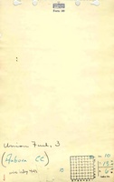
Union Fuel Company
|
| Mine Name:
|
Union Fuel No. 3 Mine
|
| Start Date:
|
1881
|
End Date:
|
February 1924
|
| Type of Mine:
|
Underground
|
| Total acres shown:
|
517
|
| Acres after map date:
|
28 Portions of the eastern part of the mine have an added general area of mining on the accompanying map to indicate where mining may have taken place after the map date.
|
General Area of mining acres shown:
|
53
|
|
|
Shaft, Slope, Drift or Tipple Location(s)
| Type
|
County
|
Township-Range
|
Section
|
Part Section
|
| Main shaft
|
Sangamon
|
13N 6W
|
10
|
NW NE NE
|
| Air shaft
|
Sangamon
|
13N 6W
|
10
|
NW NE NE
|
Geology
Geological Problems Reported
The roof varied in the mine, consisting of sandstone in some areas, with shale in others. The black shale roof ranged from 5 inches to 8 feet, and often had an overlying limestone up to 5 feet thick. Some top coal (10 inches or more) was left to protect the black shale roof, which did not stay up if it was exposed to air. The coal contained shale and pyrite in streaks and bands. The fireclay floor was 3 to 8 feet thick.
Production
| Company
|
Mine Name
|
Date
|
Production (tons)
|
|
|
|
|
|
| Total Production: 2,839,715
|
Production Notes
Coal Report production (if available)
Sources of Data
| State archive, IL_390_03
|
4-1-1922
|
1:2400
|
1:2400
|
Not final
|
| WPA, T13N-R6W
|
1-25-1924
|
1:52800
|
1:52800
|
Secondary source
|
Annotated Bibliography (Data source - brief description of information)
| Coal Reports - Production, ownership, years of operation.
|
| Directory of Illinois Coal Mines (Sangamon County) - Mine names, mine index, ownership, years of operation, seam.
|
| Mine notes (Sangamon County) - Mine type, seam, depth, thickness, geologic problems.
|
| ISGS field notes (Sangamon County) - Depth.
|
| State archive, IL_390_03 - Shaft locations, mine outline, mining method.
|
| WPA map, T13N-R6W - General area of mining (northern and eastern parts of the mine).
|
Mine Notes
Mine Images
 These files may not be true to scale and are not georgistered. These files may not be true to scale and are not georgistered.
|
Map Type:
|
WPA
|
| Map ID:
|
T13N-R6W
|
| Company:
|
|
| Mine Name:
|
|
| Caption:
|
|
| Map Date:
|
|
| Map Status:
|
Secondary
|
| Image Credit:
|
|
| Note:
|
Secondary source on the North and East side of mine index 0441
Clipped version of the WPA, full image here.
|
| More Info:
|
M0441b
|
| Full Res Download:These files are true to scale and most are georegistered for gis software. These files may be a very large (>1GB) download!
|
https://go.illinois.edu/ILMImages/sangamon/m0441b.zip
|
Photographs
Additional Notes
![[[:Union Fuel No. 3|Union Fuel No. 3]]](https://go.illinois.edu/ILMImages/sangamon/thumbnails/m0441_IL_390_03_th.jpg)