Category:Sangamon-County
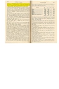
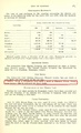
County Coal Data
Mines that Appear in Sangamon-County
- 9998 & 9999 = Unknown dates
Unlocated Mines in Sangamon-County
Mine that have known coal production but no known location
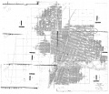
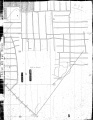
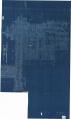
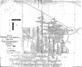
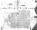
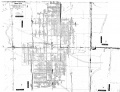
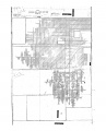
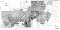
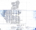
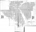
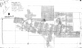
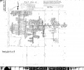
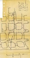
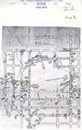
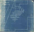
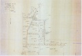
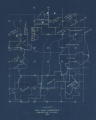
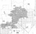
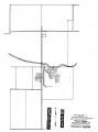
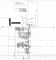
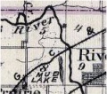
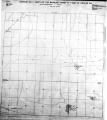
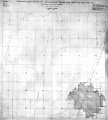
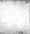
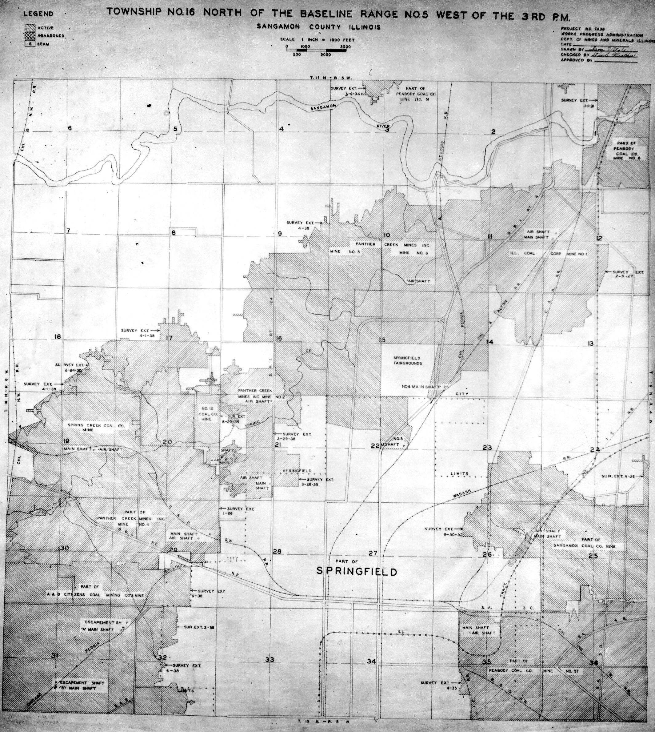
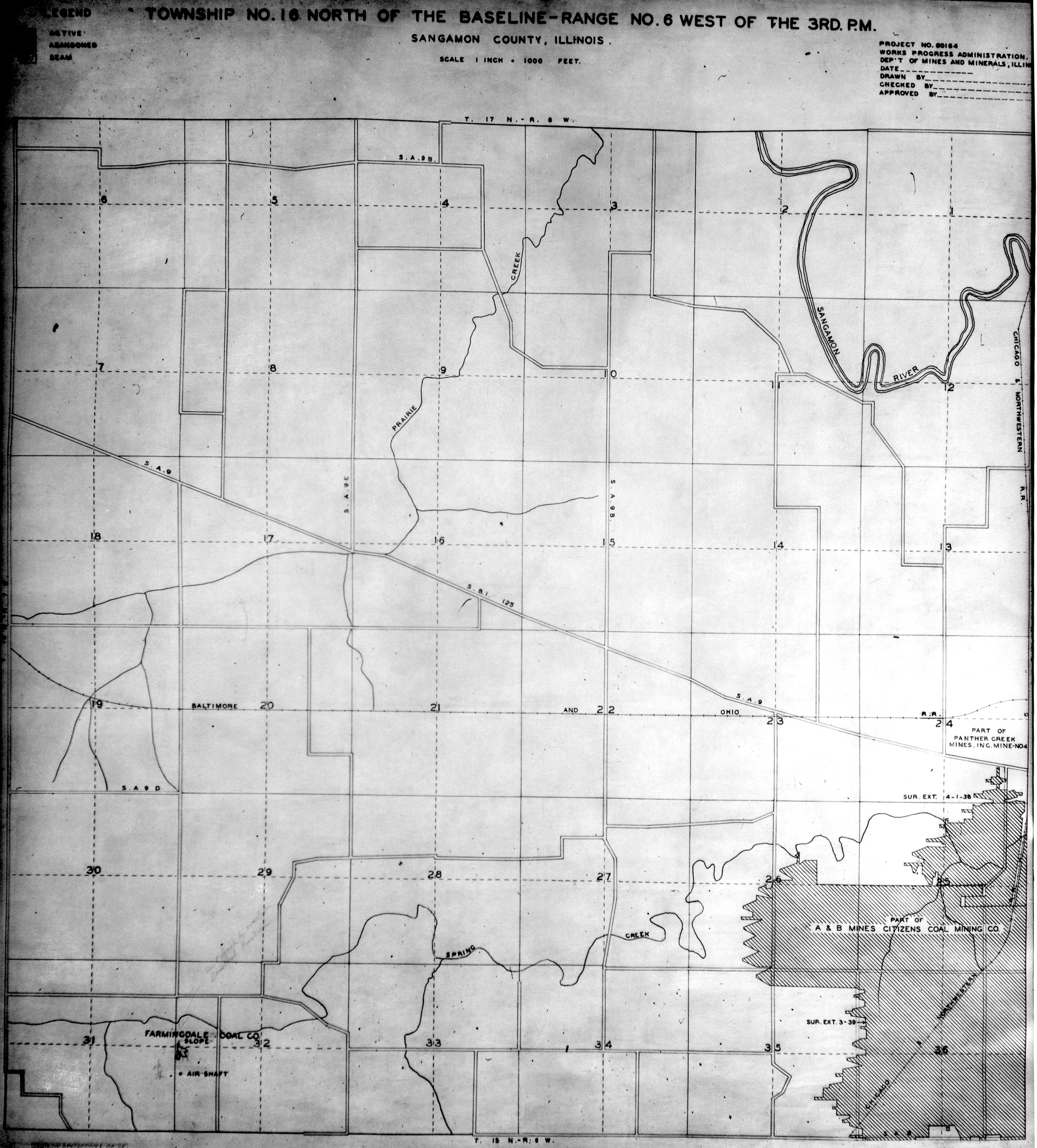
Historical Mined Out Area Maps
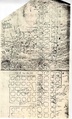
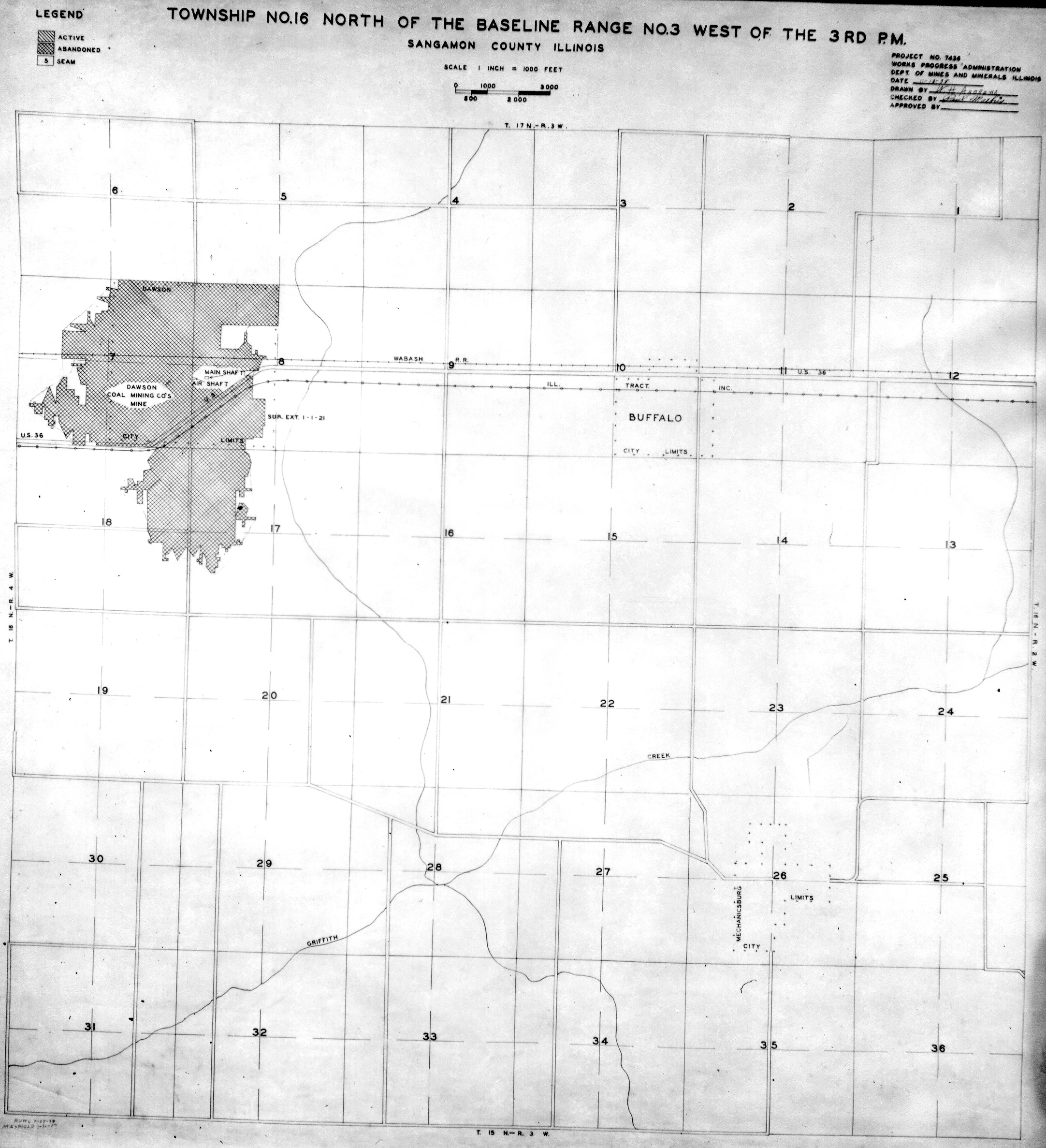
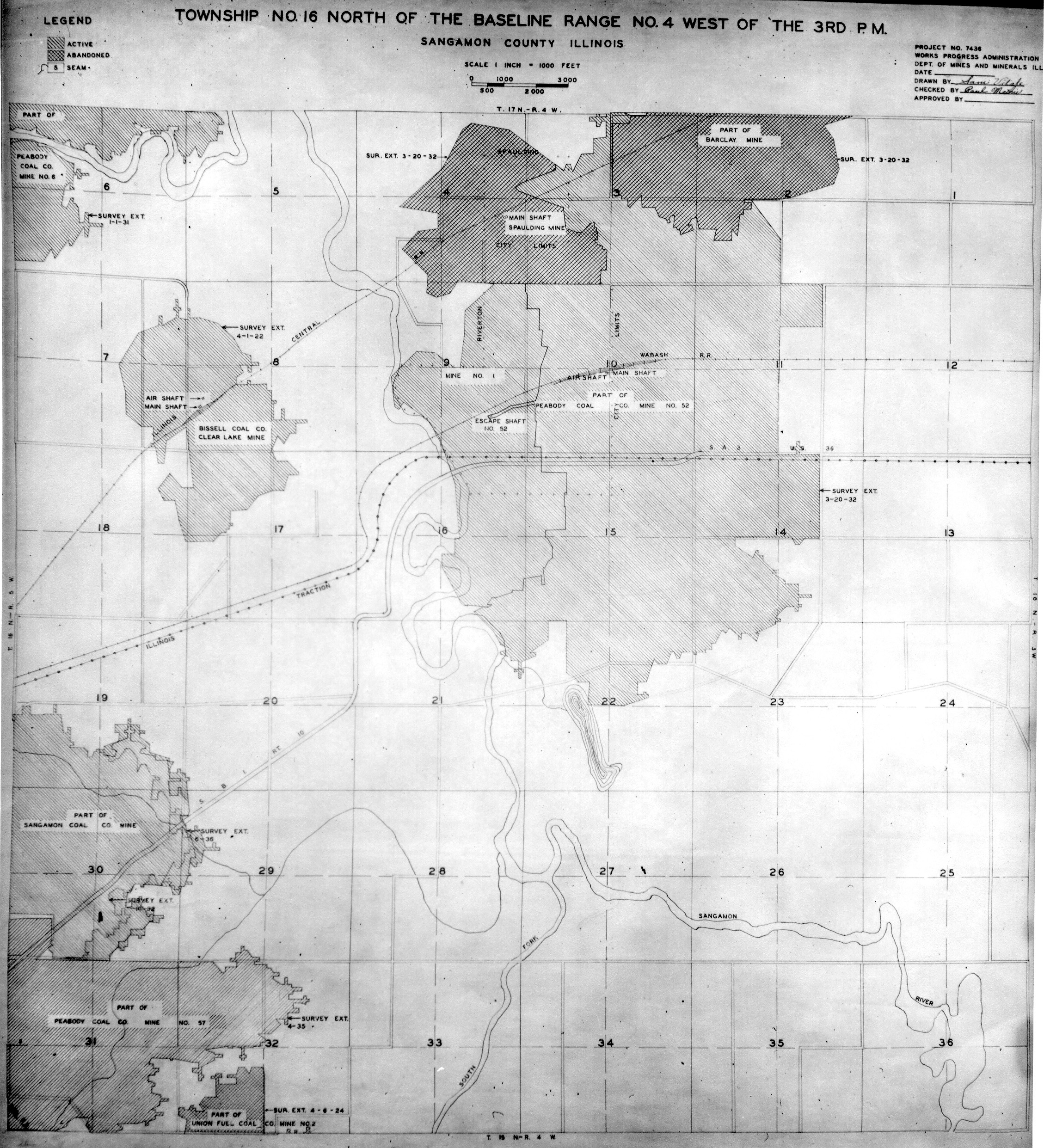
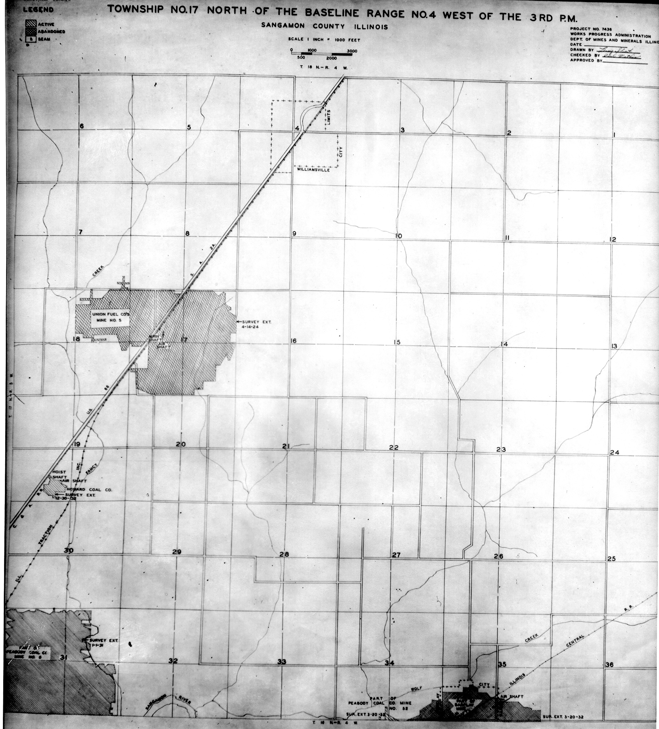
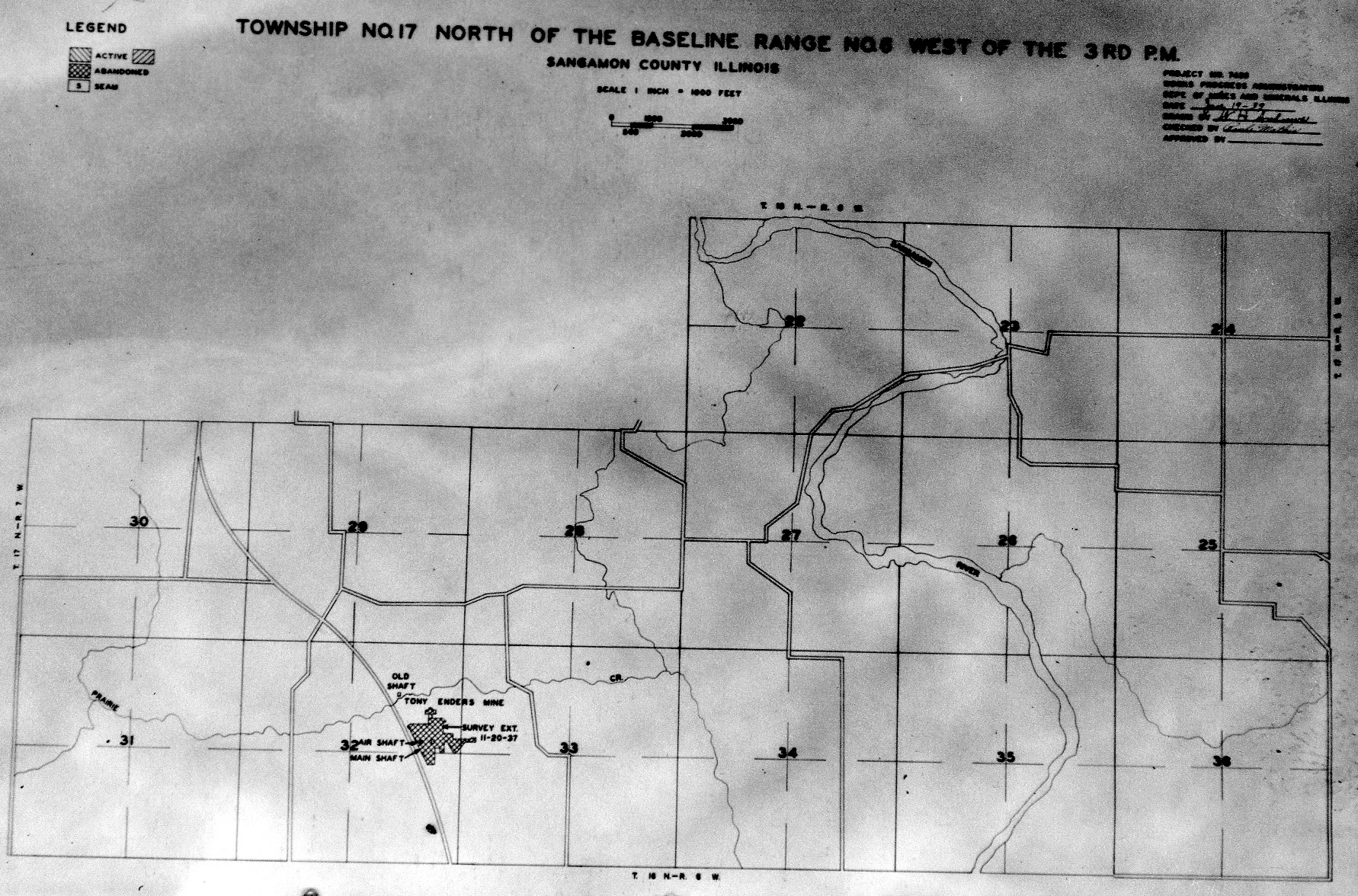
WPA
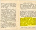
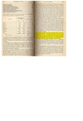
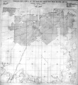
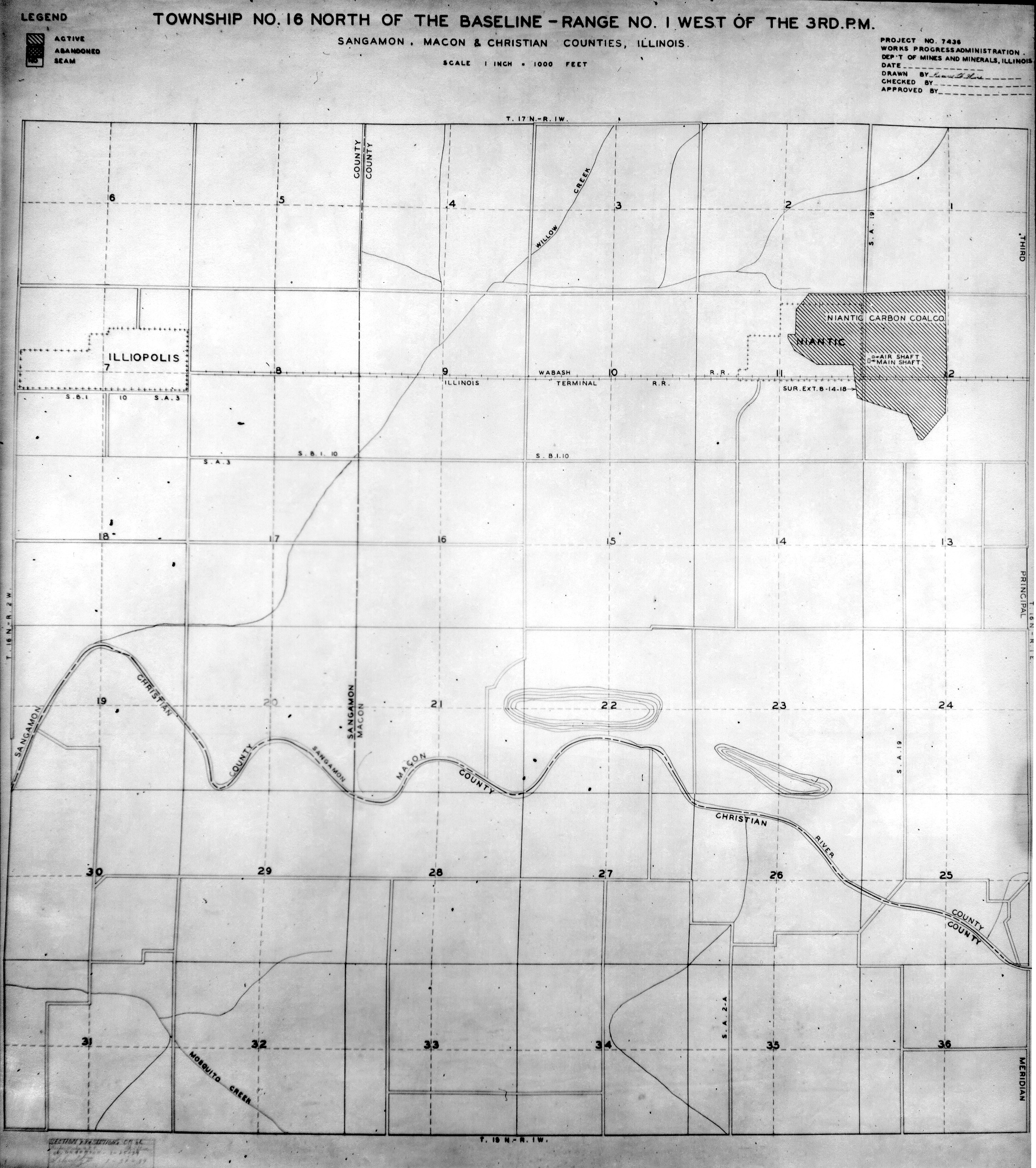
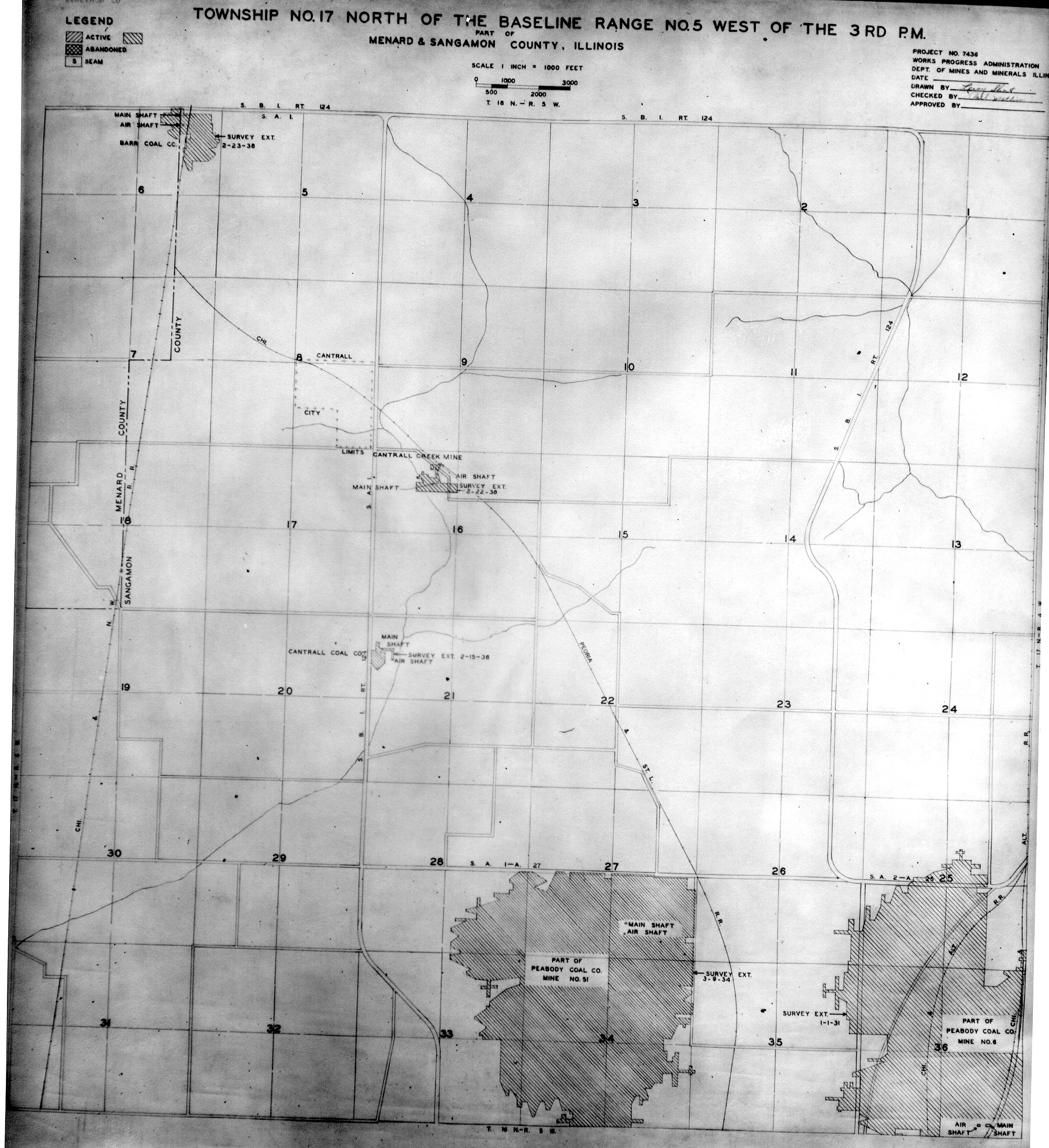
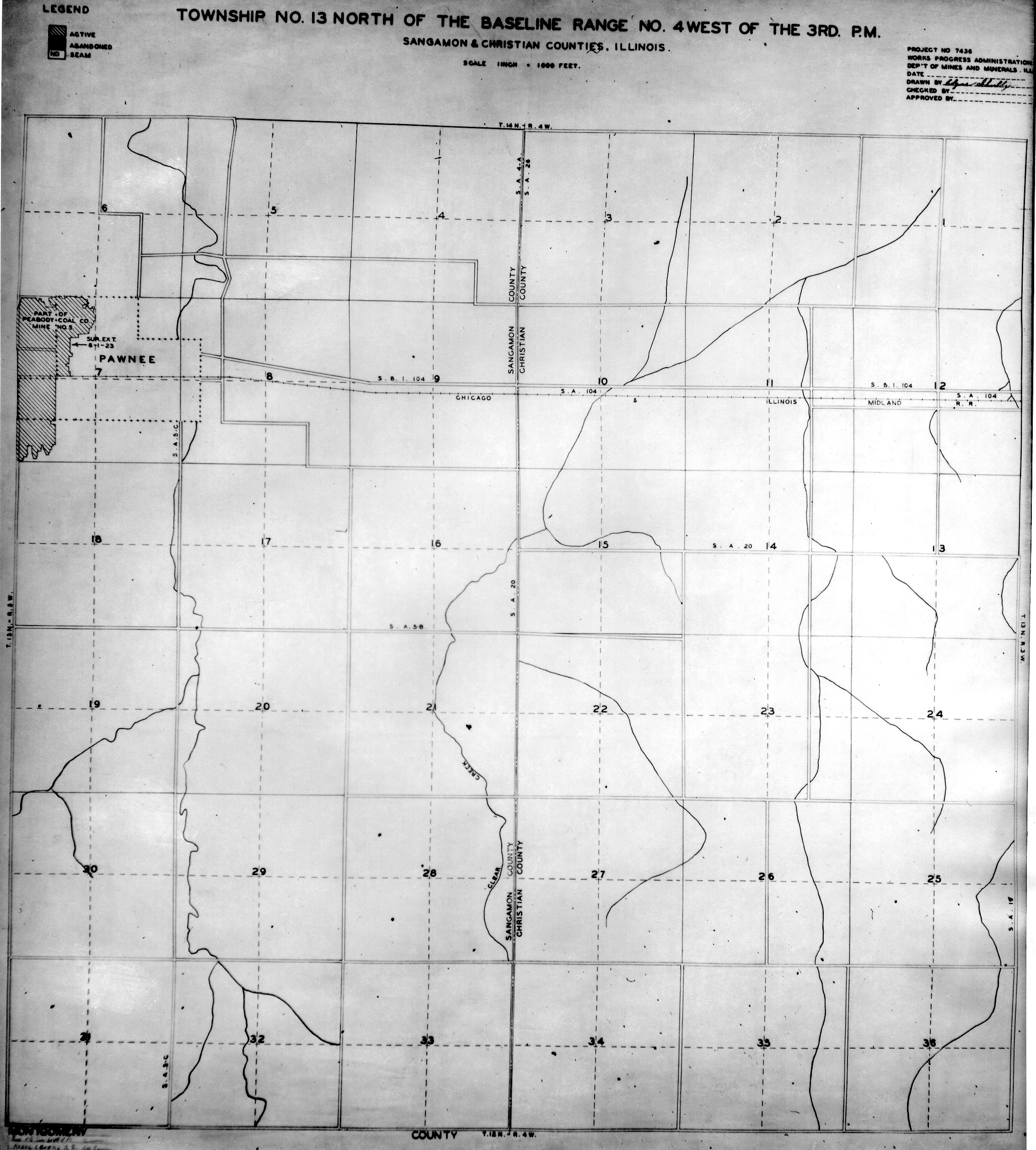
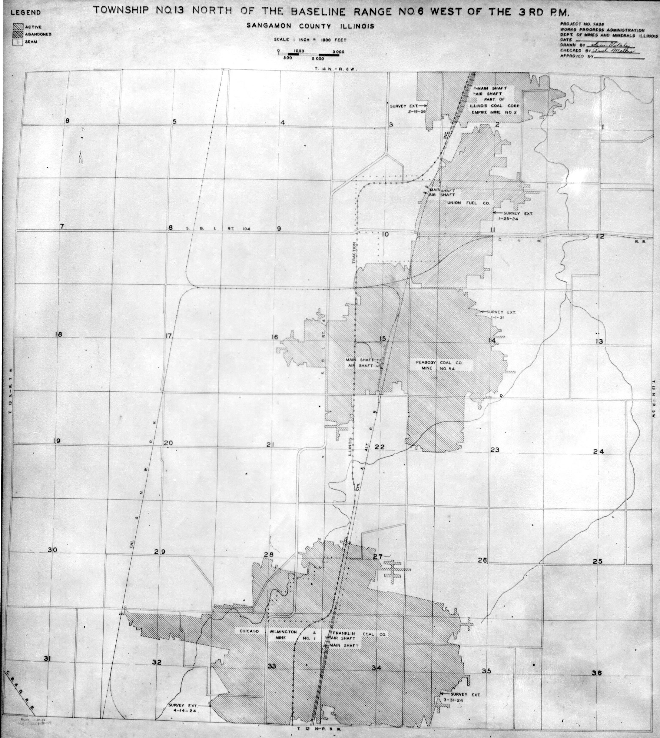
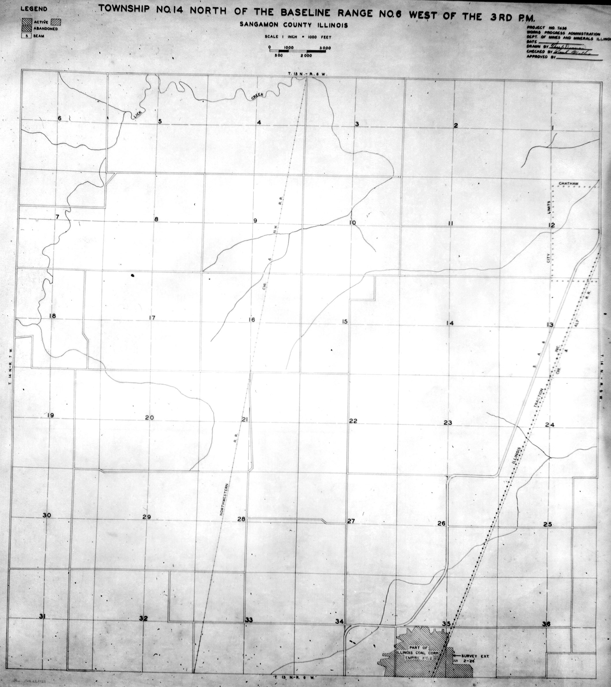
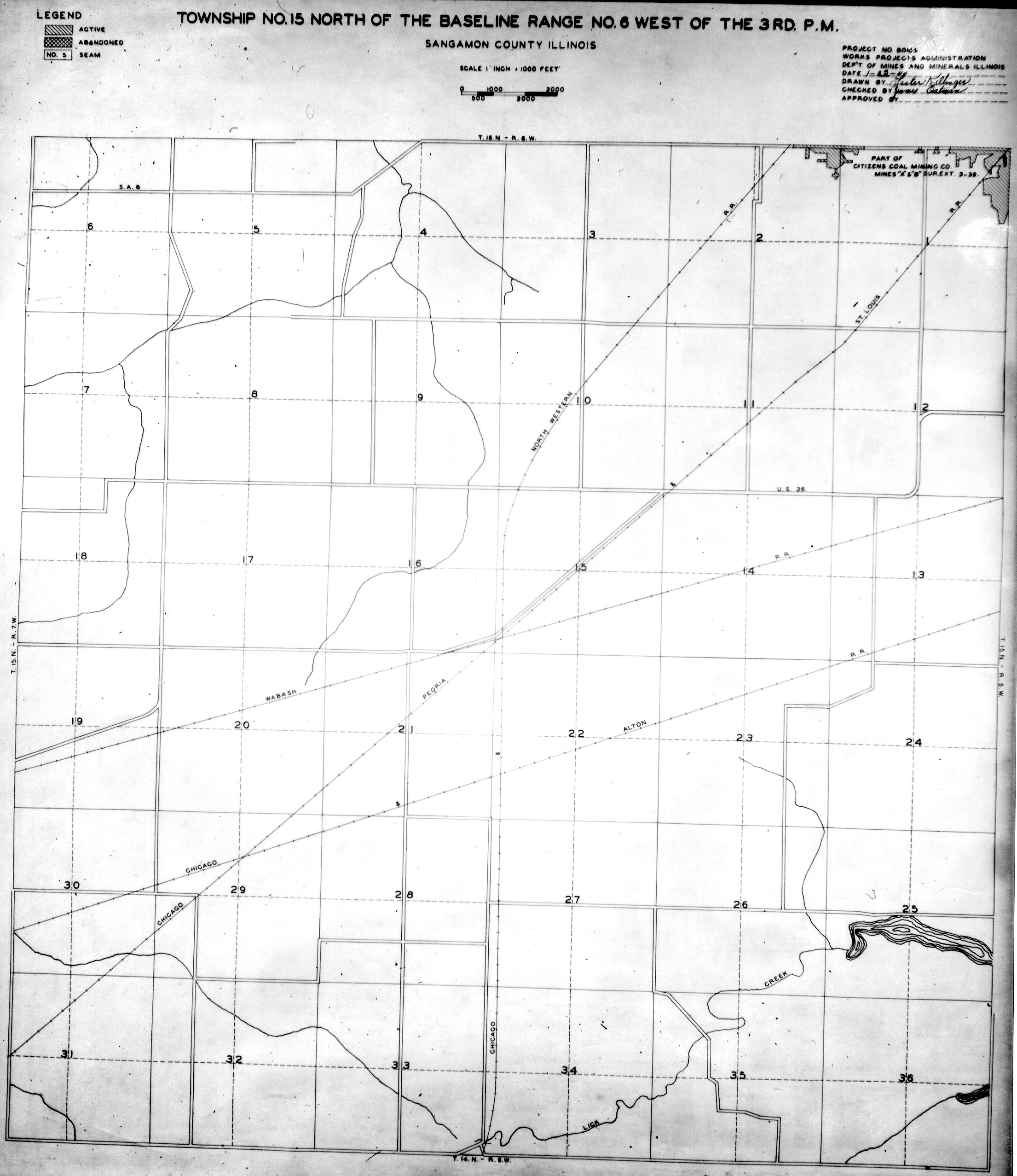
These maps were constructed as part of the nationwide Works Projects Administration (WPA), generally between 1934 and 1937 with some later updates or revisions,
Disclaimer
Maps for some locations might have multiple versions/seams, please inspected these areas closely for differences.
Notes and corrections were made by ISGS staff.
These maps are reproductions from microfilm, they may be of poor quality with text difficult to read.


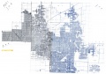
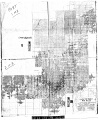
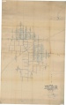
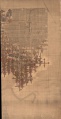
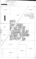
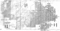
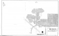
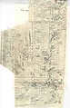
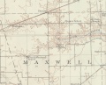
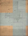
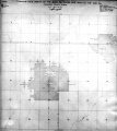
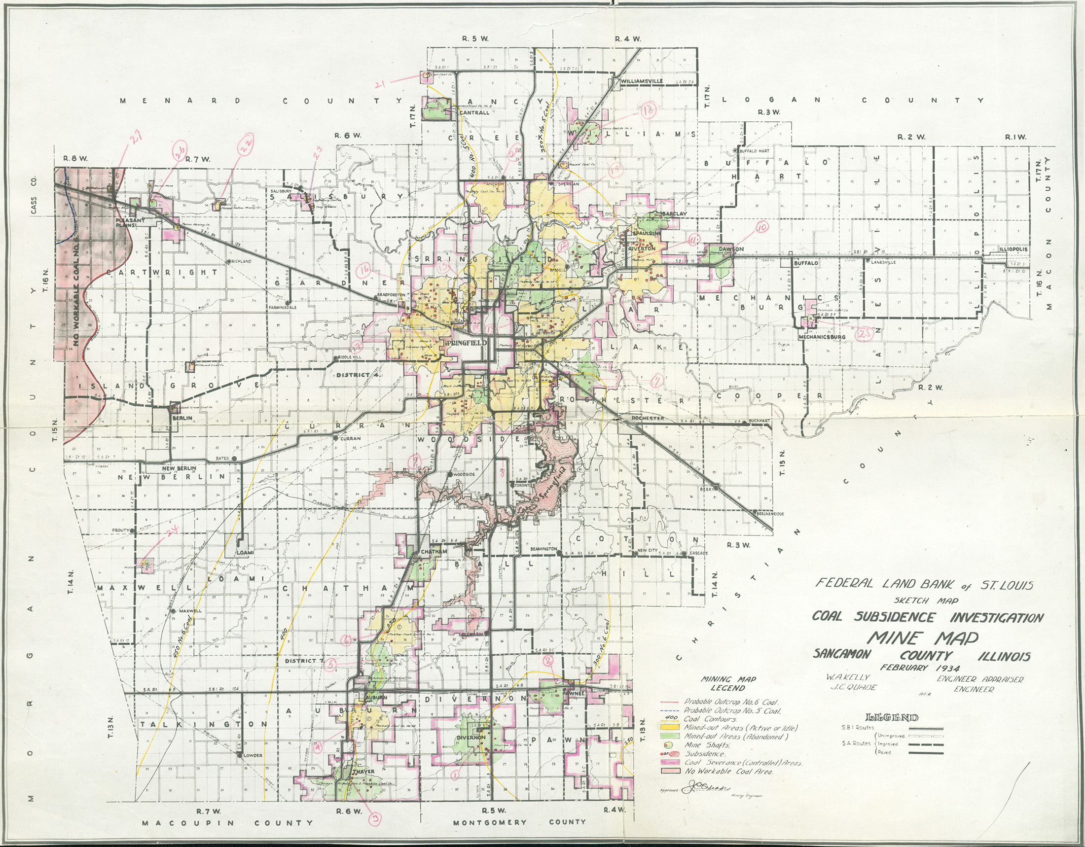
Federal Land Bank of St. Louis, Preliminary Reports on Subsidence Investigations
Federal Land Bank of St. Louis, Preliminary Reports on Subsidence Investigations (refered by Coal Section Staff as "Quade Maps")
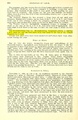
Mining engineers working for the Federal Land Bank of St. Louis mapped areas of subsidence due to coal mining in the early 1930s. These reports often include county maps of mine properties with mined-out areas including shaft locations, as well as subsidence areas.
Disclaimer
Maps for some locations might have multiple versions/seams, please inspected these areas closely for differences.
These maps are accompanied by a report, please download and inspect this document.
Notes and corrections were made by ISGS staff.

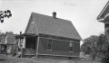
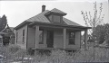
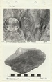
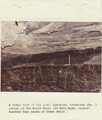
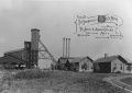
Photographs


Pages in category "Sangamon-County"
The following 93 pages are in this category, out of 93 total.
0
1
2
3
4
6
M
- FileList:M0074
- FileList:M0075 IL 359 03
- FileList:M0120 IL 60 geo
- FileList:M0193 IL 339 03
- FileList:M0314 IL 370 07
- FileList:M0441 IL 390 03
- FileList:M0441b
- FileList:M0616 4103S33 i51 54.zip
- FileList:M0616 IL 55 01
- FileList:M0616 IL 58 01
- FileList:M0616 IL 59 01
- FileList:M0618 IL 2705 01 geo
- FileList:M0618 IL 380 09 geo
- FileList:M0693
- FileList:M0933 final
- FileList:M0998 2022
- FileList:M0998 2024
- FileList:M3336 IL 334 01
- FileList:M3336b
- FileList:M3362 geo
Media in category "Sangamon-County"
The following 200 files are in this category, out of 208 total.
(previous page) (next page)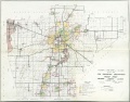 FLB sangamon.jpg 3,398 × 2,654; 1.22 MB
 M-1003 NW Springfield IL Lincoln Park Coal Coop 17 Fig 44 5.75ft coal 200ft deep.jpg 2,500 × 1,456; 461 KB
 M-1004 NW Springfield IL Lincoln Park Coal see M-1003 and 1006.jpg 2,500 × 1,467; 637 KB
 M-1005 NW Springfield IL Lincoln Park Coal.jpg 2,500 × 1,467; 534 KB
 M-1006 NW Springfield IL Lincoln Park Coal see M-1004.jpg 2,500 × 1,481; 742 KB
 M0036 351228.jpg 2,855 × 3,398; 2.17 MB
 M0036 fieldnotes.pdf 747 × 1,195, 2 pages; 541 KB
 M0036 minenotes.pdf 727 × 1,160, 13 pages; 1.27 MB
 M0037 coalreport 1905p296.pdf 633 × 977; 108 KB
 M0037 IL 451.jpg 3,398 × 2,377; 2.19 MB
 M0037 minenotes.pdf 727 × 1,160, 21 pages; 2.11 MB
 M0038 4103S33 i51 50 s3.jpg 3,398 × 1,742; 1.51 MB
 M0038 coalreport 1888p415.pdf 1,589 × 1,297; 1,004 KB
 M0038 minenotes.pdf 733 × 1,175, 14 pages; 1.57 MB
 M0038.jpg 2,784 × 3,398; 3.29 MB
 M0039 351220.jpg 3,398 × 2,925; 2.09 MB
 M0039 coalreport 1903p261.pdf 1,552 × 1,239; 313 KB
 M0039 coalreport 1904.pdf 1,652 × 1,214, 2 pages; 811 KB
 M0039 coalreport 1905.pdf 633 × 977, 3 pages; 227 KB
 M0039 minenotes.pdf 727 × 1,166, 12 pages; 1.2 MB
 M0040 minenotes.pdf 727 × 1,166, 18 pages; 1.79 MB
 M0040 pb 958 03.jpg 3,398 × 2,956; 1.52 MB
 M0074 coalreport 1899p100.pdf 1,545 × 1,170; 376 KB
 M0074 coalreport 1900p163.pdf 1,545 × 1,185; 318 KB
 M0074 minenotes.pdf 731 × 1,160, 24 pages; 2.31 MB
 M0075 coalreport 1904p293.pdf 1,675 × 1,237; 402 KB
 M0075 coalreport 1905p296.pdf 633 × 977; 111 KB
 M0075 minenotes.pdf 731 × 1,160, 22 pages; 2.13 MB
 M0119 3134 394.jpg 2,640 × 3,398; 1.04 MB
 M0119 IL 56.jpg 2,023 × 3,398; 1.04 MB
 M0119 minenotes.pdf 727 × 1,160, 12 pages; 1.36 MB
 M0120 coalreport 1905p298.pdf 633 × 977; 99 KB
 M0120 coalreport 1906p267.pdf 1,666 × 1,281; 371 KB
 M0120 minenotes.pdf 727 × 1,166, 12 pages; 1.32 MB
 M0121 coalreport 1891p135.pdf 793 × 1,275; 1.29 MB
 M0121 coalreport 1892p576.pdf 1,487 × 1,208; 369 KB
 M0121 minenotes.pdf 727 × 1,160, 17 pages; 1.85 MB
 M0121 pb 1089 geo.jpg 2,141 × 3,398; 1.1 MB
 M0122 35121701.jpg 3,398 × 2,766; 1.83 MB
 M0122 35121702.jpg 3,398 × 2,823; 1.36 MB
 M0122 coalreport 1902p207.pdf 804 × 1,250; 1.3 MB
 M0122 minenotes.pdf 733 × 1,175, 19 pages; 2.25 MB
 M0193 minenotes.pdf 727 × 1,166, 17 pages; 2.07 MB
 M0309 351196.jpg 3,398 × 2,785; 2.2 MB
 M0309 minenotes.pdf 727 × 1,166, 13 pages; 1.23 MB
 M0310 coalreport 1884.pdf 1,520 × 1,283; 365 KB
 M0310 minenotes.pdf 727 × 1,160, 9 pages; 878 KB
 M0311 coalreport 1905p298.pdf 633 × 977; 97 KB
 M0311 coalreport 1906p267.pdf 1,666 × 1,281; 370 KB
 M0311 fieldnotes.pdf 747 × 1,193; 242 KB
 M0311 minenotes.pdf 727 × 1,160, 5 pages; 486 KB
 M0312 351237.jpg 3,398 × 2,615; 1.48 MB
 M0312 coalreport 1903p261.pdf 1,552 × 1,239; 308 KB
 M0312 coalreport 1904.pdf 1,641 × 1,227; 490 KB
 M0312 minenotes.pdf 733 × 1,175, 9 pages; 912 KB
 M0313 coalreport 1882p75.pdf 1,585 × 1,227; 361 KB
 M0313 coalreport 1884.pdf 1,591 × 1,283, 2 pages; 710 KB
 M0313 coalreport 1898p180.pdf 1,554 × 1,170; 306 KB
 M0313 coalreport 1899p99.pdf 1,545 × 1,175; 328 KB
 M0313 minenotes.pdf 731 × 1,172, 8 pages; 862 KB
 M0314 coalreport 1901p214.pdf 1,345 × 1,150; 344 KB
 M0314 minenotes.pdf 731 × 1,160, 12 pages; 1.31 MB
 M0343 coalreport 1884.pdf 1,520 × 1,283, 2 pages; 712 KB
 M0343 geo.jpg 2,754 × 3,398; 1.48 MB
 M0343 minenotes.pdf 727 × 1,160, 7 pages; 743 KB
 M0412 coalreport 1903p261.pdf 1,552 × 1,239; 308 KB
 M0412 coalreport 1904p293.pdf 1,675 × 1,237; 402 KB
 M0412 coalreport 1905p296.pdf 633 × 977; 103 KB
 M0412 minenotes.pdf 727 × 1,166, 14 pages; 1.44 MB
 M0412 pb 1018 01.jpg 1,222 × 3,398; 638 KB
 M0412 pb 1018 02.jpg 1,748 × 3,398; 1.56 MB
 M0440 351248.jpg 3,398 × 1,720; 1.7 MB
 M0440 coalreport 1884.pdf 1,597 × 1,260; 355 KB
 M0440 coalreport 1888p415.pdf 1,589 × 1,297; 1,005 KB
 M0440 coalreport 1901p216.pdf 1,331 × 1,168; 332 KB
 M0440 minenotes.pdf 727 × 1,166, 13 pages; 1.31 MB
 M0441 coalreport 1884p541.pdf 1,591 × 1,283; 346 KB
 M0441 coalreport 1896p127.pdf 1,587 × 1,202; 311 KB
 M0441 minenotes.pdf 731 × 1,160, 11 pages; 1.17 MB
 M0616 minenotes.pdf 727 × 1,166, 14 pages; 1.57 MB
 M0617 coalreport 1897p96.pdf 839 × 1,185; 1.64 MB
 M0617 coalreport 1898p180.pdf 1,554 × 1,170; 307 KB
 M0617 minenotes.pdf 727 × 1,166, 30 pages; 8.44 MB
 M0618 coalreport 1884.pdf 1,597 × 1,260; 358 KB
 M0618 minenotes.pdf 727 × 1,166, 16 pages; 1.71 MB
 M0624 geo.jpg 2,822 × 3,398; 1.03 MB
 M0624 minenotes.pdf 727 × 1,166, 14 pages; 1.43 MB
 M0641 il 377.jpg 3,398 × 2,917; 1.97 MB
 M0641 minenotes.pdf 727 × 1,160, 19 pages; 3.71 MB
 M0680 351234.jpg 2,087 × 3,398; 725 KB
 M0680 minenotes.pdf 727 × 1,166, 14 pages; 1.51 MB
 M0693 minenotes.pdf 745 × 1,189, 291 pages; 31.22 MB
 M0806 coalreport 1896p126.pdf 1,587 × 1,202; 311 KB
 M0806 coalreport 1900p163.pdf 1,545 × 1,185; 319 KB
 M0806 coalreport 1901p216-7.pdf 1,331 × 1,168; 334 KB
 M0806 minenotes.pdf 731 × 1,160, 7 pages; 748 KB
 M0806b.jpg 3,398 × 3,059; 2.24 MB
 M0807 351232.jpg 3,398 × 1,754; 1.91 MB
 M0807 coalreport 1884.pdf 1,597 × 1,260; 358 KB
 M0807 coalreport 1903p261.pdf 1,552 × 1,239; 310 KB
 M0807 minenotes.pdf 727 × 1,166, 13 pages; 1.37 MB
 M0861 35120101.jpg 3,398 × 2,011; 1.12 MB
 M0861 35120102.jpg 3,398 × 2,075; 601 KB
 M0861 minenotes.pdf 727 × 1,166, 17 pages; 1.66 MB
 M0925 351245.jpg 3,398 × 2,819; 942 KB
 M0925 minenotes.pdf 727 × 1,166, 8 pages; 805 KB
 M0933 minenotes Part01.pdf 764 × 1,208, 65 pages; 29.79 MB
 M0933 minenotes Part02.pdf 700 × 1,181, 126 pages; 29.75 MB
 M0933 minenotes Part03.pdf 695 × 1,066, 121 pages; 29.83 MB
 M0933 minenotes Part04.pdf 977 × 1,514, 103 pages; 29.65 MB
 M0933 minenotes Part05.pdf 1,235 × 2,041, 80 pages; 29.82 MB
 M0933 minenotes Part06.pdf 1,243 × 2,389, 90 pages; 29.89 MB
 M0933 minenotes Part07.pdf 743 × 1,179, 93 pages; 29.93 MB
 M0933 minenotes Part08.pdf 718 × 797, 93 pages; 29.35 MB
 M0933 minenotes Part09.pdf 752 × 883, 93 pages; 29.67 MB
 M0933 minenotes Part10.pdf 737 × 1,168, 105 pages; 29.97 MB
 M0933 minenotes Part11.pdf 1,112 × 1,508, 6 pages; 2.4 MB
 M2593 minenotes.pdf 727 × 1,160, 3 pages; 363 KB
 M3336 minenotes.pdf 731 × 1,160, 5 pages; 547 KB
 M3337 coalreport 1892p576.pdf 1,487 × 1,208; 369 KB
 M3337 i51 33.jpg 3,398 × 3,233; 1.86 MB
 M3337 minenotes.pdf 727 × 1,166, 8 pages; 866 KB
 M3338 fieldnotes.pdf 750 × 1,193; 140 KB
 M3338 minenotes.pdf 733 × 1,175, 4 pages; 429 KB
 M3338a geo.jpg 3,398 × 2,088; 367 KB
 M3338b geo.jpg 2,754 × 3,398; 409 KB
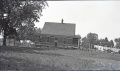
 M3338c.jpg 751 × 606; 148 KB
 M3339 coalreport 1882p75.pdf 1,585 × 1,227; 361 KB
 M3339 coalreport 1884.pdf 1,520 × 1,283; 369 KB
 M3339 coalreport 1898p180.pdf 1,554 × 1,170; 306 KB
 M3339 coalreport 1899p99.pdf 1,545 × 1,175; 328 KB
 M3339 minenotes.pdf 733 × 1,175, 6 pages; 664 KB
 M3340 i51 47.jpg 3,398 × 3,239; 2.37 MB
 M3340 minenotes.pdf 718 × 1,160, 13 pages; 1.38 MB
 M3341 minenotes.pdf 727 × 1,160, 4 pages; 347 KB
 M3341 ml4103S33 i51-22 geo.jpg 2,815 × 1,912; 1.05 MB
 M3342 coalreport 1904p291.pdf 1,641 × 1,227; 482 KB
 M3342 minenotes.pdf 727 × 1,160, 6 pages; 517 KB
 M3345 coalreport 1884p543.pdf 1,520 × 1,283; 367 KB
 M3345 minenotes.pdf 727 × 1,160, 9 pages; 787 KB
 M3345 PB 969 03 geo.jpg 3,004 × 816; 901 KB
 M3347 351239.jpg 2,555 × 3,398; 1.09 MB
 M3347 coalreport 1903p261.pdf 1,552 × 1,239; 312 KB
 M3347 coalreport 1904.pdf 1,641 × 1,227; 491 KB
 M3347 minenotes.pdf 727 × 1,160, 5 pages; 534 KB
 M3348 7 4 9.jpg 3,398 × 2,361; 2.04 MB
 M3348 coalreport 1884.pdf 1,520 × 1,283; 364 KB
 M3348 coalreport 1904p293.pdf 1,675 × 1,237; 402 KB
 M3348 i51 53.jpg 2,713 × 3,398; 988 KB
 M3348 minenotes.pdf 727 × 1,160, 4 pages; 438 KB
 M3349 351224.jpg 1,592 × 3,398; 972 KB
 M3349 minenotes.pdf 727 × 1,166, 4 pages; 378 KB
 M3350 coalreport 1900p163.pdf 1,545 × 1,185; 317 KB
 M3350 coalreport 1901p215.pdf 1,345 × 1,150; 341 KB
 M3350 minenotes.pdf 727 × 1,166, 7 pages; 742 KB
 M3351 351208.jpg 3,398 × 3,225; 1.95 MB
 M3351 coalreport 1884.pdf 1,520 × 1,283; 364 KB
 M3351 minenotes.pdf 727 × 1,166, 10 pages; 1.05 MB
 M3352 coalreport 1884.pdf 1,597 × 1,260; 362 KB
 M3352 minenotes.pdf 727 × 1,166, 5 pages; 492 KB
 M3352 pb 1023.jpg 2,623 × 3,398; 1.93 MB
 M3354 coalreport 1884.pdf 1,597 × 1,260; 358 KB
 M3354 minenotes.pdf 727 × 1,166, 5 pages; 518 KB
 M3355 geo.jpg 2,520 × 3,398; 374 KB
 M3355 minenotes.pdf 727 × 1,166, 6 pages; 560 KB
 M3356 minenotes.pdf 727 × 1,166, 4 pages; 377 KB
 M3357 coalreport 1884.pdf 1,520 × 1,283; 365 KB
 M3357 minenotes.pdf 727 × 1,166, 8 pages; 775 KB
 M3358 351254.jpg 2,275 × 3,398; 875 KB
 M3358 minenotes.pdf 727 × 1,166, 5 pages; 508 KB
 M3359 351188.jpg 3,398 × 2,275; 374 KB
 M3359 minenotes.pdf 727 × 1,166, 4 pages; 392 KB
 M3361 minenotes.pdf 727 × 1,166, 4 pages; 430 KB
 M3362 minenotes.pdf 727 × 1,166, 5 pages; 464 KB
 M3363 minenotes.pdf 727 × 1,166, 7 pages; 763 KB
 M3364 minenotes.pdf 727 × 1,166, 2 pages; 148 KB
 M3365 coalreport 1901p216.pdf 1,331 × 1,168; 333 KB
 M3365 minenotes.pdf 727 × 1,166, 2 pages; 148 KB
 M3366 minenotes.pdf 727 × 1,166, 3 pages; 243 KB
 M3367 fieldnotes.pdf 745 × 1,193; 1.75 MB
 M3367 geo.jpg 3,188 × 3,398; 748 KB
 M3367 minenotes.pdf 727 × 1,166, 7 pages; 755 KB
 M4861 coalreport 1906p268.pdf 1,616 × 1,231; 391 KB
 M4861 coalreport 1907p265.pdf 587 × 966; 64 KB
 M4861 minenotes.pdf 727 × 1,166, 7 pages; 742 KB
 M7737 geo.jpg 3,040 × 2,686; 721 KB
 Ml 876.jpg 3,880 × 2,738; 561 KB
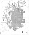
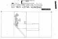
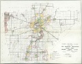 QUADE SANGAMON.jpg 2,200 × 1,718; 1.15 MB
 Sangamon minenotes.pdf 731 × 1,160, 5 pages; 573 KB
 WPA MACON SANGAMON CHRISTIAN 16N1W.jpg 2,256 × 2,544; 1.59 MB
 WPA MENARD SANGAMON 17N5W.jpg 2,280 × 2,495; 1.93 MB
 WPA MENARD SANGAMON 17N7W.jpg 1,828 × 2,048; 999 KB
 WPA SANGAMON 13N5W.jpg 2,224 × 2,498; 1.47 MB
 Wpa sangamon 13n6w.jpg 2,179 × 2,436; 825 KB
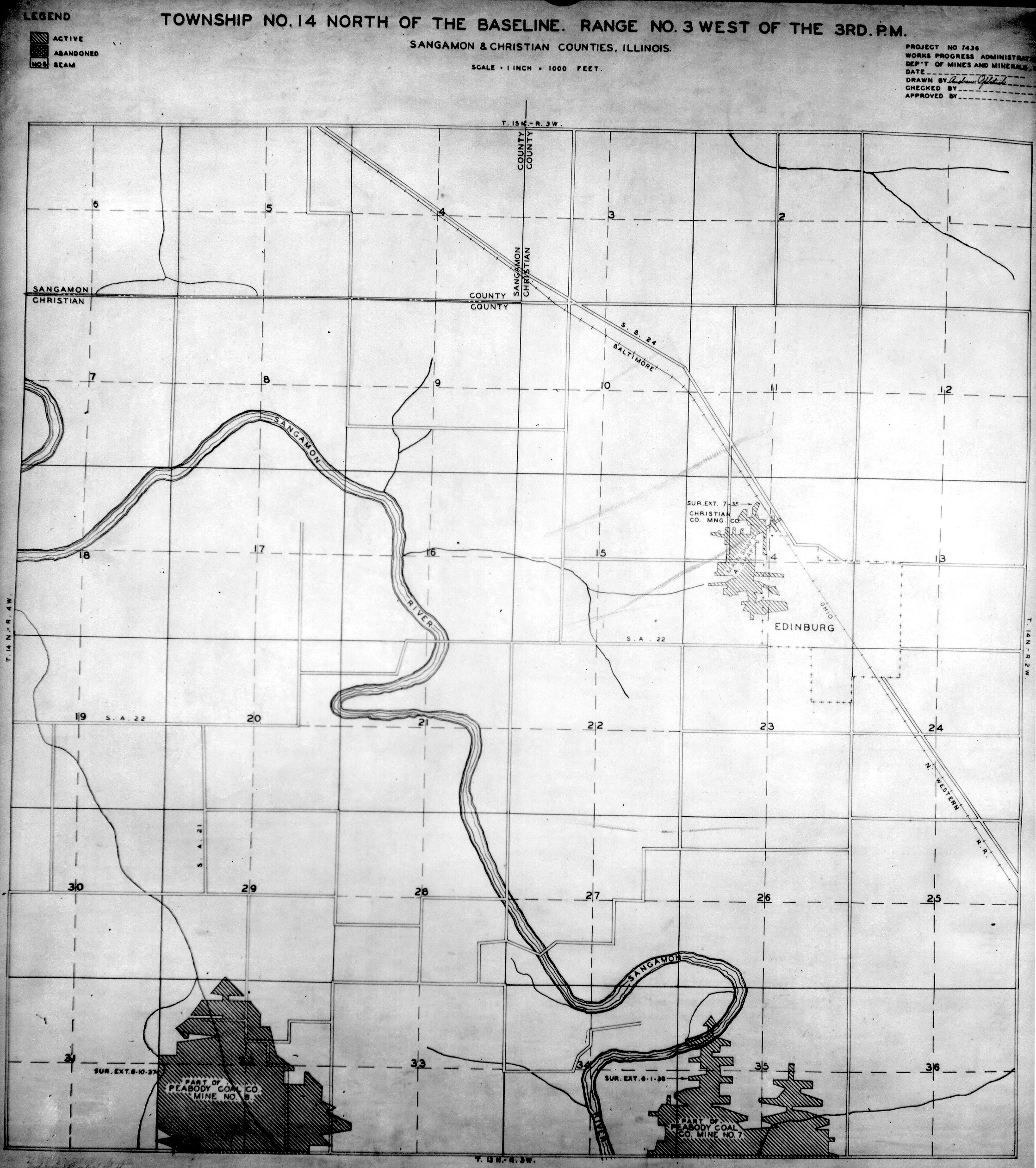
 WPA SANGAMON 14N3W.jpg 2,239 × 2,524; 1.66 MB
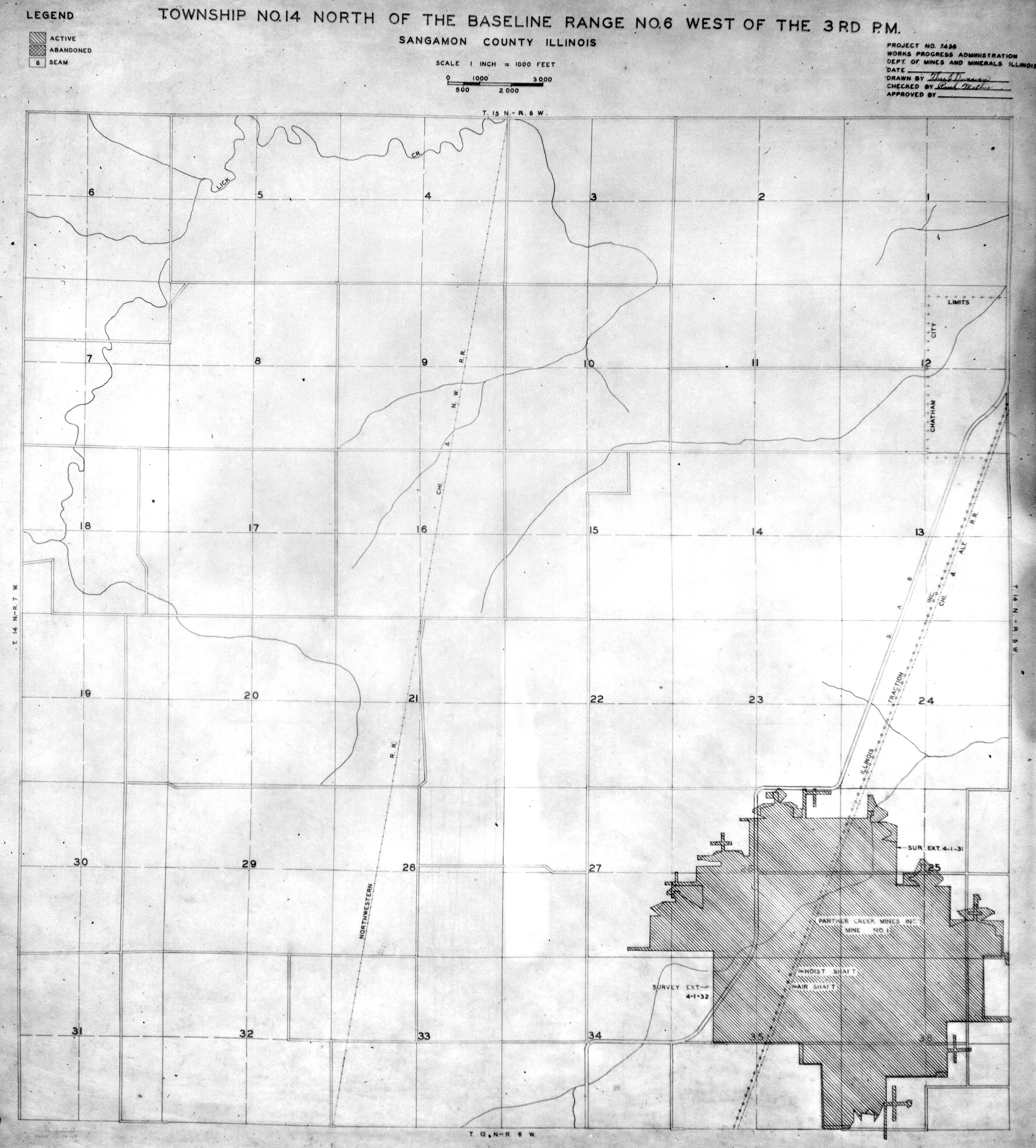
 WPA SANGAMON 14N6W NO 1.jpg 2,180 × 2,415; 1.57 MB
 Wpa sangamon 14n6w v2.jpg 2,115 × 2,378; 558 KB
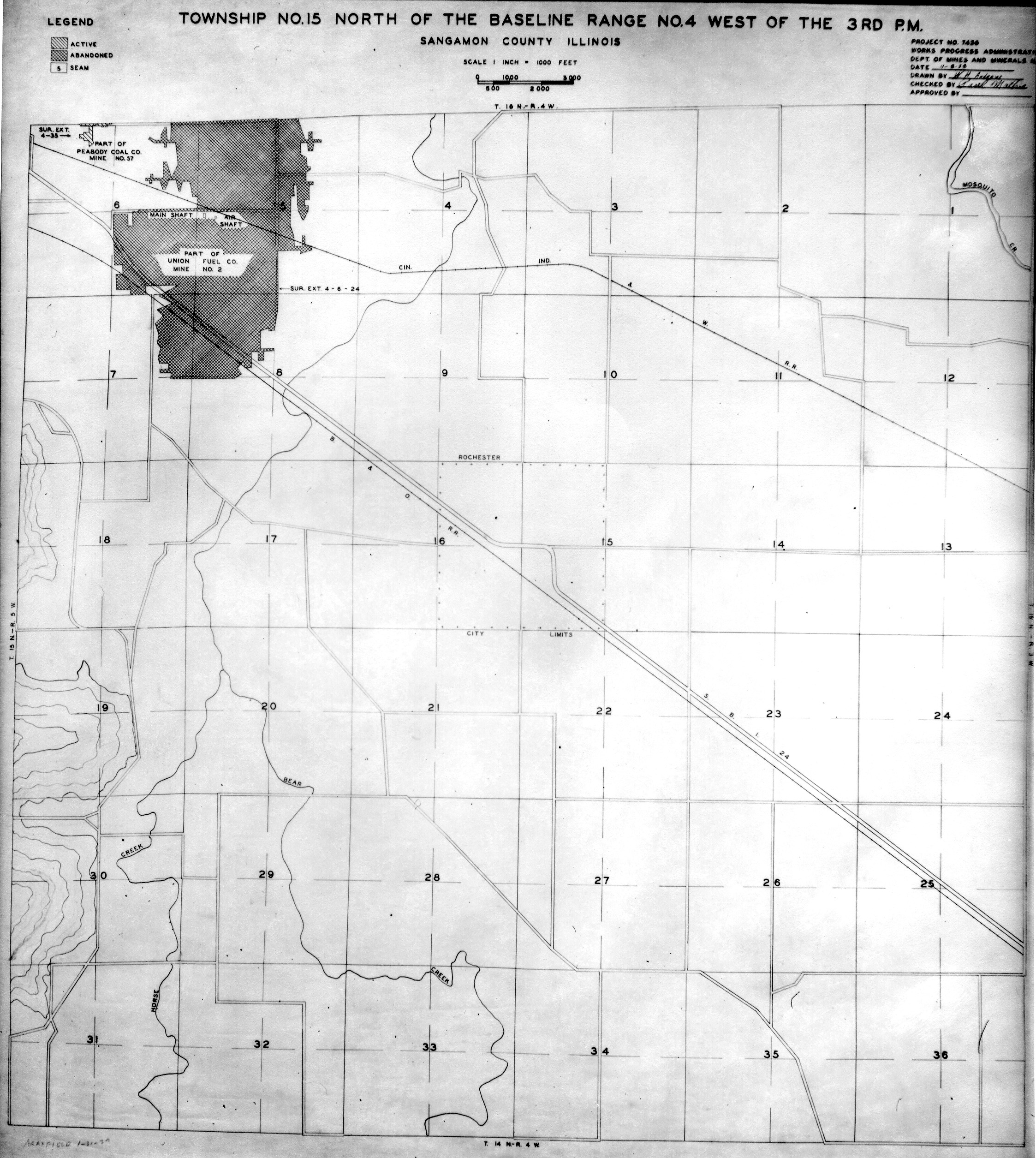
 WPA SANGAMON 15N4W.jpg 2,246 × 2,510; 1.55 MB
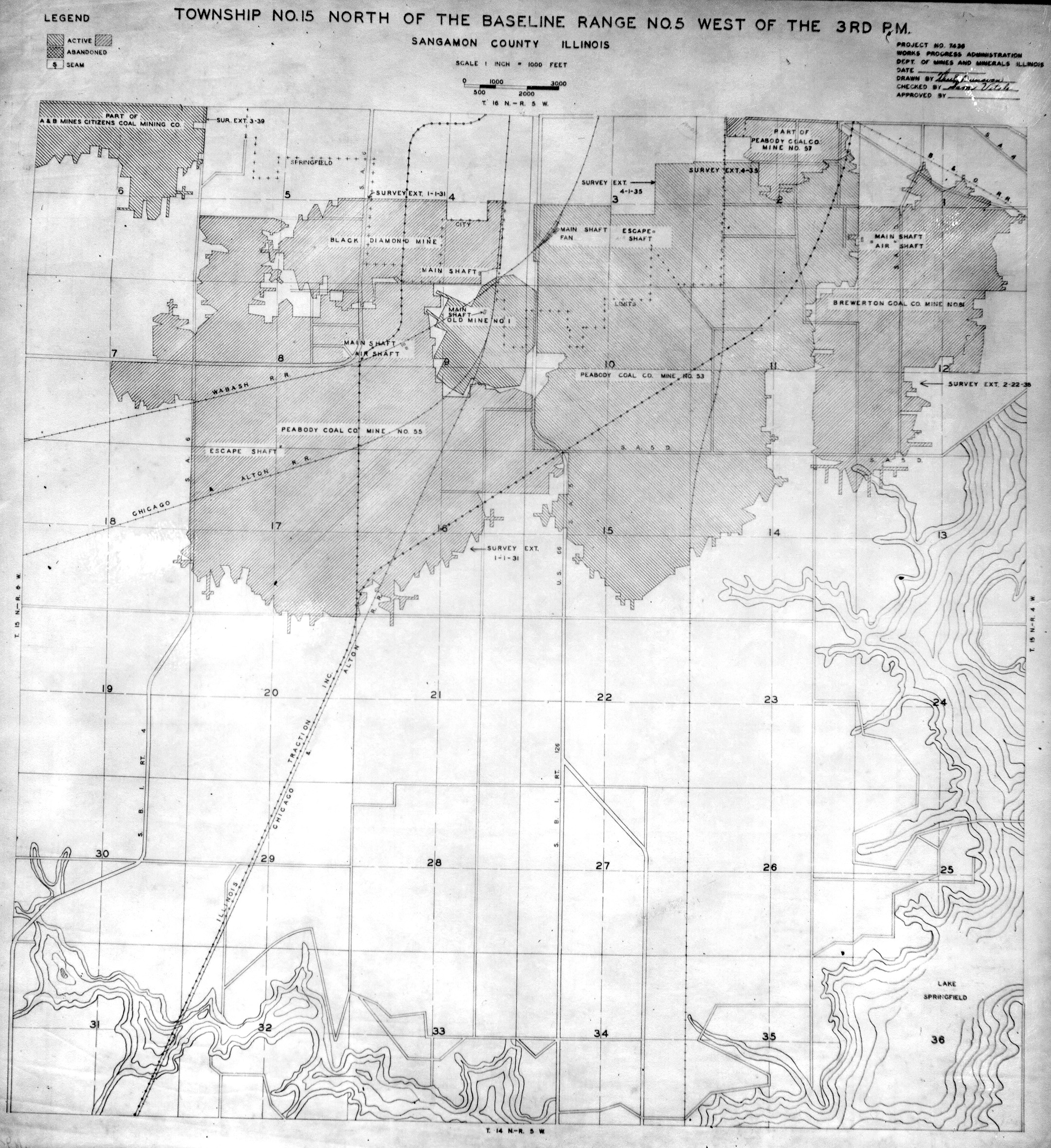
 WPA SANGAMON 15N5W.jpg 2,160 × 2,360; 1.73 MB


