Mine Index Number: 3363
| Company Name:
|
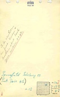
Springfield Salisbury Coal Company
|
| Mine Name:
|
Springfield Salisbury Mine
|
| Start Date:
|
1905
|
End Date:
|
1947
|
| Type of Mine:
|
Underground
|
| Total acres shown:
|
|
| Production Indicated Acres:
|
20
|
General Area of mining acres shown:
|
27
|
|
|
Shaft, Slope, Drift or Tipple Location(s)
| Type
|
County
|
Township-Range
|
Section
|
Part Section
|
| Main shaft
|
Sangamon
|
17N 6W
|
32
|
SE NW NE
|
Geology
| Springfield
|
95-144
|
|
|
5.5-5.83
|
RP
|
Geological Problems Reported
Production
| Company
|
Mine Name
|
Date
|
Production (tons)
|
| Scott Davis
|
Davis
|
1927-1933 Idle 1928 and 1929; produced less than 1,000 tons per year from 1930 to 1933 and was not listed in the Coal Reports
|
497
|
|
|
Production Notes
Coal Report production (if available)
Sources of Data
| Federal Land Bank Report
|
2-1934
|
1:158400
|
1:158400
|
Secondary source
|
| Microfilm, document 351235
|
8-1-1938
|
1:2400
|
1:2979
|
Not final
|
Annotated Bibliography (Data source - brief description of information)
| Coal Reports - Production, ownership, years of operation, mining method.
|
| Directory of Illinois Coal Mines (Sangamon County) - Mine names, mine index, ownership, years of operation.
|
| Mine notes (Sangamon County) - Mine type, shaft location, seam, depth, thickness.
|
| Federal Land Bank Report (Sangamon County) - Mine outline.
|
| Microfilm map, document 351235, reel 03134, frame 472 (map of Tony Ender’s mine, mine index 3362) - Shaft location.
|
Mine Notes
Mine Images
Federal Land Bank Report: Sangamon County
Map Date: 1934
Coal Co.: Illinois Collieries
Mine Name: Illinois Collieries No. 3 Mine
Full Res Download
![[[:Enders|Enders]]](https://wikiimage.isgs.illinois.edu/ilmines/sangamon/thumbnails/m3362_geo_th.jpg) These files may not be true to scale and are not georgistered. These files may not be true to scale and are not georgistered.
|
Map Type:
|
Microfilm
|
| Map ID:
|
351235 03134 472 18x
|
| Company:
|
Tony Enders
|
| Mine Name:
|
Enders
|
| Caption:
|
|
| Map Date:
|
8-1-1938
|
| Map Status:
|
Not Final
|
| Image Credit:
|
|
| Note:
|
|
| More Info:
|
M3362 geo
|
| Full Res Download:These files are true to scale and most are georegistered for gis software. These files may be a very large (>1GB) download!
|
https://wikiimage.isgs.illinois.edu/ilmines/sangamon/m3362 geo.zip
|
Photographs
Additional Notes