Mine Index Number: 3347
| Company Name:
|
Chicago-Springfield Coal Company
|
| Mine Name:
|
Chicago-Springfield Mine
|
| Start Date:
|
1904
|
End Date:
|
March 1927
|
| Type of Mine:
|
Underground
|
| Total acres shown:
|
907
|
| Acres after map date:
|
|
General Area of mining acres shown:
|
|
|
|
Shaft, Slope, Drift or Tipple Location(s)
| Type
|
County
|
Township-Range
|
Section
|
Part Section
|
| Shaft
|
Sangamon
|
16N 5W
|
12
|
SW SW NW
|
| Air / escape shaft
|
Sangamon
|
16N 5W
|
12
|
SW SW NW
|
Geology
Geological Problems Reported
Production
| Company
|
Mine Name
|
Date
|
Production (tons)
|
Production Notes
Coal Report production (if available)
Sources of Data
| Microfilm, document 351239
|
2-1927
|
1:2400
|
1:5297
|
Final
|
Annotated Bibliography (Data source - brief description of information)
| Coal Reports - Production, ownership, years of operation.
|
| Directory of Illinois Coal Mines (Sangamon County) - Mine names, mine index, ownership, years of operation.
|
| ENR Document 85/01 - Mining method.
|
| Mine notes (Sangamon County) - Seam, depth, thickness.
|
| Microfilm map, document 351239, reel 03134, frames 479-480 - Shaft locations, mine outline, mining method.
|
Mine Notes
Mine Images
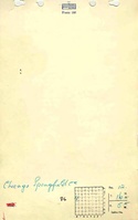
Microfilm: 351239
Map Date: 2-1927
Coal Co.: Chicago-Springfield Coal Co.
Mine Name: Chicago-Springfield Mine
Full Res Download
Photographs
Additional Notes
Additional Notes