Mine Index Number: 0412
| Company Name:
|
Peabody Coal Company
|
| Mine Name:
|
Peabody No. 51 Mine
|
| Start Date:
|
1904
|
End Date:
|
March 1934
|
| Type of Mine:
|
Underground
|
| Total acres shown:
|
941
|
| Acres after map date:
|
|
General Area of mining acres shown:
|
|
|
|
Shaft, Slope, Drift or Tipple Location(s)
| Type
|
County
|
Township-Range
|
Section
|
Part Section
|
| Main shaft
|
Sangamon
|
17N 5W
|
27
|
NW SW SE
|
| Air / escape shaft
|
Sangamon
|
17N 5W
|
27
|
NW SW SE
|
Geology
| Springfield
|
210
|
|
5.8
|
5.5
|
RPP
|
Geological Problems Reported
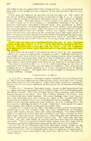
Horsebacks were common in this mine, and were sometimes pyritized and very hard. There was a slight displacement of the coal along the horsebacks. The roof was uneven due to concretions.
Production
| Company
|
Mine Name
|
Date
|
Production (tons)
|
|
|
|
|
|
| Total Production: 4,574,097
|
Production Notes
Coal Report production (if available)
Sources of Data
| Microfilm, document 351231
|
3-9-1934
|
1:2400
|
1:4155
|
Final
|
Annotated Bibliography (Data source - brief description of information)
| Coal Reports - Production, ownership, years of operation.
|
| Directory of Illinois Coal Mines (Sangamon County) - Mine names, mine index, ownership, years of operation.
|
| Mine notes (Sangamon County) - Seam, depth, thickness, geologic problems.
|
| Microfilm map, document 351231, reel 03134, frames 460-463 - Shaft locations, mine outline.
|
Mine Notes
Mine Images
Archive: PB_1018_01
Map Date: March 9, 1934
Coal Co.: Springfield District Coal Mining Co.
Mine Name: Mine No. 51
Full Res Download
Archive: PB_1018_02
Map Date: March 9, 1934
Coal Co.: Springfield District Coal Mining Co.
Mine Name: Mine No. 51
Image Credit: Illinois Department of Natural Resources - Office of Mines and Minerals
Full Res Download
Photographs