Springfield West Quadrangle
Mining in the Springfield West Quadrangle
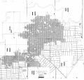
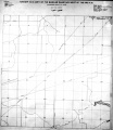
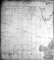
Mines underlie much of the city of Springfield. Mining began in this area in the early 19th century, but the first specific reference is to two mines that opened about 1865. Jacob Loose’s mine was at the location later mined by Wabash Coal Company (Mine Index 0313). The Old North Mine was probably located in or near the West part of the Panther Creek Mine No. 4 (Mine Index 0618). The extent of these old mines is uncertain; the boundaries may extend beyond the mapped boundaries shown.
Records of annual production were not officially kept until 1881 when he first of the Illinois Bureau of Labor Statistics Biennial Reports was published. Sangamon County ranked among the top four coal producers in the state until the 1930s, but production gradually fell off and by 1953 the overall rank was ninth. The last mine that operated in the area covered by this map was abandoned in 1964. Underground coal mining continues today just a few miles north of Springfield near the town of Williamsville.
The Springfield Coal, formerly known as the No. 5 Coal, is the major seam mined in this area. The coal is 200 to 260 feet deep and about 6 feet thick. Clay veins, also called horsebacks, were common in some mines and created problems in controlling the mine roof.
The Chapel Coal, found 90 to 190 feet above the Springfield Coal, is believed to have been mined in at lWest one mine in this quadrangle (Mine Index 2593). This coal is generally 1 to 3 feet thick and, where present, lies less than 100 feet below the surface.
Map and Directory PDF Download
Coal Mines In Illinois Springfield Area Quadrangle
Mines that Appear on the Springfield East Quadrangle
Mines that Appear on the Springfield West Quadrangle
Unlocated Mines
Sangamon County
Pages in category "Springfield West Quadrangle"
The following 25 pages are in this category, out of 25 total.
Media in category "Springfield West Quadrangle"
The following 63 files are in this category, out of 63 total.
- M-1003 NW Springfield IL Lincoln Park Coal Coop 17 Fig 44 5.75ft coal 200ft deep.jpg 2,500 × 1,456; 461 KB
- M-1004 NW Springfield IL Lincoln Park Coal see M-1003 and 1006.jpg 2,500 × 1,467; 637 KB
- M-1005 NW Springfield IL Lincoln Park Coal.jpg 2,500 × 1,467; 534 KB
- M-1006 NW Springfield IL Lincoln Park Coal see M-1004.jpg 2,500 × 1,481; 742 KB
- M0037 minenotes.pdf 727 × 1,160, 21 pages; 2.11 MB
- M0038 4103S33 i51 50 s3.jpg 3,398 × 1,742; 1.51 MB
- M0038 coalreport 1888p415.pdf 1,589 × 1,297; 1,004 KB
- M0038 minenotes.pdf 733 × 1,175, 14 pages; 1.57 MB
- M0038.jpg 2,784 × 3,398; 3.29 MB
- M0119 3134 394.jpg 2,640 × 3,398; 1.04 MB
- M0119 IL 56.jpg 2,023 × 3,398; 1.04 MB
- M0119 minenotes.pdf 727 × 1,160, 12 pages; 1.36 MB
- M0120 coalreport 1905p298.pdf 633 × 977; 99 KB
- M0120 coalreport 1906p267.pdf 1,666 × 1,281; 371 KB
- M0120 minenotes.pdf 727 × 1,166, 12 pages; 1.32 MB
- M0313 coalreport 1882p75.pdf 1,585 × 1,227; 361 KB
- M0313 coalreport 1884.pdf 1,591 × 1,283, 2 pages; 710 KB
- M0313 coalreport 1898p180.pdf 1,554 × 1,170; 306 KB
- M0313 coalreport 1899p99.pdf 1,545 × 1,175; 328 KB
- M0313 minenotes.pdf 731 × 1,172, 8 pages; 862 KB
- M0412 coalreport 1903p261.pdf 1,552 × 1,239; 308 KB
- M0412 coalreport 1904p293.pdf 1,675 × 1,237; 402 KB
- M0412 coalreport 1905p296.pdf 633 × 977; 103 KB
- M0412 minenotes.pdf 727 × 1,166, 14 pages; 1.44 MB
- M0412 pb 1018 01.jpg 1,222 × 3,398; 638 KB
- M0412 pb 1018 02.jpg 1,748 × 3,398; 1.56 MB
- M0440 351248.jpg 3,398 × 1,720; 1.7 MB
- M0440 coalreport 1884.pdf 1,597 × 1,260; 355 KB
- M0440 coalreport 1888p415.pdf 1,589 × 1,297; 1,005 KB
- M0440 coalreport 1901p216.pdf 1,331 × 1,168; 332 KB
- M0440 minenotes.pdf 727 × 1,166, 13 pages; 1.31 MB
- M0616 minenotes.pdf 727 × 1,166, 14 pages; 1.57 MB
- M0617 coalreport 1897p96.pdf 839 × 1,185; 1.64 MB
- M0617 coalreport 1898p180.pdf 1,554 × 1,170; 307 KB
- M0617 minenotes.pdf 727 × 1,166, 30 pages; 8.44 MB
- M0618 coalreport 1884.pdf 1,597 × 1,260; 358 KB
- M0618 minenotes.pdf 727 × 1,166, 16 pages; 1.71 MB
- M0807 351232.jpg 3,398 × 1,754; 1.91 MB
- M0807 coalreport 1884.pdf 1,597 × 1,260; 358 KB
- M0807 coalreport 1903p261.pdf 1,552 × 1,239; 310 KB
- M0807 minenotes.pdf 727 × 1,166, 13 pages; 1.37 MB
- M2593 minenotes.pdf 727 × 1,160, 3 pages; 363 KB
- M3339 coalreport 1882p75.pdf 1,585 × 1,227; 361 KB
- M3339 coalreport 1884.pdf 1,520 × 1,283; 369 KB
- M3339 coalreport 1898p180.pdf 1,554 × 1,170; 306 KB
- M3339 coalreport 1899p99.pdf 1,545 × 1,175; 328 KB
- M3339 minenotes.pdf 733 × 1,175, 6 pages; 664 KB
- M3340 i51 47.jpg 3,398 × 3,239; 2.37 MB
- M3340 minenotes.pdf 718 × 1,160, 13 pages; 1.38 MB
- M3348 7 4 9.jpg 3,398 × 2,361; 2.04 MB
- M3348 coalreport 1884.pdf 1,520 × 1,283; 364 KB
- M3348 coalreport 1904p293.pdf 1,675 × 1,237; 402 KB
- M3348 i51 53.jpg 2,713 × 3,398; 988 KB
- M3348 minenotes.pdf 727 × 1,160, 4 pages; 438 KB
- M3349 minenotes.pdf 727 × 1,166, 4 pages; 378 KB
- M3350 coalreport 1900p163.pdf 1,545 × 1,185; 317 KB
- M3350 coalreport 1901p215.pdf 1,345 × 1,150; 341 KB
- M3350 minenotes.pdf 727 × 1,166, 7 pages; 742 KB
- M3351 351208.jpg 3,398 × 3,225; 1.95 MB
- M3351 coalreport 1884.pdf 1,520 × 1,283; 364 KB
- M3351 minenotes.pdf 727 × 1,166, 10 pages; 1.05 MB
- Wpa sangamon 15n6w.jpg 2,210 × 2,554; 577 KB
- Wpa sangamon 16n6w.jpg 2,244 × 2,484; 1.68 MB


