Mine Index Number: 0312
| Company Name:
|
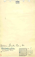
Union Fuel Company
|
| Mine Name:
|
Union Fuel No. 2 Mine
|
| Start Date:
|
1903
|
End Date:
|
April 1924
|
| Type of Mine:
|
Underground
|
| Total acres shown:
|
764
|
| Acres after map date:
|
|
General Area of mining acres shown:
|
|
|
|
Shaft, Slope, Drift or Tipple Location(s)
| Type
|
County
|
Township-Range
|
Section
|
Part Section
|
| Shaft 8.5 ft x 14.5 ft An air shaft was noted in the Coal Report, 8 x 14 ft, but the location was not discernable on the source map.
|
Sangamon
|
15N 4W
|
5
|
0 FNL, 200 FWL
|
Geology
Geological Problems Reported
Production
| Company
|
Mine Name
|
Date
|
Production (tons)
|
|
|
|
|
|
| Total Production: 3,106,909
|
Production Notes
Coal Report production (if available)
Sources of Data
| Microfilm, document 351237
|
1925
|
1:2400
|
1:5520
|
Final
|
Annotated Bibliography (Data source - brief description of information)
| Coal Reports - Production, ownership, years of operation, mining method.
|
| Directory of Illinois Coal Mines (Sangamon County) - Mine names, mine index, ownership, years of operation.
|
| ENR Document 85/01 - Mining method.
|
| Mine notes (Sangamon County) - Mine type, seam, depth, thickness.
|
| Microfilm map, document 351237, reel 03134, frames 474-477 - Shaft locations, mine outline.
|
Mine Notes
Mine Images
Microfilm: 351237
Map Date: 1925
Coal Co.: Union Fuel Co.
Mine Name: Union Fuel No. 2 Mine
Photographs
Additional Notes
Additional Notes