Mine Index Number: 3336
| Company Name:
|
Illinois Coal and Coke Company
|
| Mine Name:
|
Empire No. 2 Mine
|
| Start Date:
|
1893
|
End Date:
|
1923
|
| Type of Mine:
|
Underground
|
| Total acres shown:
|
504
|
| Acres after map date:
|
|
General Area of mining acres shown:
|
|
|
|
Shaft, Slope, Drift or Tipple Location(s)
| Type
|
County
|
Township-Range
|
Section
|
Part Section
|
| Main shaft
|
Sangamon
|
13N 6W
|
2
|
NW NE NW
|
| Air shaft
|
Sangamon
|
13N 6W
|
2
|
SW NE NW
|
Geology
Geological Problems Reported
Production
| Company
|
Mine Name
|
Date
|
Production (tons)
|
|
|
|
|
|
| Total Production: 2,770,411
|
Production Notes
Coal Report production (if available)
Sources of Data
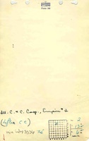
| State archive, IL_334_01
|
4-1914
|
1:2400
|
1:2400
|
Not final
|
| WPA, T13N-R6W & T14N-R6W
|
2-19-1926
|
1:52800
|
1:52800
|
Secondary source
|
Annotated Bibliography (Data source - brief description of information)
| Coal Reports - Production, ownership, years of operation.
|
| Directory of Illinois Coal Mines (Sangamon County) - Mine names, mine index, ownership, years of operation, seam.
|
| Mine notes (Sangamon County) - Mine type, shaft location, seam, depth, thickness.
|
| State archive, IL_334_01 - Shaft locations, mine outline, mining method.
|
| WPA map, T13N-R6W & T14N-R6W - Partial outline of southwest part of mine.
|
Mine Notes
Mine Images
 These files may not be true to scale and are not georgistered. These files may not be true to scale and are not georgistered.
|
Map Type:
|
WPA
|
| Map ID:
|
T13N-R6W & T14N-R6W
|
| Company:
|
|
| Mine Name:
|
|
| Caption:
|
|
| Map Date:
|
|
| Map Status:
|
Secondary
|
| Image Credit:
|
|
| Note:
|
Secondary source for mine index 3336 (southwest part of the mine)
Composite image of WPA Maps: T13N-R6W & T14N-R6W
|
| More Info:
|
M3336b
|
| Full Res Download:These files are true to scale and most are georegistered for gis software. These files may be a very large (>1GB) download!
|
https://go.illinois.edu/ILMImages/sangamon/m3336b.zip
|
![[[:Empire No. 2|Empire No. 2]]](https://go.illinois.edu/ILMImages/sangamon/thumbnails/m3336_IL_334_01_th.jpg) These files may not be true to scale and are not georgistered. These files may not be true to scale and are not georgistered.
|
Map Type:
|
State Archive
|
| Map ID:
|
IL_334_01
|
| Company:
|
Illinois Coal and Coke Company
|
| Mine Name:
|
Empire No. 2
|
| Caption:
|
|
| Map Date:
|
04-1914
|
| Map Status:
|
Not Final
|
| Image Credit:
|
|
| Note:
|
|
| More Info:
|
M3336 IL 334 01
|
| Full Res Download:These files are true to scale and most are georegistered for gis software. These files may be a very large (>1GB) download!
|
https://go.illinois.edu/ILMImages/sangamon/m3336 IL 334 01.zip
|
Photographs