Mine Index Number: 3342
| Company Name:
|
Island Grove Coal Company
|
| Mine Name:
|
Island Grove Mine
|
| Start Date:
|
1904
|
End Date:
|
1909
|
| Type of Mine:
|
Underground
|
| Total acres shown:
|
52 Production indicates approximately 3 acres were mined.
|
| Acres after map date:
|
|
General Area of mining acres shown:
|
|
|
|
Shaft, Slope, Drift or Tipple Location(s)
| Type
|
County
|
Township-Range
|
Section
|
Part Section
|
| Main shaft
|
Sangamon
|
15N 7W
|
8
|
SE NW SE
|
Geology
| Springfield
|
185-200
|
3.0
|
6.0
|
5.0
|
RP
|
Geological Problems Reported
The coal was generally 5 feet thick, but thinned to 3 feet in places. The mine was dry while the operation was active.
Production
| Company
|
Mine Name
|
Date
|
Production (tons)
|
Production Notes
Coal Report production (if available)
Sources of Data
| Federal Land Bank Report
|
2-1934
|
1:158400
|
1:158400
|
Secondary source
|
Annotated Bibliography (Data source - brief description of information)
| Coal Reports - Production, ownership, years of operation, mining method.
|
| Directory of Illinois Coal Mines (Sangamon County) - Mine names, mine index, ownership, years of operation.
|
| Mine notes (Sangamon County) - Mine type, shaft location, seam, depth, thickness, geologic problems.
|
| Federal Land Bank Report (Sangamon County) - Shaft location, mine outline.
|
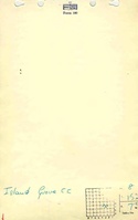
Mine Notes
Mine Images
Federal Land Bank Report: Sangamon County
Map Date: 1934
Coal Co.: Illinois Collieries
Mine Name: Illinois Collieries No. 3 Mine
Full Res Download
Photographs
Additional Notes
Additional Notes