Mine Index Number: 3352
| Company Name:
|
Springfield Coal and Mining Company
|
| Mine Name:
|
Springfield No. 3 Mine
|
| Start Date:
|
1881
|
End Date:
|
1911
|
| Type of Mine:
|
Underground
|
| Total acres shown:
|
517
|
| Acres after map date:
|
|
General Area of mining acres shown:
|
|
|
|
Shaft, Slope, Drift or Tipple Location(s)
| Type
|
County
|
Township-Range
|
Section
|
Part Section
|
| Shaft
|
Sangamon
|
16N 5W
|
24
|
SW SE NW
|
Geology
Geological Problems Reported
Production
| Company
|
Mine Name
|
Date
|
Production (tons)
|
| Sangamon Coal Company
|
Starnes
|
pre1881-1889
|
212,829 The years of operation and production before 1881 are not known. The 1882 Coal Report indicated 30 acres were mined. The production from 1883 to 1885 was reported under Sangamon No. 2 Mine (mine index 807).
|
|
|
|
|
|
|
|
| Total Production: 2,459,882
|
Production Notes
Coal Report production (if available)
Sources of Data
| Bauer, et al. map
|
4-1982
|
1:24000
|
1:37680
|
Secondary source
|
Annotated Bibliography (Data source - brief description of information)
| Coal Reports - Production, ownership, years of operation.
|
| Directory of Illinois Coal Mines (Sangamon County) - Mine names, mine index, ownership, years of operation.
|
| ENR Document 85/01 - Mining method.
|
| Mine notes (Sangamon County) - Mine type, shaft location, depth, thickness, ownership.
|
| Bauer et al., General Outlines of Mined-Out Areas of Springfield (No. 5) Coal, Springfield & Vicinity, 1973, revised 1982 - Mine outline.
|
| Federal Land Bank of St. Louis, Preliminary Report on Subsidence Investigation, Sangamon County, Illinois, February 9, 1934, J. C. Quade, Mining Engineer - Verification of mine outline.
|
Mine Notes
Mine Images
Federal Land Bank Report: Sangamon County
Map Date: 1934
Coal Co.: Illinois Collieries
Mine Name: Illinois Collieries No. 3 Mine
Full Res Download
Archive: PB_1023
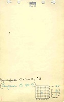
Map Date: 12-1910
Coal Co.: Springfield Coal and Mining Co.
Mine Name: Springfield No. 3 Mine
Image Credit: Illinois Department of Natural Resources - Office of Mines and Minerals
Full Res Download
Photographs
Additional Notes
Additional Notes