Mine Index Number: 3357
| Company Name:
|
Barclay Coal Mining Company
|
| Mine Name:
|
Barclay Mine
|
| Start Date:
|
1870
|
End Date:
|
March 1916
|
| Type of Mine:
|
Underground
|
| Total acres shown:
|
573
|
| Acres after map date:
|
|
General Area of mining acres shown:
|
|
|
|
Shaft, Slope, Drift or Tipple Location(s)
| Type
|
County
|
Township-Range
|
Section
|
Part Section
|
| Main shaft
|
Sangamon
|
17N 4W
|
35
|
NW SE SE
|
| Air shaft
|
Sangamon
|
17N 4W
|
35
|
SE SE SE
|
Geology
Geological Problems Reported
Production
| Company
|
Mine Name
|
Date
|
Production (tons)
|
| Barclay Coal Mining Company
|
Barclay
|
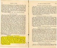
ca.1870-1915 The production and years of operation before 1881 are not known. The 1882 Coal Report indicated 75 acres were mined. The 1873 publication by A. H. Worthen et al. stated that the shaft had been sunk recently.
|
2,493,490
|
|
|
|
|
|
|
|
| Total Production: 2,496,490
|
Production Notes
Coal Report production (if available)
Sources of Data
| Microfilm, document 351228
|
5-20-1932
|
1:2400
|
1:5297
|
Secondary source
|
Annotated Bibliography (Data source - brief description of information)
| Coal Reports - Production, ownership, years of operation, mining method.
|
| Directory of Illinois Coal Mines (Sangamon County) - Mine names, mine index, ownership, years of operation.
|
| Mine notes (Sangamon County) - Mine type, shaft location, seam, depth, thickness, ownership.
|
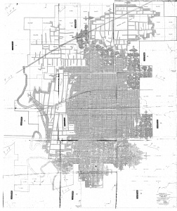
| Microfilm map, document 351228, reel 03134, frames 446-448, map of Peabody No. 52 Mine (mine index 36) - Shaft locations, mine outline.
|
| Worthen et al., 1873 - Years of operation.
|
Mine Notes
Mine Images
Microfilm: 351228
Map Date: 5-20-1932
Coal Co.: Peabody Coal Co.
Mine Name: Peabody No. 52 Mine
Photographs


