Mine Index Number: 0310
| Company Name:
|
Spaulding Coal Company
|
| Mine Name:
|
Spaulding No. 1 Mine
|
| Start Date:
|
1883
|
End Date:
|
February 1913
|
| Type of Mine:
|
Underground
|
| Total acres shown:
|
433
|
| Acres after map date:
|
|
General Area of mining acres shown:
|
|
|
|
Shaft, Slope, Drift or Tipple Location(s)
| Type
|
County
|
Township-Range
|
Section
|
Part Section
|
| Main shaft No air shaft was shown on the source map for the mine. The underground workings are connected to Peabody No. 52 Mine (mine index 36) in SE SW 3-T16N-R4W, which may have compensated for the lack of an escape shaft in the workings, but it is likely another air shaft exists.
|
Sangamon
|
16N 4W
|
4
|
SW cor NE NE SE
|
Geology
Geological Problems Reported
Production
| Company
|
Mine Name
|
Date
|
Production (tons)
|
|
|
|
|
|
| Total Production: 1,989,236
|
Production Notes
Coal Report production (if available)
Sources of Data
| Microfilm, document 351228
|
5-20-1932
|
1:2400
|
1:4800
|
Secondary source
|
Annotated Bibliography (Data source - brief description of information)
| Coal Reports - Production, ownership, years of operation, mining method.
|
| Directory of Illinois Coal Mines (Sangamon County) - Mine names, mine index, ownership, years of operation.
|
| Mine notes (Sangamon County) - Mine type, shaft location, seam, depth, thickness.
|
| Microfilm map, document 351228, reel 03134, frames 445 & 446, map of Peabody No. 52 Mine (mine index 36) - Shaft location, mine outline, mining method.
|
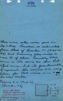
Mine Notes
Mine Images
Microfilm: 351228
Map Date: 5-20-1932
Coal Co.: Peabody Coal Co.
Mine Name: Peabody No. 52 Mine
Photographs
Additional Notes