Mine Index Number: 0531
| Company Name:
|
Greenview Fuel Company
|
| Mine Name:
|
Greenview Mine
|
| Start Date:
|
1925
|
End Date:
|
February 1954
|
| Type of Mine:
|
Underground
|
| Total acres shown:
|
226
|
| Acres after map date:
|
1
|
General Area of mining acres shown:
|
|
|
|
Shaft, Slope, Drift or Tipple Location(s)
| Type
|
County
|
Township-Range
|
Section
|
Part Section
|
| Main shaft
|
Menard
|
19N 6W
|
36
|
SW NW NW
|
| Air shaft
|
Menard
|
19N 6W
|
36
|
SE NW NW
|
Geology
Geological Problems Reported
The seam contained horizontal lenses of pyrite as well as calcite and pyrite as vertical fracture fillings.
Production
| Company
|
Mine Name
|
Date
|
Production (tons)
|
|
|
|
|
|
| Total Production: 785,218
|
Production Notes
Coal Report production (if available)
Sources of Data
| Microfilm, document 352218
|
12-1-1952
|
1:2400
|
1:5131
|
Not final
|
Annotated Bibliography (Data source - brief description of information)
| Coal Reports - Production, ownership, years of operation.
|
| Directory of Illinois Coal Mines (Menard County) - Mine names, mine index, ownership, years of operation.
|
| Mine notes (Menard County) - Mine type, shaft location, seam, depth, geologic problems.
|
| Microfilm map, document 352218, reel 03138, frame 276 - Shaft locations, mine outline, mining method.
|
Mine Notes
Mine Images
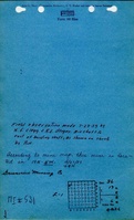
Microfilm: 352218
Map Date: 12-1-1952
Coal Co.: Greenview Fuel Company
Mine Name: Greenview Mine
Full Res Download
Photographs