Category:Menard-County
County Coal Data
Mines that Appear in Menard-County
- 9998 & 9999 = Unknown dates
Unlocated Mines in Menard-County
Mine that have known coal production but no known location
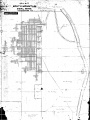
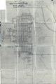
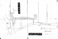
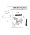
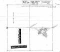
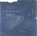
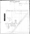
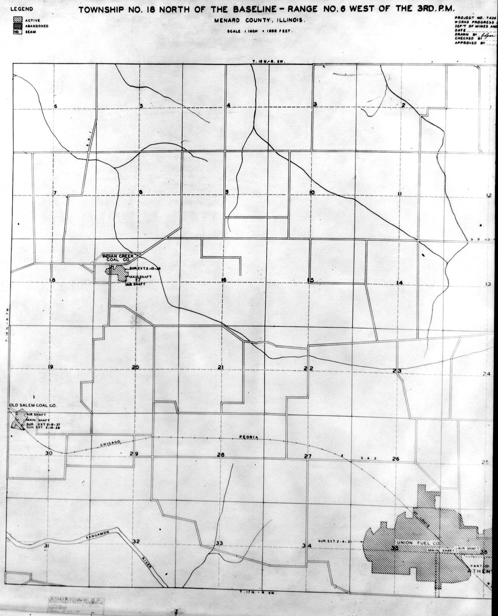
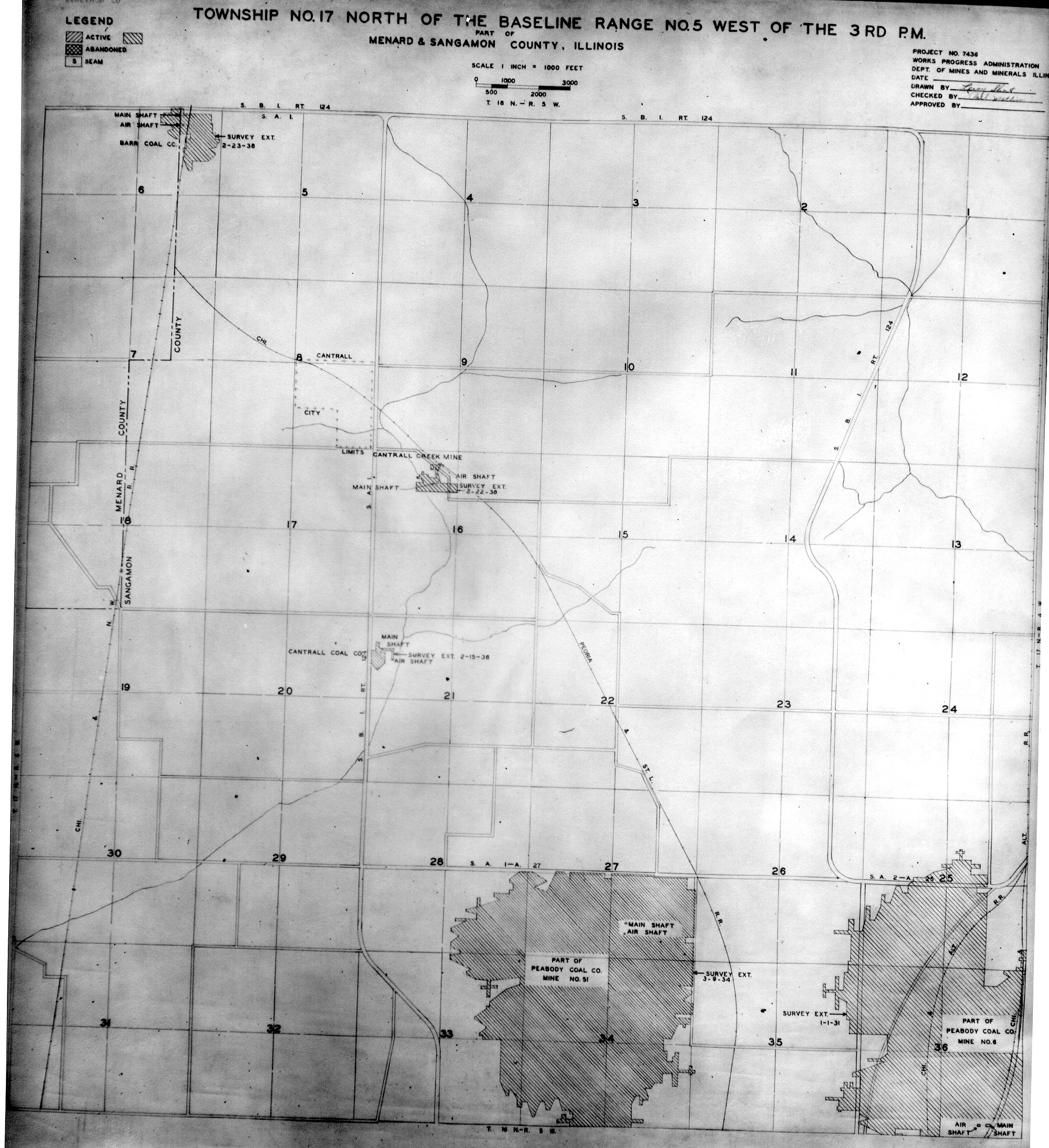
Historical Mined Out Area Maps
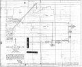
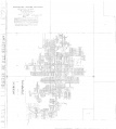
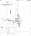
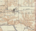
WPA
These maps were constructed as part of the nationwide Works Projects Administration (WPA), generally between 1934 and 1937 with some later updates or revisions,
Disclaimer
Maps for some locations might have multiple versions/seams, please inspected these areas closely for differences.
Notes and corrections were made by ISGS staff.
These maps are reproductions from microfilm, they may be of poor quality with text difficult to read.


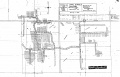
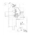
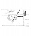
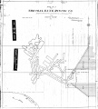
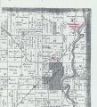
Federal Land Bank of St. Louis, Preliminary Reports on Subsidence Investigations
Federal Land Bank of St. Louis, Preliminary Reports on Subsidence Investigations (refered by Coal Section Staff as "Quade Maps")
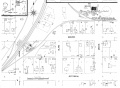
Mining engineers working for the Federal Land Bank of St. Louis mapped areas of subsidence due to coal mining in the early 1930s. These reports often include county maps of mine properties with mined-out areas including shaft locations, as well as subsidence areas.
Disclaimer
Maps for some locations might have multiple versions/seams, please inspected these areas closely for differences.
These maps are accompanied by a report, please download and inspect this document.
Notes and corrections were made by ISGS staff.
There are no Quade Maps for this county
Photographs
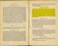
Pages in category "Menard-County"
The following 74 pages are in this category, out of 74 total.
1
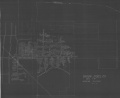
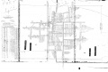
Media in category "Menard-County"
The following 101 files are in this category, out of 101 total.
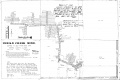
 M0034 coalreport1890 p337.pdf 750 × 1,281; 591 KB
 M0034 coalreport1891 p103.pdf 793 × 1,275; 119 KB
 M0034 fieldnotes.pdf 747 × 1,195; 209 KB
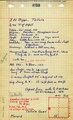
 M0034 minenotes.pdf 731 × 1,202, 15 pages; 3.45 MB
 M0034 PB360.jpg 3,390 × 2,765; 1.81 MB
 M0287 352535.jpg 3,390 × 2,283; 1.43 MB
 M0287 minenotes.pdf 731 × 1,202, 6 pages; 8.12 MB
 M0288 minenotes.pdf 731 × 1,202, 3 pages; 690 KB
 M0288 msha 1321.jpg 2,575 × 3,390; 2.12 MB
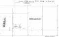
 M0288 Sanborn 1909 Sheet1.jpg 1,966 × 2,071; 442 KB
 M0289 352225.jpg 3,390 × 2,727; 2.06 MB
 M0289 coalreport1889 p35.pdf 741 × 1,183; 532 KB
 M0289 coalreport1910 p281.pdf 583 × 943; 64 KB
 M0289 minenotes.pdf 731 × 1,202, 9 pages; 7.69 MB
 M0309 minenotes.pdf 727 × 1,166, 13 pages; 1.23 MB
 M0531 minenotes.pdf 731 × 1,202, 10 pages; 2.77 MB
 M0531.jpg 3,038 × 3,390; 1.43 MB
 M0612 352210.jpg 3,390 × 2,170; 1.05 MB
 M0612 coalreport1915 p130.pdf 727 × 1,193; 352 KB
 M0612 minenotes.pdf 731 × 1,202, 13 pages; 3.13 MB
 M0772 352396.jpg 2,551 × 3,390; 1.57 MB
 M0772 coalreport1897 p80.pdf 685 × 1,185; 572 KB
 M0772 isgslib.jpg 2,257 × 3,390; 1.82 MB
 M0772 minenotes.pdf 731 × 1,202, 8 pages; 1.88 MB
 M0845 geo.jpg 2,900 × 3,390; 920 KB
 M0845 minenotes.pdf 731 × 1,202, 12 pages; 3.07 MB
 M0846 minenotes.pdf 731 × 1,202, 6 pages; 1.6 MB
 M0846.jpg 2,900 × 3,390; 905 KB
 M0896 minenotes.pdf 731 × 1,202, 10 pages; 2.61 MB
 M1290023b minenotes.pdf 731 × 1,202; 269 KB
 M2913 35223302.jpg 3,072 × 3,390; 1.64 MB
 M2913 coalreport1884 p505.pdf 1,656 × 1,268; 356 KB
 M2913 coalreport1885 p77.pdf 806 × 1,252; 362 KB
 M2939 coalreport1890 p336.pdf 754 × 1,247; 632 KB
 M2939 coalreport1900 p112.pdf 1,545 × 1,204; 309 KB
 M2939 coalreport1903.pdf 1,627 × 1,233, 3 pages; 847 KB
 M2939 coalreport1904.pdf 1,658 × 1,195, 2 pages; 768 KB
 M2939 fieldnotes.pdf 752 × 1,195, 2 pages; 481 KB
 M2939 minenotes.pdf 731 × 1,202, 2 pages; 435 KB
 M2940 352217.jpg 3,390 × 2,390; 853 KB
 M2940 minenotes.pdf 731 × 1,202, 3 pages; 577 KB
 M2941 minenotes.pdf 731 × 1,202, 2 pages; 418 KB
 M2942 352223.jpg 3,390 × 2,263; 1.11 MB
 M2942 minenotes.pdf 731 × 1,202, 6 pages; 1.53 MB
 M2943 352213.jpg 3,390 × 2,496; 960 KB
 M2943 minenotes.pdf 731 × 1,202, 3 pages; 646 KB
 M2945 minenotes.pdf 731 × 1,202, 4 pages; 957 KB
 M2945.jpg 3,390 × 2,460; 1.31 MB
 M2946 minenotes.pdf 731 × 1,202, 10 pages; 2.34 MB
 M2947 352221.jpg 2,018 × 3,390; 924 KB
 M2947 352447.jpg 3,390 × 2,278; 650 KB
 M2947 fieldnotes.pdf 752 × 1,183; 191 KB
 M2947 minenotes.pdf 731 × 1,202, 2 pages; 417 KB
 M2948 fieldnotes.pdf 745 × 1,183, 4 pages; 725 KB
 M2948 geo.jpg 2,900 × 3,390; 915 KB
 M2949 fieldnotes.pdf 745 × 1,185, 2 pages; 455 KB
 M2949 geo.jpg 2,900 × 3,390; 778 KB
 M2949 minenotes.pdf 731 × 1,202, 4 pages; 829 KB
 M2951 352216.jpg 3,390 × 2,937; 697 KB
 M2951 fieldnotes.pdf 745 × 1,183; 192 KB
 M2951 minenotes.pdf 731 × 1,202, 3 pages; 601 KB
 M3000 352228.jpg 3,055 × 3,390; 1.26 MB
 M3274 coalreport1885 p77.pdf 1,652 × 1,293; 869 KB
 M3274 coalreport1901 p167.pdf 1,331 × 1,170; 329 KB
 M3274 coalreport1902 p155.pdf 804 × 1,250; 1.36 MB
 M3274.jpg 2,957 × 3,390; 914 KB
 M3501 minenotes.pdf 731 × 1,202; 232 KB
 M3501.jpg 3,390 × 3,321; 3.48 MB
 M4088 1874 atlas.jpg 3,073 × 3,390; 3.37 MB
 M4088 coalreport1884 p505.pdf 777 × 1,222; 372 KB
 M4088 coalreport1884.pdf 1,656 × 1,268, 2 pages; 686 KB
 M4088 coalreport1885 p76-77.pdf 1,652 × 1,293; 871 KB
 M4088.jpg 2,146 × 3,390; 1.36 MB
 M4139 coalreport1893 p42.pdf 1,687 × 1,272; 401 KB
 M4139 coalreport1901 p167.pdf 1,331 × 1,170; 330 KB
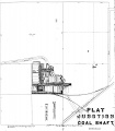
 M4139 plat 1899.jpg 953 × 638; 274 KB
 M4157 coalreport1884 p506.pdf 791 × 1,216; 354 KB
 M4157 coalreport1885 p77.pdf 775 × 1,231; 354 KB
 M4207 352226.jpg 2,839 × 3,390; 984 KB
 M4207 coalreport1884 p506.pdf 791 × 1,216; 356 KB
 M4207 coalreport1885 p78.pdf 1,652 × 1,293; 798 KB
 M4207 coalreport1889 p37.pdf 1,647 × 1,304; 925 KB
 M4309 fieldnote.pdf 758 × 1,189, 2 pages; 399 KB
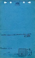
 M4963.pdf 904 × 1,464; 308 KB
 M5866 fieldnotes.pdf 745 × 1,183, 2 pages; 383 KB
 M6084.jpg 1,728 × 1,844; 1.18 MB
 M6387 coalreport1906 p268.pdf 1,616 × 1,231; 392 KB
 M6387 minenotes.pdf 731 × 1,202, 2 pages; 537 KB
 M6388 352222.jpg 3,390 × 2,143; 426 KB
 M6388 minenotes.pdf 731 × 1,202, 7 pages; 1.81 MB
 M6389 352215.jpg 2,956 × 3,390; 999 KB
 M7018.jpg 1,584 × 1,362; 838 KB
 M7783 1901 Sheet2.jpg 3,186 × 2,330; 1.08 MB
 M7783 coalreport1895 p54.pdf 750 × 1,185; 1.31 MB
 M7783 coalreport1900.pdf 1,545 × 1,204; 310 KB
 Tallula ne v1.jpg 2,595 × 3,390; 3.79 MB
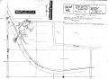
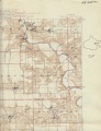
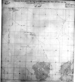
 WPA MENARD 17N6W.jpg 1,672 × 2,016; 943 KB
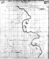
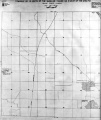
 WPA MENARD 18N6W.jpg 1,664 × 2,055; 951 KB
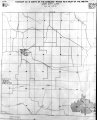
 WPA MENARD 18N7W.jpg 1,616 × 2,052; 903 KB
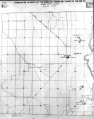
 WPA MENARD 19N5W.jpg 1,696 × 2,020; 1,022 KB
 WPA MENARD SANGAMON 17N5W.jpg 2,280 × 2,495; 1.93 MB


