Mine Index Number: 0288
| Company Name:
|
Greenview Coal Company
|
| Mine Name:
|
Greenview Mine
|
| Start Date:
|
1907
|
End Date:
|
1914
|
| Type of Mine:
|
Underground
|
| Total acres shown:
|
32
|
| Acres after map date:
|
8
|
General Area of mining acres shown:
|
|
|
|
Shaft, Slope, Drift or Tipple Location(s)
| Type
|
County
|
Township-Range
|
Section
|
Part Section
|
| Shaft
|
Menard
|
19N 6W
|
27
|
NE NW NE
|
| Air shaft
|
Menard
|
19N 6W
|
22
|
SW SE SE
|
Geology
| Springfield
|
100-110
|
|
|
5.67-6.0
|
MRP
|
Geological Problems Reported
The mine was idled for a month in 1900 from water flooding the mine after a roof fall.
Production
| Company
|
Mine Name
|
Date
|
Production (tons)
|
|
|
|
|
|
| Total Production: 149,879
|
Production Notes
Coal Report production (if available)
Sources of Data
| State archive, MSHA_1321
|
9-1912
|
1:1200
|
1:1200
|
Not Final
|
Annotated Bibliography (Data source - brief description of information)
| Coal Reports - Production, ownership, years of operation, depth, thickness, mining method.
|
| Directory of Illinois Coal Mines (Menard County) - Mine names, mine index, ownership, years of operation.
|
| Mine notes (Menard County) - Mine type, shaft location, seam.
|
| State archive, MSHA_1321, courtesy of Robert Gibson, DNR - Mine outline, shaft locations, mining method.
|
Mine Notes
Mine Images
Sanborn Fire Insurance map:
Map Date: 1909
Coal Co.: Greenview Coal Company
Mine Name: Greenview Mine
Full Res Download
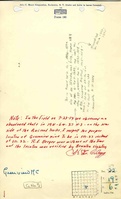
Company Map: msha_1321
Map Date: 9-1912
Coal Co.: Greenview Coal Company
Mine Name: Greenview Mine
Image Credit: Illinois Department of Natural Resources - Office of Mines and Minerals
Full Res Download
Photographs