Mine Index Number: 7783
| Company Name:
|
Greenview Coal and Mining Company
|
| Mine Name:
|
Greenview Mine
|
| Start Date:
|
1890
|
End Date:
|
1906
|
| Type of Mine:
|
Underground
|
| Total acres shown:
|
224
|
| Acres after map date:
|
|
General Area of mining acres shown:
|
275
|
|
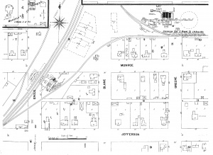
Production indicates 224 to 310 acres were mined. Those acres may be east of the adjacent Menard No. 1 Mine (mine index 4207), rather than west (as shown on the accompanying map).
|
Shaft, Slope, Drift or Tipple Location(s)
| Type
|
County
|
Township-Range
|
Section
|
Part Section
|
| Main shaft
|
Menard
|
19N 6W
|
23
|
NE SE NE The shaft was originally constructed and used for Menard No. 1 Mine (mine index 4207).
|
Geology
| Springfield
|
100-109
|
|
|
5.67-6.0
|
RP
|
Geological Problems Reported
Production
| Company
|
Mine Name
|
Date
|
Production (tons)
|
|
|
|
|
|
| Total Production: 1,362,414
|
Production Notes
Coal Report production (if available)
Sources of Data
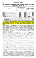
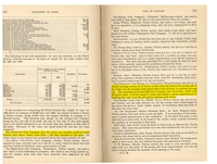
| Sanborn Fire Insurance Map The insurance map shows that the newer shaft of Menard No. 1 Mine (mine index 4207) was used by the Greenview Mine. The general area of mining shown on the accompanying map was constructed to show the approximate size of the mine based on the reported production, but the location of the general area of mining is uncertain. In the 1895 Coal Report (page 54), improvements included a statement that 2,000 feet of airway was constructed on the south side of the mine. The 1900 Coal Report noted the Greenview Coal & Mining Company had put in an electric haulage system with roadways over 5,000 feet in length, and that all the coal was on one side of the shaft. Whether the coal was east or west of the shaft is not known.
|
1901
|
Unknown
|
1:24000
|
Secondary source
|
Annotated Bibliography (Data source - brief description of information)
| Coal Reports - Production, ownership, years of operation, seam, depth, thickness, mining method.
|
| Directory of Illinois Coal Mines (Menard County) - Mine names, mine index, ownership, years of operation.
|
| Sanborn-Perris Map Company - Shaft location.
|
Mine Notes
Mine Images
Sanborn Fire Insurance map:
Map Date: 1901
Coal Co.: Greenview Coal & Mining Company
Mine Name: Greenview Mine
Full Res Download
Photographs


