Mine Index Number: 4207
| Company Name:
|
Menard Coal Company
|
| Mine Name:
|
Menard No. 1 Mine
|
| Start Date:
|
1880
|
End Date:
|
1892
|
| Type of Mine:
|
Underground
|
| Total acres shown:
|
12
|
| Acres after map date:
|
28
|
General Area of mining acres shown:
|
|
|
The reported production up to the map date indicates approximately 96 acres were mined.
|
Shaft, Slope, Drift or Tipple Location(s)
| Type
|
County
|
Township-Range
|
Section
|
Part Section
|
| Menard shaft (newer)
|
Menard
|
19N 6W
|
23
|
NE SE NE
|
| Greenview shaft (older)
|
Menard
|
19N 6W
|
23
|
NW SE NE
|
Geology
| Springfield
|
100-104
|
|
|
5.67-5.83
|
RPP,MRP
|
Geological Problems Reported
Production
| Company
|
Mine Name
|
Date
|
Production (tons)
|
| Menard County Coal Company
|
Menard
|
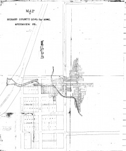
1886-1888 Greenview Coal Company and Menard County Coal Company were separate companies, but the map shows the mine workings connected underground. The map is dated shortly after the opening of Menard County Coal Company, and implies that the older workings were on the west side of the railroad tracks.
|
68,861
|
|
|
|
|
|
|
|
| Total Production: 616,269
|
Production Notes
Coal Report production (if available)
Sources of Data
| Microfilm, document 352226
|
1888
|
1:960
|
1:920
|
Not final
|
Annotated Bibliography (Data source - brief description of information)
| Coal Reports - Production, ownership, years of operation, depth, thickness.
|
| Directory of Illinois Coal Mines (Menard County) - Mine names, mine index, ownership, years of operation.
|
| Bradley, Nancy, 1940, Greenview Scrap Book, History of Greenview, Illinois, 1815-1940, published by Schnepp & Barnes, Springfield, Illinois - Mine history.
|
| Microfilm map, document 352226, reel 03138, frame 284 - Shaft locations, mine outline, mining method.
|
Mine Notes
Mine Images
Microfilm: 352226
Map Date: 1888
Coal Co.: Menard Coal Company
Mine Name: Menard No. 1 Mine
Full Res Download
Photographs


