Mine Index Number: 3501
| Company Name:
|
Peter Becker
|
| Mine Name:
|
Becker Mine
|
| Start Date:
|
1902
|
End Date:
|
June 1916
|
| Type of Mine:
|
Underground
|
| Total acres shown:
|
8
|
| Acres after map date:
|
|
General Area of mining acres shown:
|
|
|
|
Shaft, Slope, Drift or Tipple Location(s)
| Type
|
County
|
Township-Range
|
Section
|
Part Section
|
| Main shaft
|
Menard
|
18N 8W
|
14
|
SW SE NE
|
| Air shaft
|
Menard
|
18N 8W
|
14
|
SW SE NE
|
Geology
| Springfield
|
84
|
5.0
|
6.0
|
5.5
|
MRP
|
Geological Problems Reported
Production
| Company
|
Mine Name
|
Date
|
Production (tons)
|
| Peter Becker
|
Becker
|
1902-1916 A shaft was shown on the 1899 plat. Production before 1902 is unknown. William Denton (Petersburg address) operated 1895 to 1903 and may be a precursor to Becker.
|
30,332
|
|
|
Production Notes
Coal Report production (if available)
Sources of Data
| Plat map of Menard County, T18N-R8W
|
1899
|
1:3168
|
1:3168
|
Secondary source
|
| Company, state archive, MSHA_1311
|
3-13-1916
|
1:1200
|
1:1200
|
Final
|
Annotated Bibliography (Data source - brief description of information)
| Coal Reports - Production, ownership, years of operation.
|
| Mine notes (Menard County) - Shaft location, depth, thickness, ownership.
|
| Plat map of Menard County, T18N-R8W - Years of operation.
|
| Company map, state archive, MSHA_1311 - Shaft locations, mine outline, mining method.
|
Mine Notes
Mine Images
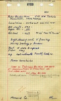
Company: msha_1311
Map Date: 3-13-1916
Coal Co.: Peter Becker
Mine Name: Becker Mine
Full Res Download
Photographs