Mine Index Number: 0289
| Company Name:
|
Menard County Coal Company
|
| Mine Name:
|
Tallula No. 1 Mine
|
| Start Date:
|
1888
|
End Date:
|
March 1914
|
| Type of Mine:
|
Underground
|
| Total acres shown:
|
253
|
| Production Indicated Acres:
|
140 to 200
|
General Area of mining acres shown:
|
|
|
The final map and mine outline shown may include unmined areas.
|
Shaft, Slope, Drift or Tipple Location(s)
| Type
|
County
|
Township-Range
|
Section
|
Part Section
|
| Main shaft
|
Menard
|
17N 7W
|
6
|
NE SE SW
|
| Escape shaft
|
Menard
|
17N 7W
|
6
|
NE SE SW
|
| Escape shaft
|
Menard
|
17N 7W
|
5
|
SE SE SW SW
|
Geology
| Springfield
|
179-185
|
5.5
|
6.5
|
6.0
|
MRP
|
Geological Problems Reported
The mine notes indicated that many horsebacks and numerous clay veins were present. “A little gas” was also noted.
Production
| Company
|
Mine Name
|
Date
|
Production (tons)
|
|
|
|
|
|
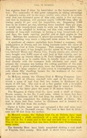
| Total Production: 758,971
|
Production Notes
Coal Report production (if available)
Sources of Data
| Microfilm, document 352225
|
4-1914
|
1:2400
|
1:4303
|
Final
|
Annotated Bibliography (Data source - brief description of information)
| Coal Reports - Production, ownership, years of operation, seam, depth, thickness, mining method.
|
| Directory of Illinois Coal Mines (Menard County) - Mine names, mine index, ownership, years of operation.
|
| Mine notes (Menard County) - Mine type, shaft location, seam, depth, thickness, geologic problems.
|
| Microfilm map, document 352225, reel 03138, frame 283 - Shaft locations, mine outline, mining method.
|
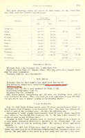
Mine Notes
Mine Images
Microfilm: 352225
Map Date: 4-1914
Coal Co.: Menard County Coal Company
Mine Name: Tallula No. 1 Mine
Full Res Download
Photographs
Additional Notes