Mine Index Number: 0612
| Company Name:
|
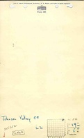
Johnson Valley Coal Company
|
| Mine Name:
|
Johnson Mine
|
| Start Date:
|
1902
|
End Date:
|
1946
|
| Type of Mine:
|
Underground
|
| Total acres shown:
|
173
|
| Acres after map date:
|
|
General Area of mining acres shown:
|
|
|
|
Shaft, Slope, Drift or Tipple Location(s)
| Type
|
County
|
Township-Range
|
Section
|
Part Section
|
| Main shaft
|
Menard
|
19N 5W
|
26
|
NE NE NE
|
| Old air shaft
|
Menard
|
19N 5W
|
26
|
NE NE NE
|
| Air shaft
|
Menard
|
19N 5W
|
26
|
SE SE NE
|
Geology
Geological Problems Reported
Faults, clastic dikes and poor roof conditions were found north and east of the shaft. Horsebacks were noted. The seam contained thin fusain and pyrite partings as well as calcite and pyrite facings. The floor was a soft underclay.
Production
| Company
|
Mine Name
|
Date
|
Production (tons)
|
|
|
|
|
|
| Total Production: 702,656
|
Production Notes
Coal Report production (if available)
Sources of Data
| Microfilm, document 352210
|
5-4-1946
|
1:2400
|
1:3807
|
Final
|
Annotated Bibliography (Data source - brief description of information)
| Coal Reports - Production, ownership, years of operation.
|
| Directory of Illinois Coal Mines (Menard County) - Mine names, mine index, ownership, years of operation.
|
| Mine notes (Menard County) - Mine type, shaft locations, seam, depth, thickness, geologic problems.
|
| Microfilm map, document 352210, reel 03138, frame 264 - Shaft locations, mine outline.
|
Mine Notes
Mine Images
Microfilm: 352210
Map Date: 5-4-1946
Coal Co.: Johnson Valley Coal Company
Mine Name: Johnson Mine
Full Res Download
Photographs