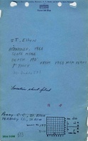
Mine Index Number: 0533
| Company Name:
|
Peabody Coal Company
|
| Mine Name:
|
St. Ellen Mine
|
| Start Date:
|
1904
|
End Date:
|
June 1960
|
| Type of Mine:
|
Underground
|
| Total acres shown:
|
3,835
|
| Acres after map date:
|
|
General Area of mining acres shown:
|
|
|
|
Shaft, Slope, Drift or Tipple Location(s)
| Type
|
County
|
Township-Range
|
Section
|
Part Section
|
| Shaft
|
St. Clair
|
2N 8W
|
26
|
SE SE SW
|
| Slope
|
St. Clair
|
2N 8W
|
35
|
NW NW NE
|
| Air shaft
|
St. Clair
|
2N 7W
|
31
|
SW NE SW
|
Geology
Geological Problems Reported
Production
| Company
|
Mine Name
|
Date
|
Production (tons)
|
|
|
|
|
|
| Total Production: 21,949,404
|
Production Notes
Coal Report production (if available)
Sources of Data
| Company, 4103.S31 i5.1-54
|
5-21-1960
|
1:4800
|
1:4800
|
Final
|
Annotated Bibliography (Data source - brief description of information)
| Coal Reports - Production, ownership, years of operation.
|
| Directory of Illinois Coal Mines (St. Clair County) - Mine names, mine index, ownership, years of operation.
|
| Mine notes (St. Clair County) - Shaft location, mine type, seam, thickness.
|
| Federal Land Bank Report (St. Clair County) - Depth, thickness.
|
| Company map, ISGS map library, 4103.S31 i5.1-54 - Shaft and slope locations, mine outline, method.
|
Mine Notes
Mine Images
![[[:St. Ellen|St. Ellen]]](https://wikiimage.isgs.illinois.edu/ilmines/st_clair/thumbnails/m0533-2_th.jpg) These files may not be true to scale and are not georgistered. These files may not be true to scale and are not georgistered.
|
Map Type:
|
ISGS map library
|
| Map ID:
|
4103.S31 i5.1-54
|
| Company:
|
Peabody Coal Company
|
| Mine Name:
|
St. Ellen
|
| Caption:
|
|
| Map Date:
|
5-21-1960
|
| Map Status:
|
Final
|
| Image Credit:
|
|
| Note:
|
|
| More Info:
|
M0533-2
|
| Full Res Download:These files are true to scale and most are georegistered for gis software. These files may be a very large (>1GB) download!
|
https://wikiimage.isgs.illinois.edu/ilmines/st clair/m0533-2.zip
|
![[[:St. Ellen|St. Ellen]]](https://wikiimage.isgs.illinois.edu/ilmines/st_clair/thumbnails/m0533-1_th.jpg) These files may not be true to scale and are not georgistered. These files may not be true to scale and are not georgistered.
|
Map Type:
|
ISGS map library
|
| Map ID:
|
4103.S31 i5.1-54
|
| Company:
|
Peabody Coal Company
|
| Mine Name:
|
St. Ellen
|
| Caption:
|
|
| Map Date:
|
5-21-1960
|
| Map Status:
|
Final
|
| Image Credit:
|
|
| Note:
|
|
| More Info:
|
M0533-1
|
| Full Res Download:These files are true to scale and most are georegistered for gis software. These files may be a very large (>1GB) download!
|
https://wikiimage.isgs.illinois.edu/ilmines/st clair/m0533-1.zip
|
Photographs