Mine Index Number: 0695
| Company Name:
|
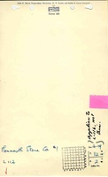
Monmouth Stone Company
|
| Mine Name:
|
Monmouth Stone No. 2 Mine
|
| Start Date:
|
1950
|
End Date:
|
May 1954
|
| Type of Mine:
|
Surface
|
| Total acres shown:
|
Nonethe source map states that 4 acres of clay and coal were worked out.
|
| Acres after map date:
|
|
General Area of mining acres shown:
|
|
|
|
Shaft, Slope, Drift or Tipple Location(s)
| Type
|
County
|
Township-Range
|
Section
|
Part Section
|
| Pit
|
La Salle
|
32N 2E
|
16
|
N 1⁄2 NE
|
Geology
Geological Problems Reported
Production
| Company
|
Mine Name
|
Date
|
Production (tons)
|
Production Notes
Coal Report production (if available)
Sources of Data
| Microfilm, document 352435
|
10-8-1954
|
(sketch only)
|
1:24000The map has no scale and does not show the mine workings. It is basically a sketch of information similar to a plat book, with the town of Lowell (shown on the La Salle Quadrangle, in 9-T32N-R2E), the Vermilion River, a cemetery and a few roads. The landowners controlled an 80 acre segment, and a rudimentary legend indicated 4 acres were mined.
|
Final
|
Annotated Bibliography (Data source - brief description of information)
| Coal Reports - Production, ownership, years of operation, mining method.
|
| Directory of Illinois Coal Mines (La Salle County) - Mine names, mine index, ownership, years of operation.
|
| Microfilm map, document 352435, reel 03139, frame 110 - General mine location.
|
Mine Notes
Mine Images
Photographs