Leonore Quadrangle
Mining in the Leonore Quadrangle
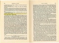
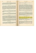
Some very early mining took place in the Leonore Quadrangle. John Kangley began mining near the town of Kangley probably between 1865 and 1875, but these mines were closed or operating under other names by the time the Coal Reports began reporting production on a yearly basis. Two large mines operated here. The C., W. & V. No. 1 Mine (mine index 2575) worked from 1894 to 1907 and the Star No. 2 Mine (mine index 2582) was active from 1887 to 1904. Both mines worked out approximately 450 acres, but the source maps were very poor and the reliable mine outlines have not been found. The remainder of the mines in this area were generally small, less than 5 acres.
The Herrin Coal was less than 70 feet deep where it occurred over the Leonore Quadrangle, and was accessed through slopes and drifts as well as shafts. The Colchester Coal was about 200 feet deep in some places.
Map and Directory PDF Download
Coal Mines In Illinois Leonore Quadrangle
Mines that Appear on the Leonore Quadrangle
Unlocated Mines
La Salle County
Pages in category "Leonore Quadrangle"
The following 36 pages are in this category, out of 36 total.
Media in category "Leonore Quadrangle"
The following 38 files are in this category, out of 38 total.
 M0695 minenotes.pdf 733 × 1,204, 6 pages; 1.5 MB
 M2450 minenotes.pdf 731 × 1,202, 2 pages; 370 KB
 M2451 fieldnotes.pdf 747 × 1,195, 2 pages; 524 KB
 M2451 minenotes.pdf 731 × 1,202, 2 pages; 348 KB
 M2566 minenotes.pdf 731 × 1,202, 3 pages; 608 KB
 M2567 minenotes.pdf 731 × 1,202, 5 pages; 1,009 KB
 M2568 minenotes.pdf 731 × 1,202, 5 pages; 1.36 MB
 M2569 minenotes.pdf 731 × 1,202, 4 pages; 809 KB
 M2570 minenotes.pdf 731 × 1,202, 4 pages; 721 KB
 M2571 minenotes.pdf 731 × 1,202, 4 pages; 724 KB
 M2572 minenotes.pdf 731 × 1,202, 5 pages; 946 KB
 M2573 minenotes.pdf 731 × 1,202, 2 pages; 359 KB
 M2575 coalreport1893.pdf 1,656 × 1,220; 366 KB
 M2575 coalreport1894.pdf 1,608 × 1,308; 338 KB
 M2575 coalreport1903.pdf 1,675 × 1,247; 327 KB
 M2575 minenotes.pdf 731 × 1,202, 3 pages; 619 KB
 M2582 coalreport1893.pdf 1,656 × 1,220; 367 KB
 M2582 coalreport1899.pdf 1,458 × 1,191; 334 KB
 M2582 coalreport1903.pdf 1,672 × 1,243; 375 KB
 M2582 coalreport1904.pdf 1,652 × 1,214; 370 KB
 M2584 minenotes.pdf 731 × 1,202, 2 pages; 361 KB
 M2585 minenotes.pdf 731 × 1,202, 2 pages; 370 KB
 M2587 minenotes.pdf 731 × 1,202, 2 pages; 377 KB
 M2588 minenotes.pdf 731 × 1,202, 3 pages; 589 KB
 M2589 minenotes.pdf 731 × 1,202, 3 pages; 506 KB
 M2590 minenotes.pdf 731 × 1,202, 2 pages; 358 KB
 M2591 minenotes.pdf 731 × 1,202, 2 pages; 364 KB
 M2592 coalreport1891.pdf 793 × 1,275; 165 KB
 M2592 minenotes.pdf 731 × 1,202, 2 pages; 360 KB
 M2660 minenotes.pdf 733 × 1,204, 2 pages; 355 KB
 M2661 fieldnotes.pdf 747 × 1,195; 287 KB
 M2661 minenotes.pdf 733 × 1,204, 3 pages; 590 KB
 M2663 minenotes.pdf 733 × 1,204, 3 pages; 579 KB
 M2665 coalreport1905.pdf 633 × 977; 88 KB
 M2665 minenotes.pdf 733 × 1,204, 2 pages; 368 KB
 M2953 minenotes.pdf 731 × 1,202, 5 pages; 1.07 MB
 M5457 minenotes.pdf 731 × 1,202, 2 pages; 355 KB
 M5496 minenotes.pdf 733 × 1,204, 2 pages; 369 KB