Mine Index Number: 2571
| Company Name:
|
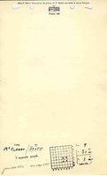
Samuel McCleary
|
| Mine Name:
|
McCleary Mine
|
| Start Date:
|
Before 1882
|
End Date:
|
1893
|
| Type of Mine:
|
Underground
|
| Total acres shown:
|
None
|
| Production Indicated Acres:
|
2With production before records were published, a total of 5 acres may have been mined.
|
General Area of mining acres shown:
|
|
|
|
Shaft, Slope, Drift or Tipple Location(s)
| Type
|
County
|
Township-Range
|
Section
|
Part Section
|
| Main slope
|
La Salle
|
31N 3E
|
9
|
NE NW SE
|
Geology
Geological Problems Reported
Production
| Company
|
Mine Name
|
Date
|
Production (tons)
|
| Samuel McCleary
|
McCleary
|
pre1882-1893Production before July 1882 is unknown, but the 1883 Coal Report indicated 3 acres had been mined.
|
17,758
|
|
|
Production Notes
Coal Report production (if available)
Sources of Data
| ISGS map library, 4103.L32 i5.1-23
|
Undated
|
1:12069
|
1:12069
|
Secondary source
|
Annotated Bibliography (Data source - brief description of information)
| Coal Reports - Production, ownership, years of operation, mine type, depth, thickness, mining method.
|
| Directory of Illinois Coal Mines (La Salle County) - Mine names, mine index, ownership, years of operation.
|
| ISGS map library, 4103.L32 i5.1-23, map of Streator Coal Field - Slope location.
|
Mine Notes
Mine Images
Photographs